


Along the route: the Mirwart provincial fish farm and the former Marsolle blast furnace (information boards).
Nearby: the splendid Mirwart Castle.


Starting from the Chapel of Notre-Dame de la Salette, the walk begins in the countryside before entering the woodland, quickly reaching the Lomme stream, which it follows upstream for over 4 km to the provincial fish farm at Mirwart.
The ponds stretch out one after the other along the course of the Marsault or Marsolle stream to the former site of the Marsolle blast furnace, which operated from 1536 to 1568 on behalf of the Lord of Mirwart.
The route then zigzags through the forest for around 9 kilometres to reach the rural heights of Bure and return to the starting point.


 Country:
Belgium
Country:
Belgium

 City:
Tellin
City:
Tellin 


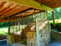
Along the route: the Mirwart provincial fish farm and the former Marsolle blast furnace (information boards).
Nearby: the splendid Mirwart Castle.
Between Ardenne and Famenne 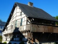 11.15 mi
+1,276 ft
-1,273 ft
6h 15
11.15 mi
+1,276 ft
-1,273 ft
6h 15
 Moderate
 Departure from Tellin (Province de Luxembourg)
Notre-Dame des Pauvres Chapel and Pont des Cloyes
Departure from Tellin (Province de Luxembourg)
Notre-Dame des Pauvres Chapel and Pont des Cloyes 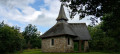 6.05 mi
+656 ft
-650 ft
3h 20
Moderate
Departure from Tellin (Province de Luxembourg)
Hermitage and Resteigne Castle
6.05 mi
+656 ft
-650 ft
3h 20
Moderate
Departure from Tellin (Province de Luxembourg)
Hermitage and Resteigne Castle 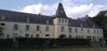 10.20 mi
+922 ft
-892 ft
5h 30
Moderate
Departure from Tellin (Province de Luxembourg)
Discover the essentials of Mirwart
10.20 mi
+922 ft
-892 ft
5h 30
Moderate
Departure from Tellin (Province de Luxembourg)
Discover the essentials of Mirwart  4.41 mi
+505 ft
-486 ft
2h 30
4.41 mi
+505 ft
-486 ft
2h 30
 Easy
Departure from Saint-Hubert (Belgique) (Province de Luxembourg)
The grand tour of Mirwart
Easy
Departure from Saint-Hubert (Belgique) (Province de Luxembourg)
The grand tour of Mirwart  9.92 mi
+1,086 ft
-1,056 ft
5h 30
Moderate
Departure from Saint-Hubert (Belgique) (Province de Luxembourg)
A woodland walk to Mirwart Castle
9.92 mi
+1,086 ft
-1,056 ft
5h 30
Moderate
Departure from Saint-Hubert (Belgique) (Province de Luxembourg)
A woodland walk to Mirwart Castle 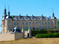 9.87 mi
+876 ft
-896 ft
5h 20
Moderate
Departure from Saint-Hubert (Belgique) (Province de Luxembourg)
From the Linçon Valley to the Masblette Valley
9.87 mi
+876 ft
-896 ft
5h 20
Moderate
Departure from Saint-Hubert (Belgique) (Province de Luxembourg)
From the Linçon Valley to the Masblette Valley  6.77 mi
+850 ft
-840 ft
3h 50
Moderate
Departure from Tellin (Province de Luxembourg)
Eaux & Forêts in Mirwart
6.77 mi
+850 ft
-840 ft
3h 50
Moderate
Departure from Tellin (Province de Luxembourg)
Eaux & Forêts in Mirwart  12.48 mi
+1,398 ft
-1,398 ft
6h 55
Difficult
Departure from Saint-Hubert (Belgique) (Province de Luxembourg)
12.48 mi
+1,398 ft
-1,398 ft
6h 55
Difficult
Departure from Saint-Hubert (Belgique) (Province de Luxembourg)
For more walks, use our search engine .
The GPS track and description are the property of this route's author. Please do not copy them without permission.
Scan this QR code with your smartphone's camera.
To open this route on your smartphone, you must have the Visorando app installed. If not, got to the Apple Store (iPhone) or Google Play Store (Android) to download the app.
 Visorando Member
