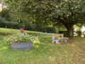
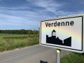
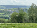
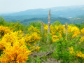
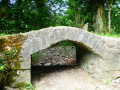
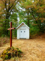
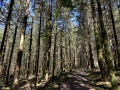
Countryside between Marche-en-Famenne and Verdenne

This route takes you to the village of Verdenne, on the plateau to the east of Marche-en-Famenne.

Details

995593
Creation:
Last update:
Last review:
  • Walking
    Activity: Walking
  • ↔
    Distance: 5.15 mi
  • ◔
    Average duration: 2h 35 
  • ▲
    Difficulty: Easy

  • ⚐
    Back to start: Yes
  • ↗
    Ascent: + 289 ft
  • ↘
    Descent: - 292 ft

  • ▲
    Highest point: 1,007 ft
  • ▼
    Lowest point: 709 ft

Photos

Description of the walk

The starting point is on Rue du Viaduc, opposite the Athénée (car park area).

(S/E) Opposite the Athénée, head right onto Rue du Viaduc.

(1) At the junction opposite the chapel, turn right onto Chaussée de Marenne. At the Fork in the road, continue to the right (to the left is Rue de la Centaurée).

(2) Turn right and go under the railway bridge (take care). At the Fork in the road following a bend to the left, turn right onto Rue du Panorama. Go straight on along this street and pass the entrance to the Paola campsite. You’ll cross Rue du Levant on your right, then another street.

(3) Cross the Chaussée de Marenne (take care) and continue straight on along Rue des Bergeronnettes. At the Y-junction, turn right onto Rue des Rossignols.

(4) After a sharp right-hand bend, at the start of Rue des Chardonnerets, turn left onto the path leading to the Grosse Haie woods. Ignore a path branching off to the right and head east-north-east through the woodland.

(5) At the junction, turn right. At the next junction, veer right and then immediately left onto Voie de la Liberté. Follow this road until you reach a four-way junction: then turn right onto Rue du Calvaire and continue for about fifty metres.

(6) At the T-junction, turn right onto Rue du Refuge. As you leave the village, leave Rue du Refuge and turn left onto a dirt track. Follow this track south-west, between woods and fields.

(7) At the end of the track, turn right onto Chemin de Verdenne. After about 50 metres, turn right. At the cross, head left.

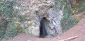
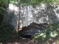
(8) At the junction, turn right and enter the Fond des Vaulx Nature Reserve. Ignore a path branching off to the right (it leads to a caving refuge) and continue westwards. At the next junction, head slightly to the left.

(9) Take the tunnel under the railway line on the right. At the tunnel exit, turn right onto Rue du Viaduc, and you’ll immediately come to the Athénée car park (S/E).


Waypoints

  1. S/E : mi 0 - alt. 748 ft - Athénée car park
  2. 1 : mi 0.15 - alt. 712 ft - Chapel (Chée de Marenne)
  3. 2 : mi 0.49 - alt. 761 ft - Railway bridge
  4. 3 : mi 1.12 - alt. 915 ft - Chaussée de Marenne
  5. 4 : mi 1.63 - alt. 942 ft - Start of the path at the ‘Bois Grosse Haie’
  6. 5 : mi 2.18 - alt. 945 ft - Junction
  7. 6 : mi 2.72 - alt. 1,004 ft - Verdenne – Rue du Refuge
  8. 7 : mi 3.9 - alt. 932 ft - Chemin de Verdenne
  9. 8 : mi 4.27 - alt. 853 ft - Fond des Vaulx Nature Reserve
  10. 9 : mi 5.09 - alt. 784 ft - Tunnel
  11. S/E : mi 5.15 - alt. 748 ft - Athénée car park

Reviews and comments

4.3 / 5
Based on 3 reviews

Reliability of the description
4 / 5
Ease of following the route
4.7 / 5
Route interest
4.3 / 5
ArinaTomberg
ArinaTomberg

Overall rating : 4.7 / 5

Date of your route : Sep 22, 2021
Reliability of the description : ★★★★★ Very good
Ease of following the route : ★★★★★ Very good
Route interest : ★★★★☆ Good
Very busy route : No

A lovely, relaxing walk with beautiful views across the fields. There are plenty of benches along the route. I combined it with another nearby route. After point 8, you can follow a short but interesting walk – the ‘Geological Trail in the Fond des Vaulx Nature Reserve’ – in the opposite direction to return to the same starting point.

Machine-translated

josette
josette

Overall rating : 4.3 / 5

Date of your route : Dec 19, 2020
Reliability of the description : ★★★★☆ Good
Ease of following the route : ★★★★☆ Good
Route interest : ★★★★★ Very good
Very busy route : No

For the starting point given, it would make more sense to specify the tourist information centre, as the Athénée isn’t there – it’s actually the Institut Saint-Laurent. There are parking facilities near the tourist information centre.
No complaints about the easy route.

Machine-translated

grandin
grandin ★

Thank you for pointing that out, sfpgregoire. It’s been corrected.

Machine-translated

sfpgregoire
sfpgregoire

Overall rating : 4 / 5

Date of your route : Sep 20, 2020
Reliability of the description : ★★★☆☆ Average
Ease of following the route : ★★★★★ Very good
Route interest : ★★★★☆ Good
Very busy route : No

Hello,
A lovely little walk.
But there’s a mistake in the route description at point 5. It says: “Then turn left onto Rue du Calvaire...”.
It’s actually to the right. If you go left, you’ll head straight into the woods.
Enjoy your walk

Machine-translated

Other walks in the area

For more walks, use our search engine .

The GPS track and description are the property of this route's author. Please do not copy them without permission.