Geological trail in the Fond des Vaulx nature reserve

The Fond des Vaulx is part of the Famenne-Ardenne Geopark, the first UNESCO Global Geopark in Belgium.
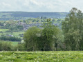
A stone's throw from the town centre, this small, steep-sided valley offers a landscape that contrasts with the expanse of the Marche plain. It is home to several caves, chantoirs and holes, including the Trotti-aux-Fosses chasm, which is unique in Belgium and remarkable for its collapse chasm morphology.

Details

3464840
Creation:
Last update:
Last review:
  • Walking
    Activity: Walking
  • ↔
    Distance: 2.48 mi
  • ◔
    Average duration: 1h 15 
  • ▲
    Difficulty: Easy

  • ⚐
    Back to start: Yes
  • ↗
    Ascent: + 151 ft
  • ↘
    Descent: - 151 ft

  • ▲
    Highest point: 906 ft
  • ▼
    Lowest point: 755 ft

Photos

Description of the walk

Parking is available on Rue du Viaduc near the school.

(S/E) Head towards the bend, take the tunnel on your left and pass under the railway. The pedestrian crossing is very high because the tunnel may be flooded at certain times. The measuring rod at the entrance to the tunnel proves this. Move from the urban environment to the natural environment.

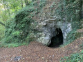
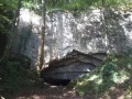
At the tunnel exit, on your right, you can take a fairly steep path to discover the Dieu-le-Père cave. To do so, keep to the right as you climb. Traces of human occupation dating back to the Neolithic period have been found here, but unfortunately, more modern debris is now visible. Take the path to the left of the cave and descend carefully.

Yellow rectangle markings

Once back on the road, turn right. Walk past the houses and ignore the path on your right.

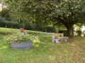
At the fork in the Fond des Vaulx stream, turn right. At the sign, take the footbridge on the left and then turn right. Walk past the barbecue area, which is located on higher ground. Continue along the path, paying attention to a trail on your left leading to an unnamed cave.

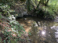
(1) At the fork, continue to the right. At the fitness trail equipment and the information sign for the Fond des Vaulx nature reserve, go down the embankment on the right to see the Sourd'Aiwe resurgence. Go back up the same path and continue to the right. At the corner of the fence, you will see signs of erosion on the ground, revealing the entrance to a small cave. Walk along the fence, noting the bare rock outcrops of the reserve, to return to the chalk grasslands.

(2) At the end of the fence and before the forest house, turn left and go up the path. Along the way, discover the Ducasse cave. At the top, turn right. At the crossroads, with a view of the canopy on your right, continue straight ahead. Pass in front of "La Cheminée", a vertical hole also known as "Trou du Renard" (Fox Hole), which is surrounded by barriers for everyone's safety. Continue and you will see a sinkhole on your left. Continue to the Trotti aux fosses chasm, which is also surrounded by barriers for everyone's safety. Walk around it to get a good view of the collapse. Return to the path and continue.

(3) At the forest path, turn right. Leave the marked trail.

(4) 70 metres further on, atthe first path on your right (not shown on the map), turn and descend. At the bottom, turn right. At the path on your left (not shown on the map), before the fitness trail equipment, turn.

GR® markings

At the forest path, turn left and climb up to the crossroads. Markings end here.

No markings

At the crossroads, continue straight ahead for 250 m to discover the Chantoirs Pierard. Retrace your steps and at the crossroads take the forest path opposite.

GR® markings

Ignore the paths on the left and right. Pass the footbridge again, then the houses you saw on the way there. Take the tunnel under the railway line again and return to your car park (S/E).


Waypoints

  1. S/E : mi 0 - alt. 755 ft - Car park Rue du Viaduc
  2. 1 : mi 0.63 - alt. 846 ft - Right at the fork
  3. 2 : mi 0.81 - alt. 843 ft - Path on the left
  4. 3 : mi 0.98 - alt. 899 ft - On the right, abandoned signposting.
  5. 4 : mi 1.03 - alt. 906 ft - Path descending to the right
  6. S/E : mi 2.48 - alt. 755 ft - Car park Rue du Viaduc

Notes

Geopark: A UNESCO Global Geopark is a territorial space with a geological heritage of international importance.

Worth a visit

Pendant
Fond des Vaulx: the valley was carved out by a tributary of the Marchette river originating from the Champlon stream. It has been inhabited since ancient times. Excavations have been carried out in the caves and rock shelters (particularly in the cave known as Trou de Dieu le Père) and have revealed traces of occupation dating back to the Palaeolithic era. Human presence in the valley has been almost continuous since that period.
More recently, the discovery of an ossuary in the Trou du Renard and various tools and pottery fragments attests to this occupation.
Grotte de Dieu le Père.
Resurgence of the Sourd'Aiwe: comes from the waters of the Agrismont chantoir via the Trotti aux Fosses.
Ducasse Cave.
La Cheminée or Trou Renard.
Doline: a form of limestone erosion. The dissolution of surface limestone leads to the formation of circular depressions measuring from a few metres to several hundred metres in diameter.
Trotti aux Fosses chasm: the very wide entrance shaft, 10 metres deep, leads to a chamber whose sloping floor is littered with enormous blocks from the vault.
Chantoirs Piérard.

Always be cautious and plan ahead when you're outdoors. Visorando and the author of this route cannot be held responsible for any accidents occurring on this route.

The GR® and PR® markings are the intellectual property of the Fédération Française de Randonnée Pédestre.

Reviews and comments

4.7 / 5
Based on 8 reviews

Reliability of the description
4.8 / 5
Ease of following the route
4.6 / 5
Route interest
4.9 / 5
Alain Wéry
Alain Wéry

Overall rating : 5 / 5

Date of your route : Jul 16, 2023
Reliability of the description : ★★★★★ Very good
Ease of following the route : ★★★★★ Very good
Route interest : ★★★★★ Very good
Very busy route : Yes

A very pleasant walk. A wonderful discovery.

Machine-translated

JemDev
JemDev

Overall rating : 4.3 / 5

Date of your route : Feb 05, 2022
Reliability of the description : ★★★★☆ Good
Ease of following the route : ★★★★☆ Good
Route interest : ★★★★★ Very good
Very busy route : No

A really nice tour to do with friends! There's just the short circular to visit the caves, which isn't suitable for elderly people as it's too slippery and too steep.

Machine-translated

Benadette64
Benadette64

Overall rating : 5 / 5

Date of your route : Feb 07, 2022
Reliability of the description : ★★★★★ Very good
Ease of following the route : ★★★★★ Very good
Route interest : ★★★★★ Very good
Very busy route : No

A very pleasant route through the woods, with easily navigable paths. We followed the stream and enjoyed a very pleasant route.
It's worth noting that we were able to enjoy our gourmet tasting on a table with benches.

Machine-translated

ArinaTomberg
ArinaTomberg

Overall rating : 5 / 5

Date of your route : Sep 22, 2021
Reliability of the description : ★★★★★ Very good
Ease of following the route : ★★★★★ Very good
Route interest : ★★★★★ Very good
Very busy route : No

A short but very interesting walk. I combined it with another route nearby. After Les Chantoirs Pierard, I reached point 8 of the easy and picturesque hike "Countryside between Marche-en-Famenne and Verdenne" and followed it in the opposite direction to return to the same starting point.

Machine-translated

Digiafamily
Digiafamily

Overall rating : 5 / 5

Date of your route : Apr 12, 2021
Reliability of the description : ★★★★★ Very good
Ease of following the route : Not used / Not applicable
Route interest : ★★★★★ Very good
Very busy route : No

A very nice hike with some lovely surprises along the way 😉

Machine-translated

sitta
sitta

Overall rating : 5 / 5

Date of your route : Oct 19, 2020
Reliability of the description : ★★★★★ Very good
Ease of following the route : ★★★★★ Very good
Route interest : ★★★★★ Very good
Very busy route : No

Very beautiful course

Machine-translated

Dan 7
Dan 7

Overall rating : 4.3 / 5

Date of your route : Sep 14, 2020
Reliability of the description : ★★★★★ Very good
Ease of following the route : ★★★★☆ Good
Route interest : ★★★★☆ Good
Very busy route : Yes

A beautiful, varied and refreshing walk lasting about an hour and a half. On school days (right next door), it is quite busy with students playing sports.

Machine-translated

Mirbou
Mirbou

Message received. I understand your point of view. Thank you for the time you devote to these activities.

Machine-translated

lazzerini
lazzerini

At Visorando, there are no plans to install permanent signage. Permits are required, and we do not necessarily live near the trails described, so maintaining them would be unrealistic. I will therefore keep my distance and see if this still poses a problem in the future.
Thank you for your feedback.

Machine-translated

Mirbou
Mirbou

A small suggestion: Consider designing a logo for your walk (a bird or something else) and displaying it at the start of the trail on a small plaque (similar to the yellow rectangle on a white background found on signposts).
It's also a good idea to indicate the distance in metres.

Best of luck.

Machine-translated

lazzerini
lazzerini

Hello,
I have added the distance in metres from the entrance to the forest path to help you find the trail. (This will be effective as soon as a moderator has accepted the update.)
But there is nothing specific or visual to describe to help you find it on your right, except that it is the first one.

Do you have any other suggestions?

Machine-translated

Mirbou
Mirbou

Overall rating : 4.3 / 5

Date of your route : Oct 10, 2020
Reliability of the description : ★★★★☆ Good
Ease of following the route : ★★★★☆ Good
Route interest : ★★★★★ Very good
Very busy route : Yes

Lovely walk with a fitness trail. At point 4, a slight hesitation about which path to take due to lack of information. Nice picnic area with barbecues.

Machine-translated

Other walks in the area

For more walks, use our search engine .

The GPS track and description are the property of this route's author. Please do not copy them without permission.