Refine your search for walks in Mandray
Mandray walks


 A short circular forest loop starting from the Col de Mandray
 Visorando Member
 2.85 mi
 +276 ft
 -269 ft
 1h 35
1h 35
 Easy
Easy
 Departure from Mandray (Vosges)
Starting from the Col de Mandray, this pleasant and easy circular walk takes you through the region’s typical forests, made up of tall firs and beech trees. A very enjoyable walk on hot days.
Roche de Rovemont circular walk via the Chapelle du Suisse and the Roche des Fées
 3.28 mi
+725 ft
-732 ft
2h 10
Easy
Departure from Fraize (Vosges)
3.28 mi
+725 ft
-732 ft
2h 10
Easy
Departure from Fraize (Vosges)
A pleasant, entirely shaded walk on the hills above Fraize, taking you to the rocky outcrops of La Roche des Fées and La Roche de Rovemont, via the Chapelle du Suisse, a spot perfect for meditation.
The memorial walls of Fraize
 2.31 mi
+318 ft
-318 ft
1h 20
Easy
Departure from Fraize (Vosges)
2.31 mi
+318 ft
-318 ft
1h 20
Easy
Departure from Fraize (Vosges)
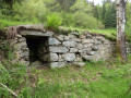
The La Costelle heritage conservation association, volunteers from the Haute-Meurthe branch of the Club Vosgien, the tourist development organisation (ATEHM) and the municipality of Fraize have joined forces to breathe new life into this heritage site. The route has been redesigned, the site cleared and the walls showcased. The information board at the start provides all the details on the history of these walls (see QR code) and on walks in the area.
Walk to the Roche du Sphinx in Anould
 1.21 mi
+135 ft
-148 ft
0h 40
Easy
Departure from Anould (Vosges)
1.21 mi
+135 ft
-148 ft
0h 40
Easy
Departure from Anould (Vosges)
A very easy little walk that takes you along a fully shaded forest path to the Roche du Sphinx, a natural site situated at an altitude of around 560 m above Anould. As an added bonus, there’s a lovely picnic area where you can relax and enjoy the surroundings.
The beautiful rocks of the Kemberg massif
10.28 mi
+2,238 ft
-2,221 ft
6h 40
 Moderate
Departure from Saulcy-sur-Meurthe (Vosges)
Moderate
Departure from Saulcy-sur-Meurthe (Vosges)
Hike in the Kemberg massif and its pink sandstone rocks. Developed by the Club Vosgien, with footbridges and protective railings, these rocks offer magnificent views of Saint-Dié and its surroundings.
Rocks and viewpoints in the Kemberg massif
 6.99 mi
+1,227 ft
-1,220 ft
4h 15
Moderate
Departure from Saulcy-sur-Meurthe (Vosges)
6.99 mi
+1,227 ft
-1,220 ft
4h 15
Moderate
Departure from Saulcy-sur-Meurthe (Vosges)
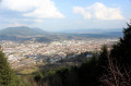
The Kemberg massif offers numerous vantage points: Roche Saint-Martin, Kiosque, Anozel and Enclume; add to these the paragliding launch sites at Col du Kiosque and Kemberg. You will enjoy the panoramic views over Saint-Dié, the Meurthe valley, and the Ormont and Bure massifs.
 The Tour du Kemberg
 8.64 mi
+367 ft
-371 ft
1 hr
Easy
Departure from Saulcy-sur-Meurthe (Vosges)
8.64 mi
+367 ft
-371 ft
1 hr
Easy
Departure from Saulcy-sur-Meurthe (Vosges)
The Kemberg massif is well known to the people who live nearby. The Tour du Kemberg is well shaded with fairly wide paths.
Simply follow the blue circles and signs. Ideal for getting back into shape or for families, with no major difficulties.
Kemberg Massif in Saint-Dié-des-Vosges
 3.59 mi
+1,142 ft
-1,106 ft
2h 40
Moderate
Departure from Saint-Dié-des-Vosges (Vosges)
3.59 mi
+1,142 ft
-1,106 ft
2h 40
Moderate
Departure from Saint-Dié-des-Vosges (Vosges)
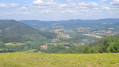
Hiking in the Kemberg massif in Saint-Dié-des-Vosges, covered with fir trees and offering two superb viewpoints: La Roche du Kiosque and La Roche de Saint-Martin.
The Schlitteurs climb to Roche du Sapin Sec
 7.25 mi
+1,818 ft
-1,827 ft
4h 55
Moderate
Departure from Saint-Dié-des-Vosges (Vosges)
7.25 mi
+1,818 ft
-1,827 ft
4h 55
Moderate
Departure from Saint-Dié-des-Vosges (Vosges)
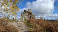
This route invites you to discover the Montée des Schlitteurs, as it is offered to sports enthusiasts every Christmas Eve. It will take you to Roche du Sapin Sec, then to other beautiful rocks with magnificent views, before beginning the descent to Saint-Dié-des-Vosges, its cathedral and the banks of the Meurthe.
Saprée Vadrouille in the footsteps of Saint Déodat in Saint-Dié
 Association / Club / Walk leader
 2.50 mi
+72 ft
-72 ft
1h 15
Easy
Departure from Saint-Dié-des-Vosges (Vosges)
2.50 mi
+72 ft
-72 ft
1h 15
Easy
Departure from Saint-Dié-des-Vosges (Vosges)
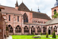
With the Jubilee Year of Hope, since November 2024, our Catholic Church in the Vosges has developed a proposal: "Saprée Vadrouille, travel journal for paths of hope", with three issues per year focusing on liturgical times and the saints of the Vosges.Several itineraries are proposed in the Vosges as local pilgrimages and paths of hope. This is an opportunity to rediscover our region and our local saints throughout the Vosges department. Each itinerary can be done independently of the others, at any time of year. "In the footsteps of Saint Déodat" is the route proposed in the very first "Saprée Vadrouille", which you can discover here.
The five rocks of Kemberg
 8.08 mi
+1,617 ft
-1,611 ft
5h 05
Moderate
Departure from Saint-Dié-des-Vosges (Vosges)
8.08 mi
+1,617 ft
-1,611 ft
5h 05
Moderate
Departure from Saint-Dié-des-Vosges (Vosges)
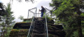
A day hike to discover the Kemberg massif. Several viewpoints from the rocks, secured by railings.
The rocks of the Kemberg sandstone massif in Saint-Dié
 10.47 mi
+1,929 ft
-1,916 ft
6h 30
Moderate
Departure from Saint-Dié-des-Vosges (Vosges)
10.47 mi
+1,929 ft
-1,916 ft
6h 30
Moderate
Departure from Saint-Dié-des-Vosges (Vosges)
Discover the Kemberg sandstone massif starting from the Saint-Dié SNCF railway station. This hike passes by numerous rocks offering beautiful views of Saint-Dié, the Bure, Ormont and Madeleine massifs and the Meurthe valley.
Circular walk starting from the Col du Bonhomme
5.97 mi
+938 ft
-968 ft
3h 35
Moderate
Departure from Le Bonhomme (Haut-Rhin)
A pleasant walk for the whole family, with a lovely climb at the end.
Recommended in good weather; otherwise, the start of the path is muddy.
From the Col des Bagenelles to the Mines d'Échery
 11.82 mi
+3,143 ft
-3,136 ft
8h 10
11.82 mi
+3,143 ft
-3,136 ft
8h 10
 Difficult
Departure from Le Bonhomme (Haut-Rhin)
Difficult
Departure from Le Bonhomme (Haut-Rhin)
Beautiful hike in the Val d'Argent, via the Tree of Liberty, to discover the old mines of the village of Échery and its clock tower.
Climb to the summit of Grand Brézouard and enjoy a 360° panorama of the Sainte-Marie-aux-Mines valley and the Vosges mountain ranges.
Les Brézouard
 7.56 mi
+1,194 ft
-1,191 ft
4h 30
Moderate
Departure from Le Bonhomme (Haut-Rhin)
7.56 mi
+1,194 ft
-1,191 ft
4h 30
Moderate
Departure from Le Bonhomme (Haut-Rhin)
If you want to go on a beautiful hike starting from the Col des Bagenelles, between the valleys of Sainte-Marie-aux-Mines and Kaysersberg, the Petit and Grand Brezouard tour is for you. Here is the Tour des Petit and Grand Brezouard, which offers views of these two valleys, the Alsace plain and, in the distance, the Black Forest. Very well marked by the Club Vosgien, it is suitable for all types of hikers, including children.
20/08/2024: Hike modified to avoid the Grand Brézouard, which has been unmarked to reinforce the quiet zone.
Gerbepal-Boslimpré-Osseux-Roche des Chiens-Gerbepal
 12.59 mi
+1,604 ft
-1,578 ft
7h 10
Difficult
Departure from Gerbépal (Vosges)
12.59 mi
+1,604 ft
-1,578 ft
7h 10
Difficult
Departure from Gerbépal (Vosges)
This route was chosen for the Popular Walk on 18 June 2017 in Gerbepal.
Ormont Massif
 3.92 mi
+1,161 ft
-1,158 ft
2h 50
Moderate
Departure from Saint-Dié-des-Vosges (Vosges)
3.92 mi
+1,161 ft
-1,158 ft
2h 50
Moderate
Departure from Saint-Dié-des-Vosges (Vosges)
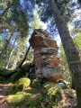
Hike through the pine forests on the heights of Saint-Dié-des-Vosges, in the Ormont area, to discover Saint-Dié from several viewpoints.
Les Roches d'Ormont - Les Molières waterfall
 7.36 mi
+1,768 ft
-1,772 ft
4h 55
Moderate
Departure from Saint-Dié-des-Vosges (Vosges)
7.36 mi
+1,768 ft
-1,772 ft
4h 55
Moderate
Departure from Saint-Dié-des-Vosges (Vosges)
A beautiful circular route near Saint-Dié, featuring the many remarkable rocks of the Ormont massif, with viewing points offering beautiful views of Saint-Dié.
You will also discover part of the "Sentier du Capitaine Bonnefoy" trail with some remains from the First World War. Return via the bucolic site of the Molières waterfall.
The Champ de Roches from Corcieux
10.12 mi
+991 ft
-961 ft
5h 30
Moderate
Departure from Corcieux (Vosges)
The Champ de Roches is located in the municipality of Barbey-Seroux, near the Col des Arrentès between the Neuné and Vologne valleys. This "river" of rocks stretches between conifer plantations for 400 metres long and 40 metres wide. The existence of such chaos is surprising and has given rise to numerous legends in which the presence of the Devil is never far away.Although most of this hike takes place on forest trails and paths, the relatively long but easy loop includes a few stretches of road that allow you to discover the town of Corcieux at the start and finish, as well as the charming hamlets in the surrounding area. There are beautiful, idyllic landscapes throughout this circuit.
Col des Bagenelles and Grand Brezouard from Le Bonhomme
 10.33 mi
+2,211 ft
-2,185 ft
6h 40
Difficult
Departure from Le Bonhomme (Haut-Rhin)
10.33 mi
+2,211 ft
-2,185 ft
6h 40
Difficult
Departure from Le Bonhomme (Haut-Rhin)
A very beautiful circular hike from Le Bonhomme, which is not too busy. We were lucky enough to pass through areas filled with flowering foxgloves... magnificent.A varied route through forests and pastures.
The Tête des Faux and the Étang du Devin from Le Bonhomme
 5.77 mi
+1,906 ft
-1,929 ft
4h 20
Moderate
Departure from Le Bonhomme (Haut-Rhin)
5.77 mi
+1,906 ft
-1,929 ft
4h 20
Moderate
Departure from Le Bonhomme (Haut-Rhin)
This circular hike starts in the village of Le Bonhomme and follows the "Circuit de la Grande Guerre sur le massif de la Tête des Faux" (Great War Trail on the Tête des Faux massif), which was a fierce battlefield between 1914 and 1915.
Here you will find remnants of the 1914-18 war, two imposing cemeteries, as well as fortifications and technical installations erected by the Germans.
The Étang du Devin and its bucolic setting offer a place to rest.
 From Bonhomme to Calvaire
 8.80 mi
+1,850 ft
-1,837 ft
6 hrs
Moderate
Departure from Le Bonhomme (Haut-Rhin)
8.80 mi
+1,850 ft
-1,837 ft
6 hrs
Moderate
Departure from Le Bonhomme (Haut-Rhin)
A lovely snowshoe walk in a place steeped in legends and the history of the 1914-1918 war.
From Bonhomme to Lac Blanc towards Tête des Faux and Étang du Devin
 9.35 mi
+2,536 ft
-2,526 ft
6h 30
Difficult
Departure from Le Bonhomme (Haut-Rhin)
9.35 mi
+2,536 ft
-2,526 ft
6h 30
Difficult
Departure from Le Bonhomme (Haut-Rhin)
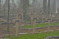
A circular hike starting from Le Bonhomme. It takes us through the forest to Lac Blanc.
The return journey crosses a small section of the battlefields of theFirst World War. There are numerous military structures, as well as a national necropolis and a German military cemetery.
An important place of remembrance in the history of the Alsace region.
Le Bonhomme, the three passes and the battlefields of 1914-1918
 11.31 mi
+2,539 ft
-2,559 ft
7h 25
Difficult
Departure from Le Bonhomme (Haut-Rhin)
11.31 mi
+2,539 ft
-2,559 ft
7h 25
Difficult
Departure from Le Bonhomme (Haut-Rhin)
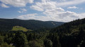
This hike will take you from Le Bonhomme to the 1914-1918 battlefields of Tête des Faux, then to the three passes of Calvaire, Louschbach and Bonhomme. Along the way, depending on the season, you can enjoy the abundance of blueberry bushes along the path.
Around the Tête des Faux from the Col du Calvaire via the Étang du Devin
 7.87 mi
+928 ft
-928 ft
4h 25
Moderate
Departure from Le Bonhomme (Haut-Rhin)
7.87 mi
+928 ft
-928 ft
4h 25
Moderate
Departure from Le Bonhomme (Haut-Rhin)
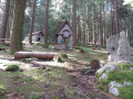
An easy hike through pine and blueberry forests, allowing you to discover relics from the 1914-1918 war and offering wide views of the Orbey valley and the Vosges mountain ranges in the first part of the hike.
L'Étang du Devin via the Tête des Faux
 6.38 mi
+1,447 ft
-1,470 ft
4h 10
Moderate
Departure from Le Bonhomme (Haut-Rhin)
6.38 mi
+1,447 ft
-1,470 ft
4h 10
Moderate
Departure from Le Bonhomme (Haut-Rhin)
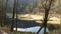
A lovely walk through the woods starting from the Lac Blanc winter sports resort.The Étang du Devin is the main attraction of this hike, offering beautiful views of the Béhtine Valley.Memories of the First World War hang over the first part of the walk.A hike best undertaken in fine weather or in winter when there is a lack of snow.
Tour of Lac Blanc via the Ferme-auberge du Pré Bracot
 Tourism professional6.61 mi
+1,732 ft
-1,759 ft
4h 35
Moderate
Departure from Le Bonhomme (Haut-Rhin)
Tourism professional6.61 mi
+1,732 ft
-1,759 ft
4h 35
Moderate
Departure from Le Bonhomme (Haut-Rhin)
This circular route, starting from the Lac Blanc resort, takes in some of the most beautiful sites in the Hautes Vosges (Gazon du Faing, Château Hans) and ends at the Ferme-auberge du Pré Bracot.
Tête des Faux and Duchesne Cemetery from Col du Calvaire
 4.50 mi
+525 ft
-538 ft
2h 30
Moderate
Departure from Le Bonhomme (Haut-Rhin)
4.50 mi
+525 ft
-538 ft
2h 30
Moderate
Departure from Le Bonhomme (Haut-Rhin)
A memorial hike to a small peak that was the scene of violent clashes in 1914-1915, traces of which are still visible on the ground. Along the way, you will pass the very moving Duchesne Cemetery located in the middle of the forest.
Rudlin Waterfall
 1.47 mi
+404 ft
-404 ft
1h 00
Easy
Departure from Plainfaing (Vosges)
1.47 mi
+404 ft
-404 ft
1h 00
Easy
Departure from Plainfaing (Vosges)
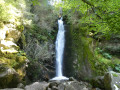
By making a loop from the Étang des Dames, you can quickly reach the Rudlin Waterfall. This is a pretty waterfall about ten metres high, accessible via a path through the woods from the bottom of the valley.
Le Gazon du Faing from Rudlin
 7.61 mi
+2,008 ft
-1,982 ft
5h 15
Moderate
Departure from Plainfaing (Vosges)
7.61 mi
+2,008 ft
-1,982 ft
5h 15
Moderate
Departure from Plainfaing (Vosges)
This hike takes you to the Hautes Chaumes in the Tanet-Gazon du Faing Nature Reserve, starting on the Vosges side via the Ruhlock trail along a stream and returning via the Rudlin waterfall.There are beautiful views from the ridges over Lac Blanc and Lac des Truites or Lac du Forlet.
The Lac Blanc viewpoints
 2.45 mi
+390 ft
-407 ft
1h 30
Easy
Departure from Orbey (Haut-Rhin)
2.45 mi
+390 ft
-407 ft
1h 30
Easy
Departure from Orbey (Haut-Rhin)
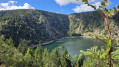
After a wide, tree-lined path, the view suddenly opens up onto the lake and its turquoise hues.You can admire the Rocher Hans and the rocky cliffs surrounding the lake. Continue downhill to the Lac Blanc dam, then head back up towards the Auberge du Blancrupt, where you’ll enjoy a panoramic view of the Alsace plain.
An easy walk along limestone paths starting from Martimpré
 7.31 mi
+738 ft
-741 ft
4h 00
Easy
Departure from Gerbépal (Vosges)
7.31 mi
+738 ft
-741 ft
4h 00
Easy
Departure from Gerbépal (Vosges)
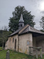
Hello, I’d like to suggest a route that I run during my stays in Martimpré. It takes me about an hour to run, and probably around 2 to 2½ hours to walk. For the more adventurous, this route passes close to the Tête de Nayemont; if you’re curious, you can enjoy a beautiful view from there, but be careful – the path is quite technical and the signposting is poor.
The Lac Blanc Circuit
 2.71 mi
+791 ft
-784 ft
1h 55
Moderate
Departure from Orbey (Haut-Rhin)
2.71 mi
+791 ft
-784 ft
1h 55
Moderate
Departure from Orbey (Haut-Rhin)
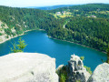
Although the climb up to Rocher Hans and the statue of the Virgin Mary at its summit may not look easy, it isn’t as difficult as it seems, even for little ones. After the effort (all the same), the reward!Of course, Rocher Hans itself is inaccessible, but the various viewpoints overlooking the lake are truly magnificent.Be careful, though – the descent is a bit trickier: less steep, but more slippery in places.The final few hundred metres, along the road, are safe: the path is separated and protected by a metal and wooden guardrail.
Four Lakes Circuit in the Vosges
 10.93 mi
+2,073 ft
-2,103 ft
6h 50
Difficult
Departure from Orbey (Haut-Rhin)
10.93 mi
+2,073 ft
-2,103 ft
6h 50
Difficult
Departure from Orbey (Haut-Rhin)
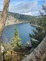
A walk in the Alsatian Vosges from Lac Blanc to Lac Vert and back via Lac des Truites and Lac Noir. These are three circular routes that follow on from one another, so much so that there are two points where you can shorten the route.
- Note added following a comment on 19 August 2026.>Please note : the route passes through an area where access is prohibited; the path between Gazon du Faing (14) and Lac Noir (15) is closed.- Updated by the author on 21 August 2026
Lac Blanc - Tête des Faux circular loop
 6.96 mi
+968 ft
-961 ft
4 hrs
Moderate
Departure from Orbey (Haut-Rhin)
6.96 mi
+968 ft
-961 ft
4 hrs
Moderate
Departure from Orbey (Haut-Rhin)
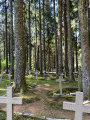
Five routes are marked out in the Lac Blanc 1200 ski resort, offering several levels of difficulty, with distances ranging from 3 to 14 km. This route is a compilation of sections from three of these routes, forming a circular route of approximately 11 km, taking into account the passages closed due to the marking of quiet zones. The route mainly follows forest paths through a forest of tall fir trees. It includes a beautiful but physically demanding climb on a path winding between the trees, a passage near a First World War necropolis, a short descent through the undergrowth, and then an arrival on a stubble field offering a superb view: first of the Alsace plain and the Black Forest in the distance, then of the Lac Blanc glacial cirque. The route continues through the Lac Blanc Adventure Park before returning to the car park.
From Lac Blanc to Gazon de Faing via the Hisrchsteine and the lakes
15.99 mi
+3,222 ft
-3,196 ft
10h 10
 Very difficult
Departure from Orbey (Haut-Rhin)
Very difficult
Departure from Orbey (Haut-Rhin)
A long, challenging hike with a series of ups and downs: it goes up and down. Starting from Lac Blanc, the hike climbs quite steeply towards the Rocher du Hans, offering views over Lac Blanc. This is followed by a descent to Lac Noir, which adds to the beauty of the landscape. Next comes an ascent, then a flat section leading to Lac du Forlet. The hike climbs again and descends to the final lake: Lac Vert. Heading towards the Col de la Schlucht, the route takes you past the Hirschsteine steps and their viewpoint over the Munster valley, followed by a dizzying and somewhat technical section along the cliff face. The return journey then follows the ridge, offering numerous views, along a slightly flatter path that passes through the Tanet and the Gazon du Faing.
Tour of four Alsatian lakes
 10.19 mi
+2,438 ft
-2,434 ft
6h 50
Difficult
Departure from Orbey (Haut-Rhin)
10.19 mi
+2,438 ft
-2,434 ft
6h 50
Difficult
Departure from Orbey (Haut-Rhin)
An exceptional hike offering panoramic views of successive lakes. There are a few challenging climbs, but it's well worth the effort. Best done in good weather to fully enjoy the views available to hikers.