


 Country:

 City:
City:


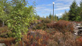
Access: In Corcieux,at the roundabout, head towards Granges/Vologne via Rue de l’Hôtel de Ville, then turn left onto the D31 towards Les Arrentès de Corcieux (alt. 684 m). At the Col des Arrentès de Corcieux, turn left towards Le Clair Sapin (3 km). Continue straight on along the main road to the Clair Sapin holiday centre and its car park, the start of the walk.
(S/E) Follow the path up through the trees (marked with Red Triangles) to join the Route Forestière de Derrière Nayemont straight ahead, passing to the left of a beautiful house. After a long left-hand bend of about 1.5 km, you’ll reach a crossroads.
(1) Continue uphill to the left, staying on the Route Forestière de Derrière Nayemont (Red Triangle) until you reach the Ronchamps crossroads (IGN elevation 849).
(2) Turn left onto the Clairsapin Forest Road (Yellow Triangle and Blue Cross), following a gentle climb for about 350 metres until you reach a crossroads.
(3) Leave the Yellow Triangle markings (this is the return route), turn left (Blue Cross markings) onto the wide path climbing towards the Tête de Nayemont via its western slope. The gradient becomes steeper; after about 300 m, at the junction, keep left for about a hundred metres and reach a multi-way junction.
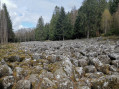
(4) Turn right onto a steep, stony climb towards the Tête de Nayemont via its western slope (Blue Cross). When the path turns right, heading north-east, it joins the start of the path leading to the summit.
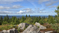
(5) Leave the path, which continues round the north side, and turn right to reach the summit of the Tête de Nayemont.
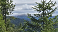
A stunning spot offering a 360° panoramic view of the Vosges peaks (climb onto the highest rocks to see over the vegetation), notably the Hohneck – recognisable by its inn – and the surrounding mountain ranges.
Cross this rocky terrain and continue along the path on the opposite side of the slope (marked with a Blue Cross). It descends and rejoins the path you took on the way up. Continue the descent and rejoin the forest road at the junction you passed on the way up.
(3) Turn left heading due north (marked with a Yellow Triangle) onto the Route Forestière du Clairsapin. The path remains level; keep heading in this direction until you reach a junction with paths on the right.
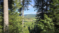
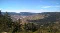
(6) Keep to the left on the path, which begins its descent with a wide left-hand bend, leading after just over 1 km to the car park (S/E). There isa lovely clearing offering views of the village of Gerbépal and the Saint-Dié basin in the distance.
 Visorando Member

 Average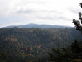
 Difficult
 Very difficult
