


Refine your search for walks in Lux
Lux walks


 Circular walk between Tille, the Romanesque church and the Templars’ site, starting from Lux
 Visorando Member
 9.24 mi
 +262 ft
 -243 ft
 4h 30
4h 30
 Easy
Easy
 Departure from Lux (Côte-d'Or)
Starting from Lux-sur-la-Tille, a nearly entirely flat circular route along dirt tracks to explore the Tille valley, the River Ignon and the leats of Tilchâtel. The walk takes you past the Ferme de Fontenotte, a former Templar commandery, and the beautiful Church of Saint-Florent in Tilchâtel, a Romanesque church adorned with fine capitals and bearing an inscription on its portal.
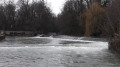
The banks of the Tille and the Perte de la Venelle in Lux
 5.35 mi
+62 ft
-62 ft
2h 30
Easy
Departure from Lux (Côte-d'Or)
5.35 mi
+62 ft
-62 ft
2h 30
Easy
Departure from Lux (Côte-d'Or)
This circular walk will take you around the charming village of Lux, its dam, the banks of the Tille, its fountains, its church, its park along the Tille, and the peaceful spot known as the Perte de la Venelle.
Why not combine a walk with a picnic by the water (the Tille) in Lux, perhaps in the landscaped park?
Around Bèze
 5.84 mi
+220 ft
-213 ft
2h 55
Easy
Departure from Bèze (Côte-d'Or)
5.84 mi
+220 ft
-213 ft
2h 55
Easy
Departure from Bèze (Côte-d'Or)
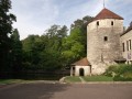
Superb village around the Bèze resurgence and its cave, which can be visited by boat.
Source du Bué in Pichanges
 5.07 mi
+148 ft
-161 ft
2h 25
Easy
Departure from Pichanges (Côte-d'Or)
5.07 mi
+148 ft
-161 ft
2h 25
Easy
Departure from Pichanges (Côte-d'Or)
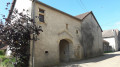
This circular route will take you to the Source du Bué with its curious legend. You can also explore the village, its chapel and its equally fascinating history, the Templars’ house, the manor house and the fortified church.In spring, you can see wild orchids in bloom.
A circular starting from Gemeaux, a picturesque village.
 5.58 mi
+141 ft
-131 ft
2h 40
Easy
Departure from Gemeaux (Côte-d'Or)
5.58 mi
+141 ft
-131 ft
2h 40
Easy
Departure from Gemeaux (Côte-d'Or)
Circular route around and through Gemeaux to discover this picturesque little village in the Côte d'Or, rich in architectural heritage: its market halls, medieval house, church, castle, fountain and wash house.
The Velours Forest and its picturesque surroundings
11.68 mi
+420 ft
-423 ft
5h 45
 Moderate
Departure from Bourberain (Côte-d'Or)
Moderate
Departure from Bourberain (Côte-d'Or)
A circular walk starting from Bourberain, passing near the Étang de Bessey, leading to a visit to Bèze (spring and caves) and a partial traverse of the Forêt de Velours, including the Creux du Diable and its star-shaped junctions.
Circular walk starting from Viévigne via Bèze
12.34 mi
+433 ft
-453 ft
6h 05
 Difficult
Departure from Viévigne (Côte-d'Or)
Difficult
Departure from Viévigne (Côte-d'Or)
A circular walk starting from Viévigne that leads to Bèze through fields and woods. Enjoyable scenery throughout the walk and a close-up view of the beautiful Dame Alix ponds.
In the footsteps of Gargantua around Marcilly-sur-Tille
4.73 mi
+174 ft
-180 ft
2h 20
Easy
Departure from Marcilly-sur-Tille (Côte-d'Or)
A short, easy walk around the village of Marcilly-sur-Tille, which is situated on the River Ignon and not on the River Tille as its name suggests, passing by the Étang de Venarde where you can see many birds (depending on the season). You’ll walk along the River Ignon, with its wash house and old mill, and reach Mont de Marcilly, where you’ll enjoy a magnificent view over the Tille Valley.
Circular route around Flacey
 5.81 mi
+236 ft
-230 ft
2h 55
Moderate
Departure from Flacey (Côte-d'Or)
5.81 mi
+236 ft
-230 ft
2h 55
Moderate
Departure from Flacey (Côte-d'Or)
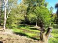
A pretty little village, with a stream and a mix of forest paths and open stretches. You can cover fewer kilometres by, for example, avoiding the loop around the grassy area.
This route is described for Nordic walking but is also suitable for hiking.
La Combe Marey, starting from Is-sur-Tille
 Tourist office
 5.24 mi
+486 ft
-472 ft
2h 50
Easy
Departure from Is-sur-Tille (Côte-d'Or)
5.24 mi
+486 ft
-472 ft
2h 50
Easy
Departure from Is-sur-Tille (Côte-d'Or)
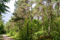
As you walk along the Combe Marey trail, some of Is-sur-Tille’s natural treasures are revealed to you. They lie hidden in the woods… This route will allow you to discover the limestone plateau overlooking Is-sur-Tille, the old Montchevreuil house and the small bell tower. Route recommended by the Tille and Ignon Valleys Tourist Office. Official route listed in the Côte-d’Or PDIPR.
Hunting days: Sundays and public holidays.
Les Mauritaines, departing from Is-sur-Tille
 6.71 mi
+574 ft
-571 ft
3h 35
Moderate
Departure from Is-sur-Tille (Côte-d'Or)
6.71 mi
+574 ft
-571 ft
3h 35
Moderate
Departure from Is-sur-Tille (Côte-d'Or)
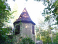
This forest route will allow you to discover the limestone plateau overlooking Is-sur-Tille, a wayside cross, a spring: the Marcevau fountain, and the small bell tower. The route, proposed by the Tille and Ignon Valleys Tourist Office, is listed in the Côte-d’Or PDIPR.
PDIPR: Departmental Plan for Walking and Hiking Routes.
Hunting days: Sundays and public holidays.
The Meuley Circuit in Is-sur-Tille
 4.46 mi
+325 ft
-328 ft
2h 20
Easy
Departure from Is-sur-Tille (Côte-d'Or)
4.46 mi
+325 ft
-328 ft
2h 20
Easy
Departure from Is-sur-Tille (Côte-d'Or)
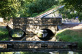
This route, partly through woodland, will allow you to discover the leat des Courtines, the market halls, the medieval defensive ditch and a viewpoint overlooking Mont de Marcilly
Hunting days: Sundays and public holidays. Côte-d’Or PDIPR route.
From Beire-le-Châtel to Spoy and back
 5.56 mi
+72 ft
-79 ft
2h 35
Easy
Departure from Beire-le-Châtel (Côte-d'Or)
5.56 mi
+72 ft
-79 ft
2h 35
Easy
Departure from Beire-le-Châtel (Côte-d'Or)
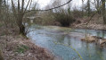
Beire-le-Châtel: canton of Saint-Apollinaire (formerly canton of Mirebeau).
The village takes its name from the Gaulish word "Beire", meaning "plain". The discovery of a temple dedicated to Januaria recalls the position of Beire-le-Châtel in Gallo-Roman times, at the crossroads of ancient roads where the remains of two Roman roads can be found. In addition, six Gallo-Roman burials were found in 2019.
In the forest of Crécey-sur-Tille via the Vornay valley
 4.41 mi
+417 ft
-410 ft
2h 25
Easy
Departure from Crécey-sur-Tille (Côte-d'Or)
4.41 mi
+417 ft
-410 ft
2h 25
Easy
Departure from Crécey-sur-Tille (Côte-d'Or)
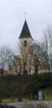
This route will take you to Crécey-sur-Tille Castle and its dovecote, wash houses, wayside crosses and the Church of Notre-Dame de la Nativité. This walk will also take you through the forest via the Combe Vornay to the north-east of the village.
A tour of Selongey’s chapels
 5.39 mi
+404 ft
-384 ft
2h 50
Easy
Departure from Selongey (Côte-d'Or)
5.39 mi
+404 ft
-384 ft
2h 50
Easy
Departure from Selongey (Côte-d'Or)
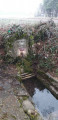
Selongey takes its name from a Roman estate once situated at the ‘Champ de Mars’. Centuries of history have left it with some remarkable monuments: a 13th-century church housing a carillon of 48 bells, listed as a historic monument, and a 19th-century organ, the Chapel of Saint Gertrude (1530) and the Chapel of Saint Anne (1637). There are also a few old houses dating from the 15th and 16th centuries.
The Valley at Selongey
 Local authority
 7.32 mi
+696 ft
-715 ft
4h 00
Moderate
Departure from Selongey (Côte-d'Or)
7.32 mi
+696 ft
-715 ft
4h 00
Moderate
Departure from Selongey (Côte-d'Or)
Gradually leave Selongey behind as you climb higher to discover the Venelle valley from a different perspective.
This circular route links Selongey to Foncegrive, alternating between country lanes, woodland paths and village crossings. After an initial section through the woods, the route reaches the heights of Foncegrive and its viewpoint. The walk then passes through the village before gaining altitude again via the paths and woods of Gency.
The return journey to Selongey offers one final change of scenery. The natural landscapes gradually give way to the urban and industrial heritage of a town closely linked to the history of SEB and the famous Cocotte-Minute.
The Tertre Trail in Selongey
 6.98 mi
+591 ft
-577 ft
3h 45
Moderate
Departure from Selongey (Côte-d'Or)
6.98 mi
+591 ft
-577 ft
3h 45
Moderate
Departure from Selongey (Côte-d'Or)
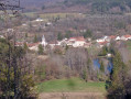
The Selongey area, home to the SEB pressure cooker, invites you to explore its Tertre hiking trail. Its name comes from the woodland you will pass through during this hike, which reaches a highest point of 415 m.
You will pass by the statue of the Virgin Mary, along the Tille and Venelle wind farm, before descending into the village. You will continue the walk along Rue du Mont and pass by the Church of Saint-Rémy de Foncegrive on your return to Selongey.
Short version of the Tertre hike from Selongey
 Association / Club / Walk leader
 4.93 mi
+449 ft
-436 ft
2h 40
Easy
Departure from Selongey (Côte-d'Or)
4.93 mi
+449 ft
-436 ft
2h 40
Easy
Departure from Selongey (Côte-d'Or)
The Selongey area, home to the SEB pressure cooker, invites you to explore its Tertre hiking trail. Its name comes from the woodland you will pass through during this hike, which reaches a highest point of 415 m.You’ll pass by the statue of the Virgin Mary, along the Tille and Venelle wind farm, before descending a beautiful path to join the track that will take you back to Selongey. You’ll finish this hike by passing near the pressure cooker factory.
The Gency to Selongey Trail
 4.96 mi
+377 ft
-394 ft
2h 35
Easy
Departure from Selongey (Côte-d'Or)
4.96 mi
+377 ft
-394 ft
2h 35
Easy
Departure from Selongey (Côte-d'Or)
The area around Selongey, the birthplace of the Seb pressure cooker, invites you to explore its Gency walking trail. Its name is taken from one of the three hills overlooking the village. This easy, signposted trail will take you through the forest that covers much of this hill.You’ll cross the Venelle before reaching the hill. You’ll finish this walk by passing near the pressure cooker factory.
A long circular route through the Clénay Forest
 9.90 mi
+164 ft
-164 ft
4h 40
Moderate
Departure from Clénay (Côte-d'Or)
9.90 mi
+164 ft
-164 ft
4h 40
Moderate
Departure from Clénay (Côte-d'Or)
Do you enjoy wide open spaces, nature and peace and quiet, away from the beaten route?
Then come and take a walk in the Clénay state-owned forest; we’ll walk along the River La Flacière to the village of Flacey, where we can admire the wash house, the castle and its church. Then we’ll return to Clénay through the forest.
The Clénay State Forest, starting from Saint-Julien
9.95 mi
+184 ft
-171 ft
4h 45
Moderate
Departure from Saint-Julien (Côte-d'Or)
A walk that combines a stroll through the old village of Saint-Julien and a visit to the surrounding area, before crossing part of the Clénay National Forest, following an active railway line, and returning via the Fontaine aux Lions in Saint-Julien, skirting Clénay.
Please note: the route on the ground does not always correspond to the route on the IGN map due to forestry operations.
From Mirebeau-sur-Bèze to Noiron-sur-Bèze via the national forest
 10.46 mi
+92 ft
-92 ft
4h 55
Moderate
Departure from Mirebeau-sur-Bèze (Côte-d'Or)
10.46 mi
+92 ft
-92 ft
4h 55
Moderate
Departure from Mirebeau-sur-Bèze (Côte-d'Or)
This walk through the national forest will take you past the castle, Noiron and Blagny.
It follows a path once used by horses and pack animals to carry timber, charcoal and large game out of the forests, or to bring in woodcutters, charcoal burners and their equipment.
We will visit the villages of Mirebeau-sur-Bèze and Noiron-sur-Bèze, through which the River Béze flows.