Route from Montaigu to Crécey-sur-Tille

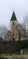
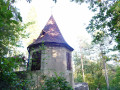
At the gateway to the Tille Valley, Le Montaigu is a hamlet situated deep within the forest at Crécey-sur-Tille. This route will take you past the castle and its dovecote (visible from the road), the wash houses, the church and the natural heritage found in the forest. This is the ideal spot to enjoy a peaceful walk.
Hunting days: Saturdays, Sundays and public holidays. Côte-d’Or PDIPR route.

Details

n°4409445
Creation:
Last update:
Last review:
  • Walking
    Activity: Walking
  • ↔
    Distance: 3.65 mi
  • ◔
    Average duration: 2h 05 
  • ▲
    Difficulty: Easy

  • ⚐
    Back to start: Yes
  • ↗
    Ascent: + 449 ft
  • ↘
    Descent: - 436 ft

  • ▲
    Highest point: 1,289 ft
  • ▼
    Lowest point: 909 ft

Photos

Description of the walk

Parking near the football pitch, Place du Moulin.

(S/E) Walk up Rue du Moulin to the roundabout and turn left onto Rue de Bourgogne, following it for about a hundred metres until you reach thefirst street on the left.

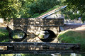
(1) Turn left into Rue du Château. Near the gate, the castle remains visible. The old dovecote is also visible from the road. At the end of this street, at the junction, turn left down Rue Basse, leaving the steps on your right. In the left-hand bend that follows, you’ll reach the wash house.

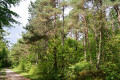
(2) Turn right and continue along the path until you reach the D120 road. Cross it towards the path on the left. Take this path to the right of the road, which climbs into the forest for over 1.5 km. You’ll reach the junction marked by the Croix de Brun.

(3) Carry on straight ahead for about 200 m and head down the path on the right. Walk for about 700 m.

(4) At the bottom of the path, turn right in a 180° turn. The path climbs steeply again very quickly until it reaches a junction at the top.

(5) At the junction, keep to the left and continue down towards the village. The path reaches a junction near a farm. Pass the farm on your right and continue downhill. At the Stop sign, cross the road and climb up the tree-lined embankment on the right until you reach the cross.

(6) Head back down towards the junction on the left onto Rue de Champagne and enter Crécey-sur-Tille. Pass the town hall on Rue de Bourgogne and, after the bend to the left, you’ll reach the junction where the circular route begins.

(1) Continue along Rue de Bourgogne, as on the way out, and join Rue du Moulin and the car park (S/E).


Waypoints

  1. S/E : mi 0 - alt. 925 ft - Place du Moulin. Near the - Tille (rivière)
  2. 1 : mi 0.15 - alt. 938 ft - Junction marking the circular loop
  3. 2 : mi 0.31 - alt. 909 ft - Washhouse
  4. 3 : mi 1.41 - alt. 1,276 ft - Croix de Brun
  5. 4 : mi 1.93 - alt. 1,148 ft - Junction
  6. 5 : mi 2.49 - alt. 1,211 ft - Descent towards the village
  7. 6 : mi 3.31 - alt. 961 ft - Rue de Champagne - Église de la Nativité (Crécey-sur-Tille)
  8. S/E : mi 3.65 - alt. 925 ft - Place du Moulin

Notes

Reviews and comments

4.3 / 5
Based on 2 reviews

Reliability of the description
4.5 / 5
Ease of following the route
4.5 / 5
Route interest
4 / 5
BREIZH 21
BREIZH 21

Overall rating : 4 / 5

Date of your route : Oct 18, 2021
Reliability of the description : ★★★★☆ Good
Ease of following the route : ★★★★☆ Good
Route interest : ★★★★☆ Good
Very busy route : No

A lovely walk in the sunshine: a long climb in the open, followed by a pleasant, peaceful path through the woods.

Machine-translated

mclemencet
mclemencet

Overall rating : 4.7 / 5

Date of your route : Feb 14, 2021
Reliability of the description : ★★★★★ Very good
Ease of following the route : ★★★★★ Very good
Route interest : ★★★★☆ Good
Very busy route : Yes

Please note: there is hunting on some Sundays, but between 11.00 and 13.00 they were resting in their ‘hut’

Machine-translated

LouiseGuichard
LouiseGuichard

Not accessible on hunting days. So avoid Sundays during the hunting season – don’t make the same mistake we did!! – but we’ll be going back...

Machine-translated

Other walks in the area

For more walks, use our search engine .

The GPS track and description are the property of this route's author. Please do not copy them without permission.