Country:
 City:
City:


(S/E) From the Courvelles Sports Complex, head south-east, skirting the campsite. Turn right onto Voie du Marché, which you should follow to the right and continue up to its end.
(1) Cross the D3 departmental road. Please note: make sure you use the pedestrian crossing on the left. Then head down Rue de Bussin, opposite the Voie du Marché. On your right, you’ll see the buildings of the Seb factory, which take up the whole centre of the village.
(2) Take Rue de Marey on the left. Follow it for 100 metres before turning right onto a well-maintained path. Then, a little further on, turn left.
(3) At the crossroads, carry straight on.
(4) You’ll come to a tarmac path near a water tower. Follow it to the left; further on, it turns into a track. Follow this track uphill for 1.1 km.
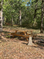
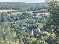
(5) Turn right onto the path, which is clearly signposted ‘La Vallée’. About thirty metres on, a lovely clearing offers a view of the village of Foncegrive nestled amongst the greenery. A picnic table invites you to stop for a picnic in this beautiful spot. Then follow the path back to the village.
(6) You’ll come out onto the departmental road at the entrance to Foncegrive. Please note: even though there’s little traffic on this small road, do take care. Turn right onto the road. Walk past the town hall before crossing the Venelle. Leave the main road by continuing straight on along the Chemin de Boussenois, then turn right onto the Chemin de Praillard and right again onto the Chemin de Geney. Throughout your walk through the village, the yellow markings are very prominent and provide clear guidance.
(7) Leave the tarmac section by turning onto the Chemin de Longchamps. Follow it to the left for 750 metres. Take care not to miss the path leading up to the Forêt de Gency (signposted).
(8) Take the steep path leading into the forest and follow the well-marked trail for 2 km. It crosses two lovely valleys and ends at the edge of the forest.
(9) Once you reach the white path, follow it to the right until you reach the first houses. Continue along Rue des Saulx, which is a continuation of the path.
(10) Turn left onto Rue Sentier du Grand Tétot, which leads to the health centre. From there, continue to the right towards the Seb offices, which can be seen further along the street.
(11) Cross Rue Meville D27 at the pedestrian crossing, walk 40 metres to the right and turn left onto Rue de la Greuillotte, which runs through the Seb factory. Continue straight on as the road climbs and becomes a pedestrian-only street. Carefully cross the D3 county road and take Rue du Stade, opposite, which leads back to the Courvelles Sports Complex (S/E).
 Local authority

 Association / Club / Walk leader
 Easy
Easy 
 Visorando Member
 Difficult