Short version of the Tertre hike from Selongey

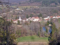
The Selongey area, home to the SEB pressure cooker, invites you to explore its Tertre hiking trail. Its name comes from the woodland you will pass through during this hike, which reaches a highest point of 415 m.
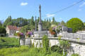
You’ll pass by the statue of the Virgin Mary, along the Tille and Venelle wind farm, before descending a beautiful path to join the track that will take you back to Selongey. You’ll finish this hike by passing near the pressure cooker factory.

Details

93590309
Creation:
Last update:
Last review:
  • Walking
    Activity: Walking
  • ↔
    Distance: 4.93 mi
  • ◔
    Average duration: 2h 40 
  • ▲
    Difficulty: Easy

  • ⚐
    Back to start: Yes
  • ↗
    Ascent: + 449 ft
  • ↘
    Descent: - 436 ft

  • ▲
    Highest point: 1,401 ft
  • ▼
    Lowest point: 981 ft
  • ⚐ Country: France
  • ⚐ City: Selongey (21260)
  • ⚑
    Start/End: N 47.584712° / E 5.182463°
  • ❏
    IGN map(s): Ref. 3121SB
  • Hour-by-hour weather

Photos

Description of the walk

Park in the car park on Rue Henri Jevain, Place Frédéric Lescure, opposite the hall of the same name.

(S/E) With your back to the hall, head off to the right. Soon, turn left onto Rue du 12 Juillet 1998, then walk alongside the artificial football pitch until you reach a side street (Voie du Marché). Follow it to the right, join the D3 and take it to the left for 50 m.

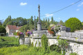
(1) Turn right at the statue of the Virgin Mary onto Rue de la Charme, and continue straight on at the first two junctions until you reach a triangular junction with a central tree-lined island. Cross over to the opposite side.

(2) Follow Rue du Tertre, which branches off to the left. At the next junction, turn left and continue along Rue du Tertre, then follow the dirt track for 2.3 km until you reach the wind farm.

(3) Turn right onto a straight stretch of about 1 km.

(4) Leave the track to the right onto a winding path that leads to the edge of a field.

(5) Walk along the edge of the field for 100 m, keeping well to the side to respect the crops, then take the dirt track on the right which leads back to Selongey

(6) Once on the tarmac, Rue de Marey, head down to the left until you reach Rue de Bussin. At the junction, turn right onto this uphill street, then take the street on the left towards Orville. At the next junction, continue left onto the D3 and you will soon find Rue du Stade on the right. Follow it to the car park of the Salle Frédéric Lescure (S/E).

Waypoints

  1. S/E : mi 0 - alt. 997 ft - Frédéric Lescure Hall car park
  2. 1 : mi 0.38 - alt. 1,037 ft - Crossroads of the - Statue de la Vierge - Selongey
  3. 2 : mi 0.68 - alt. 1,106 ft - Rue du Tertre
  4. 3 : mi 2.18 - alt. 1,391 ft - Start of the straight section
  5. 4 : mi 2.63 - alt. 1,243 ft - Final straight section
  6. 5 : mi 2.89 - alt. 1,142 ft - Walk along the field
  7. 6 : mi 4.5 - alt. 1,007 ft - Rue de Marey - Venelle (rivière) - Affluent de la Tille
  8. S/E : mi 4.93 - alt. 997 ft - Frédéric Lescure Hall car park

Notes

Easy parking at the starting point.
The hiking trail is set in the heart of the countryside. Always be careful, prepared and respectful.

Worth a visit

(S/E) The SEB factory, founded in 1857 by Antoine Lescure, has made Selongey the home of the pressure cooker since 1953. A factory outlet is open in the town of Selongey.
There are also plenty of leisure activities, restaurants and accommodation options available in the town.

Other walks in the area

For more walks, use our search engine .

The GPS track and description are the property of this route's author. Please do not copy them without permission.