The Meuley Circuit in Is-sur-Tille

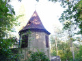
This route, partly through woodland, will allow you to discover the leat des Courtines, the market halls, the medieval defensive ditch and a viewpoint overlooking Mont de Marcilly
Hunting days: Sundays and public holidays. Côte-d’Or PDIPR route.

Details

4409030
Creation:
Last update:
Last review:
  • Walking
    Activity: Walking
  • ↔
    Distance: 4.46 mi
  • ◔
    Average duration: 2h 20 
  • ▲
    Difficulty: Easy

  • ⚐
    Back to start: Yes
  • ↗
    Ascent: + 325 ft
  • ↘
    Descent: - 328 ft

  • ▲
    Highest point: 1,240 ft
  • ▼
    Lowest point: 902 ft
  • ⚐ Country: France
  • ⚐ City: Is-sur-Tille (21120)
  • ⚑
    Start/End: N 47.521391° / E 5.108764°
  • ❏
    IGN map(s): Ref. 3121SB, 3122SB
  • Hour-by-hour weather

Photos

Description of the walk

Start at Place de la Résistance (car park).

(S/E) Turn left onto Rue des Capucins, cross it and take Rue Gambetta opposite, which runs alongside the Courtines leat. Turn left onto Rue de Laignelet, then walk along the right-hand side of Place de la République, where the Tourist Office is located.

(1) At the end of the square, take the Truchebeuf footbridge over the Ignon, turn right onto Rue Poinsot and head towards another footbridge. After crossing it, turn left and walk 100 metres along Rue Félix Lechenet.

(2) Turn right onto Rue de la Rochotte and continue along this street until you reach the ‘Stop’ sign on the D 959.

(3) Cross this road and then follow it on the right past Transports Cordier. Opposite the ‘end of built-up area’ sign, turn left onto a path leading into the woods. At the Fork in the road, veer left.

(4) At the crossroads, take the path on the left which climbs gently up to the Chemin des Carrières.

(5) Take a sharp left-hand bend and walk past the quarries where ‘Pierre d’Is-sur-Tille’ stone was once quarried (private property). Continue along Rue des Carrières, followed by Rue François Rude.

(6) Cross the medieval defensive ditch via the Porte de Langres bridge and take Rue Pasteur. Continue to Place Jean Durant (a Protestant pastor in Is from 1623 to 1678).

(7) Turn right onto Quai Miton (named after the parish priest who founded the first hospice in 1412). Turn right and walk a few dozen metres along Ruelle Saint-Antoine, then turn left into Ruelle de Graviers, which leads onto Rue des Capucins.

(8) Follow it to the left to reach the car park situated a little further on to the right (S/E).

Waypoints

  1. S/E : mi 0 - alt. 915 ft - Place de la Résistance (car park)
  2. 1 : mi 0.3 - alt. 906 ft - Truchebeuf footbridge - Ignon (rivière)
  3. 2 : mi 0.46 - alt. 906 ft - Rue de la Rochotte
  4. 3 : mi 0.96 - alt. 925 ft - Junction with the D 959
  5. 4 : mi 1.61 - alt. 1,129 ft - A path that climbs slightly
  6. 5 : mi 2.66 - alt. 1,207 ft - Quarry path
  7. 6 : mi 4.07 - alt. 906 ft - Porte de Langres Bridge
  8. 7 : mi 4.15 - alt. 906 ft - Quai Jacques Miton
  9. 8 : mi 4.31 - alt. 909 ft - Rue des Capucins
  10. S/E : mi 4.46 - alt. 915 ft - Place de la Résistance (car park)

Notes

Reviews and comments

4.7 / 5
Based on 2 reviews

Reliability of the description
5 / 5
Ease of following the route
5 / 5
Route interest
4 / 5
Agenceur
Agenceur
• Edited:

Overall rating : 4.7 / 5

Date of your route : Jul 27, 2023
Reliability of the description : ★★★★★ Very good
Ease of following the route : ★★★★★ Very good
Route interest : ★★★★☆ Good
Very busy route : No

A pleasant walk starting with a stroll through Is-sur-Tille (the least interesting part, as to avoid the main road you have to go through an industrial estate with a few lorries passing by) before heading onto a wooded path. This section is quite pleasant, even though I came across six or seven trees lying across the path – which just goes to show that the path isn’t used by motorbikes or quad bikes! The walk took 1 hour 25 minutes, at the dog’s pace!

Machine-translated

Xylo21
Xylo21

Overall rating : 4.7 / 5

Date of your route : Feb 20, 2021
Reliability of the description : ★★★★★ Very good
Ease of following the route : ★★★★★ Very good
Route interest : ★★★★☆ Good
Very busy route : No

A lovely little walk we did as a family on 20 February 2021 in clear weather. The forest paths were a bit muddy in places but nothing we couldn’t manage; we came across two people on horseback. The walk took just over two hours with an 8-year-old child.

Machine-translated

Other walks in the area

For more walks, use our search engine .

The GPS track and description are the property of this route's author. Please do not copy them without permission.