Country:
 City:
City:


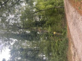
The start of the walk is at the Courvelles Sports Centre, the starting point for the village’s four signposted walks. A large car park provides ample parking.
(S/E) At the start, head down to the left, due south-east, skirting the campsite. Turn right onto the Voie du Marché, which you should follow to the right and continue up to its end.
(1) Cross the D3 county road. Please note: make sure you use the pedestrian crossing on the left. Then walk down Rue de Bussin opposite the Voie du Marché. On your right, you’ll see the buildings of the Seb factory, which occupy the entire centre of the village.
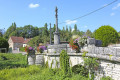
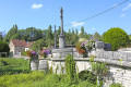
(2) Cross the Venelle over the old stone bridge and take Rue de Champoint opposite. At the next junction, continue along Rue de Champoint to the left.
(3) Take Chemin de Foncegrive on the left and follow it for 1.6 km.
(4) A few metres before reaching the Route de Foncegrive (D27), take the hairpin bend path which climbs to the right. When the path ends at a stony track, turn left. Then take a right-hand bend.
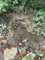
(5) On your right, you’ll notice a lovely little spring that crosses the path before disappearing into the woods. Take the path on the right which climbs into the forest. Follow the signposting to take the path on the right at the next junction, then at each subsequent junction, follow the yellow markings carefully. When it’s no longer possible to go straight ahead, keep to the right.
(6) Once you reach the white path, follow it to the right until you reach the first houses.
(7) Take the path on the left as you leave Rue des Saulx to reach the medical centre and carry on towards the Seb offices.
(8) Cross at the pedestrian crossing and turn left onto Rue de la Greuillotte, which runs through the Seb factory. Carry on straight ahead as the road climbs and becomes a pedestrian-only street. Cross the D3 county road with care and take Rue du Stade, opposite, which leads back to the starting point (S/E).
 Association / Club / Walk leader
 Moderate
 Local authority
 Visorando Member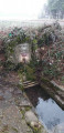
 Tourist office