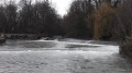
Circular in Vingeanne starting from Chevigny

A walk through woodland and along the canal, passing through charming villages – a pleasant family outing with no difficulty.

Details

n°59971118
Creation:
Last update:
Last review:
  • Walking
    Activity: Walking
  • ↔
    Distance: 11.29 mi
  • ◔
    Average duration: 5h 35 
  • ▲
    Difficulty: Moderate

  • ⚐
    Back to start: Yes
  • ↗
    Ascent: + 466 ft
  • ↘
    Descent: - 436 ft

  • ▲
    Highest point: 873 ft
  • ▼
    Lowest point: 686 ft
  • ⚐ Country: France
  • ⚐ City: Bèze (21310)
  • ⚑
    Start/End: N 47.457352° / E 5.307965°
  • ❏
    IGN map(s): Ref. 3122SB
  • Hour-by-hour weather

Description of the walk

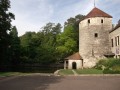
In Bèze, head towards Bourberain via the D960. On leaving Bèze, turn right and take the D30H towards Chevigny. On arrival in Chevigny, opposite the church, take the road on the left passing under a dovecote and park at the side of it. Please be aware that tractors are in use.

(S/E) Walk back up towards the church and join the D30H towards Béze, until you reach the farm known as Les Brosses.

(1) Walk round the farm and follow theGR® trail, marked in white and red, along the road to the ‘Ferme de la Rente Rouge’. Walk past the farm, staying on theGR® trail. Continue along the path behind the farm, cross the fields and reach the edge of a wood.

(2) Enter the woodland; there is a sign here advising caution during the hunting season. Reach the edge of the forest.

(3) Enter the woodland, continue along the path and stay on it, ignoring all turnings to the right or left, until you reach a junction with a road.

(4) Turn right onto the road, then turn left immediately at the next junction. Follow the signs for Dampierre as indicated on the signpost. Walk alongside a woodland; on emerging from it, you’ll come to another junction.

(5) Turn right. Follow a straight stretch of road to reach another crossroads. Turn left to reach the flying club hangars further on, on the right-hand side. Continue on to the village.

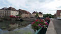
(6) Turn left towards Dampierre-et-Flée. At the junction, turn right onto Rue du Moulin. Cross the bridge over the canal between Champagne and Burgundy, then pass under it by going round to the left to reach the towpath that forms part of the Voie Verte.

(7) Turn left onto it and follow it as far as lock 35.

(8) Leave this path here, cross the bridge and follow the Chemin des Prés towards Beaumont-sur-Vingeanne. Continue to the junction with the D27c.

(9) Turn right onto this road, which is also known as Rue de Plantenay. Continue with care, passing the town hall. Carry on along Rue de la Mairie, then turn left onto Rue des Châteaux d’Eau. You’ll come to a wayside cross near the water towers.

(10) Turn right towards Mirebeau. Continue along this wide track, skirting a woodland, then reach its western edge.

(11) Turn left onto a straight path and follow it until you reach a six-way junction.

(12) Take the small road on the right – take care as vehicles use this road. Continue through the fields of La Combe Jean Lorge. You will then rejoin the D30b at the crossroads on the edge of the Bois de l’Abbé.

(13) Turn right onto this road, then immediately right again onto the wide track and follow it to the Chevigny car park (S/E).

Waypoints

  1. S/E : mi 0 - alt. 751 ft - Chevigny car park
  2. 1 : mi 0.69 - alt. 794 ft - Ferme des Brosses
  3. 2 : mi 1.59 - alt. 846 ft - Edge of the woods
  4. 3 : mi 1.91 - alt. 856 ft - Woods
  5. 4 : mi 3.62 - alt. 814 ft - Crossroads
  6. 5 : mi 4.36 - alt. 820 ft - Crossroads at the edge of the woods
  7. 6 : mi 5.21 - alt. 764 ft - Hangars
  8. 7 : mi 5.7 - alt. 705 ft - Towpath - Canal entre Champagne et Bourgogne
  9. 8 : mi 6.42 - alt. 702 ft - Lock 35
  10. 9 : mi 6.77 - alt. 709 ft - D27c
  11. 10 : mi 7.2 - alt. 817 ft - Water towers
  12. 11 : mi 8.04 - alt. 774 ft - Edge of the woods
  13. 12 : mi 9.03 - alt. 771 ft - Six-way junction
  14. 13 : mi 10.06 - alt. 794 ft - After a few metres, rejoin the dirt track.
  15. S/E : mi 11.29 - alt. 758 ft - Chevigny car park

Notes

(6) In the village of Dampierre-et-Flée, there is a stall selling local produce on the square (pâté, pâté en croûte). Picnics are possible.
Between (10) and (11) You can stop for a break at the Town Hall Square in Beaumont-sur-Vingeanne.

Worth a visit

(8) The locks, where you might see boats passing through if you’re lucky today.
Between (8) and (9): the canal between Champagne and Burgundy
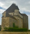
Between (9) and (10) Château de Beaumont-sur-Vingeanne, 3 Rue de Richebourg: The château is an 18th-century building in the classical style, set in 6-hectare grounds with a kitchen garden in Beaumont-sur-Vingeanne in the Côte-d’Or, Burgundy. It has been listed as a historic monument since 16 April 1948.

Always be cautious and plan ahead when you're outdoors. Visorando and the author of this route cannot be held responsible for any accidents occurring on this route.

The GR® and PR® markings are the intellectual property of the Fédération Française de Randonnée Pédestre.

Reviews and comments

4.2 / 5
Based on 2 reviews

Reliability of the description
4.5 / 5
Ease of following the route
5 / 5
Route interest
3 / 5
patetiti
patetiti

Overall rating : 4.3 / 5

Date of your route : Feb 03, 2025
Reliability of the description : ★★★★☆ Good
Ease of following the route : ★★★★★ Very good
Route interest : ★★★★☆ Good
Very busy route : No

From the start, I followed a path roughly marked in yellow to reach the Bois Rouge farm, to avoid the main road towards Bèze Il

Machine-translated

Marti21
Marti21

Thank you for your comments; it’s true that it’s not quite as interesting, but the route takes you through woods and across plains, alongside the canal, with the added attraction of old buildings in the villages.

Machine-translated

cuzcodom
cuzcodom

Overall rating : 4 / 5

Date of your route : Jan 26, 2025
Reliability of the description : ★★★★★ Very good
Ease of following the route : ★★★★★ Very good
Route interest : ★★☆☆☆ Disappointing
Very busy route : No

Best avoided in hot weather.
However, it’s fine to visit during the hunting season, as according to a sign, hunting drives only take place on Saturdays. On other days, it’s quiet...

Machine-translated

Other walks in the area

For more walks, use our search engine .

The GPS track and description are the property of this route's author. Please do not copy them without permission.