Country:
 City:
City:


Coming from Is-sur-Tille via the D959, turn right onto Rue Basse and drive past the town hall. Park in the grassy car park alongside the D120, near the bus stop.
(S/E) Head north-east and follow the D120 towards Crecey-sur-Tille.
(1) Just after crossing the River Tille, take the first path on the left, signposted ‘MTB’.
(2) At a fork in the road, turn left onto the track from Crecey to Marey. Continue straight on (north-west) along the edge of the forest.
(3) Cross a stream at a place called Place Marc Siri 1984 and continue north-west along the track. Further on (elevation 296), ignore a track coming from the right and cross a stream. You’ll arrive in Marey-sur-Tille and come to a junction level with the second house on the right-hand side.
(4) Take a path on the left, behind a hedge. You’ll emerge onto Rue de Gorgeot and follow it to the right. At the end, turn left onto the D959, cross the bridge over the Tille and carry straight on to the church.
(5) Turn right into Grande Rue. Take the first left, into Rue de L’Arguillier. At the end of the tarmac, continue along the path as it continues. Head uphill into the forest.
(6) Join the D120 and follow it to the right, continuing uphill.
(7) When the road bends to the right, leave it and carry straight on along a dirt track.
(8) At the end, cross the D120d (silo) and continue along the track opposite. Further on (elevation 409), ignore a track coming from the left and head downhill to reach the village of Luxerois.
(9) Turn left onto the D120g, just after the bus shelter. When the road bends to the left (elevation 416), continue straight ahead along a track. Head down between the fields, keeping a south-easterly direction.
(10) At Combe Langrois, on the right, turn left towards Bois Valby. In the woods, turn right. On leaving the woods, turn left and stay on the edge of the woods until you reach the hamlet of Les Moritaines.
(11) After passing a green shed on your right, take a marked mountain-bike track to the right. Enter the forest and, at a Fork in the road, veer left (south-east).
(12) Cross a small road (D120d) and take the unpaved track opposite (leave the signposted route and stay on the Chemin de Monchevreuil). Pass the next three tracks on your left.
(13) At the Poteau de Montchevreuil, turn left, and at the Fork in the road immediately ahead, turn right. Follow the Chemin des Mauritaines heading east-southeast for 600 m.
(14) Turn left. Head downhill with the Combe de la Terriote below on your right. Ignore a path coming from the left and continue downhill.
(15) At the T-junction as you emerge from the woods, turn left and walk north-east between the fields.
(16) Join the D959 and follow it to the left for about a hundred metres. Then take the first path on the right. After about 200 metres, turn left (north-north-west). Further on, continue along a white track.
(17) Shortly afterwards, when the dirt track turns right, carry on straight ahead. Enter Villey-sur-Tille via Ruelle des Vignes. At the T-junction, turn slightly left.
(18) At the end, follow Rue de l’Église to the right and, at the junction, carry straight on along this street.
(19) At the foot of the church, turn right onto Rue du Château (D120). Walk past the town hall, cross the River Tille and return to the car park where you started (S/E).

 Visorando Member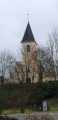
 Easy
Easy 
 Tourist office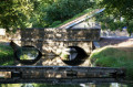

 Moderate
  Local authority
 Association / Club / Walk leader