


Refine your search for walks in Giat
Giat walks

 The Trois Tourtes du Sioulet from Herment
 Visorando Member
 6.24 mi
 +604 ft
 -597 ft
 3h 25
3h 25
 Moderate
 Departure from Herment (Puy-de-Dôme)
A pleasant walk north of Herment, exploring the Sioulet Valley and the druidic site of Les Trois Tourtes. The varied route through a hedgerow-lined countryside combines meadows and woodland sections, making for a very natural and peaceful route.
Around the ponds near Flayat
 4.27 mi
+171 ft
-194 ft
2h 05
4.27 mi
+171 ft
-194 ft
2h 05
 Easy
Departure from Flayat (Creuse)
Easy
Departure from Flayat (Creuse)
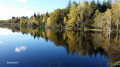
During this walk, you will discover some of the many ponds in the commune of Flayat.
You are in a mushroom-rich area and the landscape is spectacular in autumn when the trees are ablaze with colour and reflected in the ponds.
Chemin des Trois Communes starting from Chard
 Tourist office4.62 mi
+486 ft
-509 ft
2h 35
Moderate
Departure from Chard (Creuse)
Tourist office4.62 mi
+486 ft
-509 ft
2h 35
Moderate
Departure from Chard (Creuse)
The three-village trail will take you from the village of Chard to the village of Lioux-les-Monges, where you can enjoy beautiful views and visit the Jardin de la Cure. You will finish the hike by crossing the village of Châtelard. Hiking information sheet available from the Auzances tourist office (Place du Marché).
Walk around the Étang Neuf and its footbridges
 2.18 mi
+23 ft
-23 ft
1h 00
Easy
Departure from Montel-de-Gelat (Puy-de-Dôme)
2.18 mi
+23 ft
-23 ft
1h 00
Easy
Departure from Montel-de-Gelat (Puy-de-Dôme)
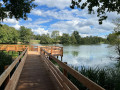
Set off to explore L’Étang Neuf and its footbridges in a magnificent setting!
The Sioulet Gorges
 4.49 mi
+387 ft
-390 ft
2h 25
Easy
Departure from Pontaumur (Puy-de-Dôme)
4.49 mi
+387 ft
-390 ft
2h 25
Easy
Departure from Pontaumur (Puy-de-Dôme)
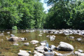
Leaving the village of Pontaumur, you will discover the Sioulet, a tributary of the Sioule and a paradise for trout fishermen. The wild gorges will delight lovers of unspoilt nature.
Circular loop via the Roman road to Néoux
 4.72 mi
+427 ft
-410 ft
2h 35
Easy
Departure from Néoux (Creuse)
4.72 mi
+427 ft
-410 ft
2h 35
Easy
Departure from Néoux (Creuse)
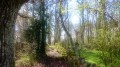
Starting from Néoux, this is a short, easy circular family walk along pleasant paths and part of a Roman road, the Sentier de César, through woods and meadows. The route is designed to avoid roads as far as possible.
Mirambel Forest
 4.71 mi
+315 ft
-312 ft
2h 25
Easy
Departure from Saint-Rémy (Corrèze) (Corrèze)
4.71 mi
+315 ft
-312 ft
2h 25
Easy
Departure from Saint-Rémy (Corrèze) (Corrèze)
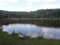
This route takes you through one of the most beautiful deciduous forests on the Millevaches plateau.
The village of Saint-Rémy is also well worth a visit.
The Rochers de Saint-Julien
 2.69 mi
+141 ft
-141 ft
1h 20
Easy
Departure from Dontreix (Creuse)
2.69 mi
+141 ft
-141 ft
1h 20
Easy
Departure from Dontreix (Creuse)
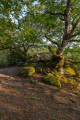
Set off to explore the Rochers de Saint-Julien in the heart of the mysterious Forêt de Drouille.
Drouille woods circuit from Courdemanges (yellow markings)
 Local authority3.65 mi
+246 ft
-230 ft
1h 55
Easy
Departure from Charron (Creuse) (Creuse)
Local authority3.65 mi
+246 ft
-230 ft
1h 55
Easy
Departure from Charron (Creuse) (Creuse)
Stroll through the Drouille Forest along small paths. Enjoy the magnificent undergrowth and admire several crosses along the way, including the imposing stone cross of Courdemanges.
La Vergnade circuit from Courdemanges (yellow markings)
7.67 mi
+617 ft
-633 ft
4h 05
Moderate
Departure from Charron (Creuse) (Creuse)
Starting from Courdemanges, this is a magnificent, well-maintained walk through woodland. Note the recent restoration of an old weighbridge, magnificent views and the imposing Croix Tontus in the village of Courdemanges.
Streams, brooks and rivers, south of Felletin
 9.56 mi
+1,289 ft
-1,286 ft
5h 30
Moderate
Departure from Felletin (Creuse)
9.56 mi
+1,289 ft
-1,286 ft
5h 30
Moderate
Departure from Felletin (Creuse)
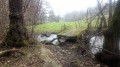
Starting from Felletin, this short hike will take you along streams, rivers and brooks, wells, wash houses and drinking troughs, crossing footbridges, a typical Limousin plank bridge and even a balancing ford.
Felletin circular route to the Combes dam
 10.44 mi
+1,280 ft
-1,394 ft
5h 55
Moderate
Departure from Felletin (Creuse)
10.44 mi
+1,280 ft
-1,394 ft
5h 55
Moderate
Departure from Felletin (Creuse)
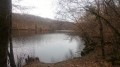
This hike allows you to discover the Creuse in all its forms: a fast-flowing river north of Felletin, which slows down and spreads out before the dam, then drops downstream before resuming its course towards Aubusson.
Left bank, then right bank, the circular route also takes you to the Combes dam.
Auzances - La Mérodie
3.73 mi
+492 ft
-512 ft
2h 10
Easy
Departure from Auzances (Creuse)
Set off to explore the town of Auzances and the village of La Mérodie. Hiking information sheet available from the Auzances Tourist Office (Place du Marché).
Circular Coux in Auzances
2.52 mi
+213 ft
-220 ft
1h 20
Easy
Departure from Auzances (Creuse)
A short, shaded circular loop between woods and meadows, hilly, consisting of very passable dirt tracks and very small roads used by locals. During the walk, you will pass a small pond with tables and benches. Horses may be present on the route.
Arle Circuit (blue markings)
5.96 mi
+551 ft
-541 ft
3h 15
Moderate
Departure from Charron (Creuse) (Creuse)
A beautiful hike at the gateway to Auvergne, discovering the small heritage sites and landscapes of Creuse. Discover the flora and fauna of our countryside and stop at pretty viewpoints.
The Jean Guitton Trail in Champagnat
6.58 mi
+656 ft
-659 ft
3h 35
Moderate
Departure from Champagnat (Creuse)
This walk follows the paths once taken by Jean Guitton during his holidays in the Creuse at the Château de Fournoux. Hiking map available from the Auzances tourist office (Place du Marché).
The ‘Electric Dordogne’ in Saint-Sauves-d’Auvergne
9.08 mi
+1,204 ft
-1,224 ft
5h 15
Moderate
Departure from Saint-Sauves-d'Auvergne (Puy-de-Dôme)
A circular route starting from Saint-Sauves-d’Auvergne, with two round trips added to the route: the first along the fast-flowing Dordogne, just past the first dam on its course, just downstream from La Bourboule; the second to climb to the summit of the Petit Puy de Châteauneuf, for a beautiful viewpoint. A Sully lime tree and a 12th-century carved archway in the village of Saint-Sauves round off this outing.
The Four Crosses Route in Vergheas
 3.61 mi
+400 ft
-371 ft
2h 00
Easy
Departure from Vergheas (Puy-de-Dôme)
3.61 mi
+400 ft
-371 ft
2h 00
Easy
Departure from Vergheas (Puy-de-Dôme)
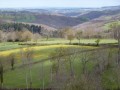
A hike in the Combrailles, amongst valleys and hills – on foot, by bike or on horseback – come and explore this green haven.
The Huit Croix (eight crosses)
 7.31 mi
+850 ft
-856 ft
4h 05
Moderate
Departure from Vergheas (Puy-de-Dôme)
7.31 mi
+850 ft
-856 ft
4h 05
Moderate
Departure from Vergheas (Puy-de-Dôme)
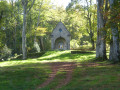
A hike between rivers and woodland hills, in the Combrailles region.
Champagnat Woods via the Croix du Loup
 4.94 mi
+472 ft
-472 ft
2h 40
Easy
Departure from Champagnat (Creuse)
4.94 mi
+472 ft
-472 ft
2h 40
Easy
Departure from Champagnat (Creuse)
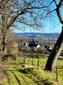
Starting from the village, this circular route will take you to the Croix du Loup and allow you to explore the woods of Champagnat. On a clear day, you can see the Massif du Sancy and the Puy de Dôme.
Please note that this route is not signposted. So make sure you have the description with you.
Around Aubusson
3.48 mi
+482 ft
-486 ft
2h 00
Easy
Departure from Aubusson (Creuse)
A short, easy walk to explore Aubusson, the banks of the Creuse, the old mill, the Bois de la Bonne Vierge, and the heights of Saint-Jean with a magnificent view of the chapter house.
Les Eaux Minérales in Saint-Priest-des-Champs
 3.11 mi
+407 ft
-436 ft
1h 45
Moderate
Departure from Saint-Priest-des-Champs (Puy-de-Dôme)
3.11 mi
+407 ft
-436 ft
1h 45
Moderate
Departure from Saint-Priest-des-Champs (Puy-de-Dôme)
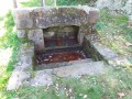
A pleasant, short, shaded walk, mainly through woodland, with a point of interest to discover: the site known as Eaux Minérales (a source of iron-rich water, not commercially exploited but showcased).
No major difficulty; just a slight elevation gain, with a fairly steep slope at the end of the route.
A particularly refreshing walk in summer as it is largely under the cover of trees.
Following the granite outcrops around Chaveroche
6.79 mi
+774 ft
-761 ft
3h 50
Moderate
Departure from Chaveroche (Corrèze)
A walk suggested, without a detailed description, by “Haute-Corrèze Communauté”. Marked in yellow (needs reviewing in places…), it mainly follows a route through the woods, which is very pleasant on a hot summer’s day.
Banne d'Ordanche and Borne des Quatre Seigneurs from Pré Cohadon
8.59 mi
+1,952 ft
-1,923 ft
5h 40
Moderate
Departure from Murat-le-Quaire (Puy-de-Dôme)
Starting from the Murat-le-Quaire leisure area, the route climbs directly to the Banne d'Ordanche, then passes by the Borne des Quatre Seigneurs before returning through the forest. Superb views.
Visit Murat-le-Quaire
0.85 mi
+102 ft
-102 ft
0h 30
Easy
Departure from Murat-le-Quaire (Puy-de-Dôme)
A walk to discover this village in the Dordogne valley, located in the hills above La Bourboule.
The Gour Saillant waterfall
 2.07 mi
+433 ft
-440 ft
1h 20
Easy
Departure from Saint-Priest-des-Champs (Puy-de-Dôme)
2.07 mi
+433 ft
-440 ft
1h 20
Easy
Departure from Saint-Priest-des-Champs (Puy-de-Dôme)
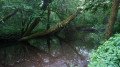
A short round trip to enjoy the beautiful Gour Saillant waterfall.
La Banne d'Ordanche from Le Pessy or Le Pré Cohadon
 6.82 mi
+1,883 ft
-1,883 ft
4h 45
Moderate
Departure from Murat-le-Quaire (Puy-de-Dôme)
6.82 mi
+1,883 ft
-1,883 ft
4h 45
Moderate
Departure from Murat-le-Quaire (Puy-de-Dôme)
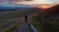
A pleasant circular walk, starting from the hamlet of Le Pessy (Murat-le-Quaire, above the spa town of La Bourboule). The route passes through magnificent beech forests before reaching the summer pastures and high-altitude meadows of the Banne d’Ordanche. This volcanic peak, rising to 1,512 m, offers exceptional views: from the Cantal mountains to the Corrèze plateaus, all the way to the Dôme mountains.
Circular route between La Bourboule and Saint-Sauves-d’Auvergne
 Association / Club / Walk leader10.36 mi
+1,398 ft
-1,378 ft
6h 00
Moderate
Departure from La Bourboule (Puy-de-Dôme)
Association / Club / Walk leader10.36 mi
+1,398 ft
-1,378 ft
6h 00
Moderate
Departure from La Bourboule (Puy-de-Dôme)
Starting from the tourist office in La Bourboule – a charming town with superb spa architecture, including the Grands Thermes with its oriental-style domes – this circular walk will take you through the landscapes of the upper Dordogne valley, passing through Saint-Sauves-d’Auvergne, a village designated a ‘Classée Commune Touristique’ in 2016.
La Banne d'Ordanche from La Bourboule
9.01 mi
+2,411 ft
-2,395 ft
6h 15
 Difficult
Departure from La Bourboule (Puy-de-Dôme)
Difficult
Departure from La Bourboule (Puy-de-Dôme)
Rising to an altitude of 1,515 metres above the village of Murat-le-Quaire, the Banne d’Ordanche is a volcanic peak offering a 360° view that is truly breathtaking. This hike begins with an ascent, starting with gentle zigzags before finishing with steps leading to the summit of the Banne.
The thermal Dordogne at La Bourboule
3.62 mi
+528 ft
-541 ft
2h 05
Easy
Departure from La Bourboule (Puy-de-Dôme)
A circular walk to discover the small spa town, taking in a number of viewpoints on either side of the Dordogne River.
Pregnoux Circular in La Bourboule
 3.51 mi
+440 ft
-449 ft
2h 00
Easy
Departure from La Bourboule (Puy-de-Dôme)
3.51 mi
+440 ft
-449 ft
2h 00
Easy
Departure from La Bourboule (Puy-de-Dôme)
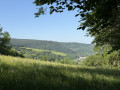
This route takes you along the River Dordogne before heading up to the rural village of Le Pregnoux, situated on the hills above the spa town, then back to La Bourboule via Parc Fenestre, alongside the River Vendeix.
La Bourboule - Le Mont Dore route
 25.64 mi
+7,228 ft
-6,680 ft
3 days
Moderate
Departure from La Bourboule (Puy-de-Dôme)
25.64 mi
+7,228 ft
-6,680 ft
3 days
Moderate
Departure from La Bourboule (Puy-de-Dôme)
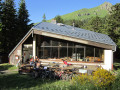
A three-day hike starting from La Bourboule, taking you to several peaks in Auvergne (Capucin, Puy de Cliergue, Puy de la Tour Carrée, Le Sancy), the Chaudefour Valley, the Grande Cascade waterfall, etc., ending in the town of Le Mont Dore.
La Bourboule - Mont Dore Resort
9.63 mi
+3,022 ft
-1,614 ft
7h 05
Difficult
Departure from La Bourboule (Puy-de-Dôme)
We will set off from the Étoile du Sancy in La Bourboule and head to the ECIR Chalet in the resort of Mont Dore, passing through Capucin, Puys de Cliergue, La Tour Carrée and Val de Courre.
Le Puy Gros from La Bourboule
8.71 mi
+2,339 ft
-2,333 ft
6h 05
Difficult
Departure from La Bourboule (Puy-de-Dôme)
A hike that begins with a lovely climb through lush semi-alpine vegetation, rich in colour and country scents. Le Puy Gros, the remnant of an ancient volcanic dome, offers a unique panorama over the Upper Dordogne valley and the spa towns of Mont-Dore and La Bourboule.
 Saint-Sauves-d’Auvergne from La Bourboule
11.28 mi
+1,555 ft
-1,581 ft
2 hrs
Moderate
Departure from La Bourboule (Puy-de-Dôme)
A route that follows the Dordogne river to Saint-Sauves-d’Auvergne along a wooded path, then a gentle climb up to the ridges with beautiful, sweeping views, before reaching Lac du Pré Cohadon. The walk then takes you through the village of Murat-le-Quaire before returning to La Bourboule, which, when viewed from above, reveals its superb architecture, including the Grands Thermes with their oriental-style domes and the stately mansions.
Vendeix, the stream, the rock and the hamlets
6.36 mi
+1,742 ft
-1,759 ft
4h 25
Moderate
Departure from La Bourboule (Puy-de-Dôme)
A circular route on the south side of La Bourboule, following the Vendeix, a tributary of the Dordogne which you follow during the first part of the hike, which is also the name of a small basalt spur, the Roche de Vendeix, and two hamlets. After passing by the Rocher de l'Aigle, which offers a breathtaking view of La Bourboule, the hike ends with a visit to some of the must-see sights of this small spa town.
Discover the thermal springs of the Dordogne
3.47 mi
+709 ft
-709 ft
2h 15
Easy
Departure from La Bourboule (Puy-de-Dôme)
Starting from La Bourboule, this hike follows the spring trail along the banks of the Dordogne. Halfway through, you can either retrace your steps or go via Rigolet Bas as described below.
This hike allows you to discover thermal springs such as the Félix Spring and the Croizat Spring.