Country:

 City:
City:


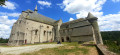
Park in the car park in the centre of the village of Chaveroche, opposite the little church. This car park is the starting point for the walk.
(S/E) Leave the car park by turning right onto Rue des Fontaines, which passes in front of the restored village oven (with a thatched cottage at the back). A little further on, pass the cemetery on your left.
(1) After the cemetery, turn right towards the community hall. Cross its car parks, then walk alongside it on the right-hand side. Then turn right to follow a small road that runs straight through Chaverochette. This continues as a track which, after a winding descent, leads to a crossroads.
(2) Turn right onto a track which, after about 700 m, joins a road. Take this road to the left, until you reach the right-hand bend leading to the hamlet of La Grafouillère.
(3) Continue straight ahead along the track. After 50 m, ignore the track going uphill opposite and turn onto the one on the right. After crossing a stream, ignore the track coming in from the left (running alongside a fence), pass under a high-voltage power line, and emerge onto a road.
(4) Turn right (no signposting) and follow this road to the first houses in Chassaing. Turn left onto a road which, after passing through the village, continues as a track. At the top of the hill, ignore a path on the left and carry on straight ahead. Further on, on the descent, ignore two paths on the right and continue downhill. After running alongside the Diège, the path joins a road (RD 49).
(5) Follow this road to the left as it climbs to a junction, where you turn left (towards “Neuf Jours”). Follow this road to the top of the hill, where it turns left. Take the opportunity to look back and enjoy the view of the Sancy Massif.
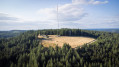
(6) Then head straight ahead onto a track which, after passing under the high-voltage power lines, continues to climb. Follow it to a crossroads on level ground (after a clear-cut area).
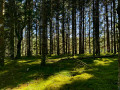
(7) Turn left onto a new path which, through the Douglas firs, leads to a road. Take this road to the right until you reach the bottom of the descent (water tower).
(8) Turn left and follow this road downhill to the junction (Stop sign). Turn right and, after 100 m, take the road on the left and follow it for 350 m.
(9) Leave this road to the left and follow a wide track. Ignore a track branching off to the left and carry on straight ahead. When you come to another track joining from the left, you’ll be back on the route you took on the way there.
(2) Carry on straight ahead, uphill and round bends, through the village of Chaverochette, and continue along the small road until you reach the community hall. Walk alongside it on the left, cross the car parks and rejoin the road.
(1) Turn left and follow the road to the village car park, opposite the church (S/E).


 Visorando Member
 Easy
Easy 
 Difficult