Country:

 City:
City:


When arriving in Felletin from the north via Aubusson, as soon as you enter the village, park in the public car park, which is accessible on the right-hand side at the corner of the Auberge Felletinoise.
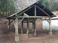
(S/E) Return to the road (there’s a well in the low wall by the roadside) and head towards the village centre. At the first junction – a roundabout (town hall, war memorial) – turn slightly right towards the Église du Château (closed when we visited; it sometimes hosts tapestry exhibitions). Walk round the church on the right, passing its entrance, and you’ll come to a square with some beautiful houses. Leave the square on your left and turn immediately right: note the courtyard of a beautiful house (the media library) opening up on the right, featuring a well. Turn into the first street on the right, Rue Feydeau.
(1) Turn left onto Rue des Fosses. After No. 7, go down a few steps on the right and continue along a tarmac path. You’ll come to a park – actually just a meadow – on the left; cross it, keeping parallel to the street on the right, which lies slightly below. You’ll reach a crossroads opposite No. 13 Rue de l’Espérance.
(2) For a round trip to the diamond-cutting district, turn right. The street is lined with beautiful old houses; you’ll also notice a well. Pass a lovely house with a turret and you’ll reach the old Pont Roby bridge over the Creuse. Opposite, on Rue des Diamantaires, is the former diamond-cutting workshop (see Practical Information).
(3) Retrace your steps back to No. 13 Rue de l’Espérance.
(2) Continue straight on. At the junction, take the street that turns sharply to the right and immediately pass the Jardin de la Chapelle Blanche. After your visit, carry on along the street, Route de Tulle. About fifty metres further on, turn left onto a path between two old houses. Carry on straight ahead along the tarmac until you reach a junction, at a small square with a well. Carry on straight ahead along Rue Pierre Constant and you’ll soon reach another junction.
(4) Opposite, slightly to the right, a path leads to a park with picnic tables, should you wish to take a break. Otherwise, turn left (Rue de Chanteloube), then head up Rue Quinault on the left and turn right onto Rue du Four (on the left, you’ll notice a well in the low wall). At the T-junction, turn right and you’ll come to a crossroads, next to a very beautiful well. Turn left onto Grande Rue and carry straight on until you reach Sainte Valérie Church.
(5) There is an entrance on this street, near a fountain featuring a bust of Philippe Quinault. The interior of this church is well worth a visit: it features both ancient and contemporary murals, polychrome wooden statues and some very fine carved capitals.
Leave the church through the same door, turn left to walk past the Tourist Office (a half-timbered house), then turn slightly left to reach a square, where you’ll find another entrance to the church. Turn slightly to the right, towards the pretty façade of the Caisse d’Épargne; leave this on your left and continue to the square you saw at the start of the walk, but on the other side. Turn right at the bust of Jean-Jacques Courtaud Diverneresse, and head down the narrow street between Nos. 1 Routes d’Aubusson and Grande Rue. At the junction, turn right and, facing an old chapel, take the street on its right. At the crossroads just after that, go straight on along Rue de Beaumont. Follow this street as it climbs up to the Faubourg de Beaumont.
(6) A square (former cemetery) with beautiful trees, a well, an old chapel, traditional houses and picnic tables. Retrace your steps for about fifty metres, then turn slightly right onto Rue de l’Ancien Champ de Foire. You’ll immediately pass a beautiful old house on your right.
(7) At the Fork in the road, opposite a park (picnic tables, view of the village below), turn left onto Petite Rue des Écoles. Continue along a path that leads down to Rue de la Pelleterie (a beautiful house, a collection of stone planters). At the end of the street, first turn right then left to follow Rue des Écoles, which leads onto Route d’Aubusson. Turn right to return to your car park (S/E).
 Visorando Member
 Moderate