The Rochers de Saint-Julien

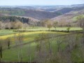
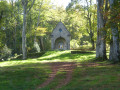
Set off to explore the Rochers de Saint-Julien in the heart of the mysterious Forêt de Drouille.

Details

14375380
Creation:
Last update:
Last review:
  • Walking
    Activity: Walking
  • ↔
    Distance: 2.69 mi
  • ◔
    Average duration: 1h 20 
  • ▲
    Difficulty: Easy

  • ⚐
    Back to start: Yes
  • ↗
    Ascent: + 141 ft
  • ↘
    Descent: - 141 ft

  • ▲
    Highest point: 2,254 ft
  • ▼
    Lowest point: 2,113 ft

Photos

Description of the walk

Park in the car park near Dontreix Town Hall.

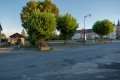
(S/E) Head towards the village square and walk past the town hall.

(1) Carry on straight ahead towards the church. Walk past the church and then past the statue of the Virgin Mary to reach the crossroads.

(2) Turn right onto Ruze Renon to walk round the village. Then head back down towards the square.

(1) Just before the square, turn left onto Route de Charensat. Walk past the village hall and the stadium and admire the statue of Saint Julian.

(3) When you reach the Croix Saint-Antoine, turn right towards the Rochers de Saint-Julien.

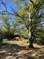
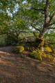
(4) At the junction, take the path on your right and follow it to the end. You’ll come to a magnificent oak tree marking the entrance to the site, with the Rochers de Saint-Julien situated just behind and below it.

(5) To return, take the same path in the opposite direction back to the car park (S/E).

Waypoints

  1. S/E : mi 0 - alt. 2,113 ft - Car park
  2. 1 : mi 0.06 - alt. 2,126 ft - Junction of the double circular loop
  3. 2 : mi 0.17 - alt. 2,139 ft - Crossroads
  4. 3 : mi 0.99 - alt. 2,228 ft - Cross of Saint-Antoine
  5. 4 : mi 1.22 - alt. 2,254 ft - Junction
  6. 5 : mi 1.48 - alt. 2,244 ft - Rochers de Saint-Julien
  7. S/E : mi 2.69 - alt. 2,113 ft - Car park

Reviews and comments

4.7 / 5
Based on 2 reviews

Reliability of the description
5 / 5
Ease of following the route
5 / 5
Route interest
4 / 5
guyleb
guyleb

Overall rating : 4.7 / 5

Date of your route : Aug 03, 2022
Reliability of the description : ★★★★★ Very good
Ease of following the route : ★★★★★ Very good
Route interest : ★★★★☆ Good
Very busy route : No

The first part of the route follows a tarmac road, which is a shame. The starting point could be moved to the edge of the forest and the walk extended beyond the rocks. A short descent then leads to a picturesque stream, and it is possible to continue on from there.

Machine-translated

lebayle210554
lebayle210554

Overall rating : 4.7 / 5

Date of your route : Oct 20, 2021
Reliability of the description : ★★★★★ Very good
Ease of following the route : ★★★★★ Very good
Route interest : ★★★★☆ Good
Very busy route : Yes

A lovely walk – these rocks look stunning in their autumn colours

Machine-translated

Other walks in the area

For more walks, use our search engine .

The GPS track and description are the property of this route's author. Please do not copy them without permission.