The Trois Tourtes du Sioulet from Herment

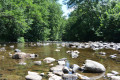
A pleasant walk north of Herment, exploring the Sioulet Valley and the druidic site of Les Trois Tourtes. The varied route through a hedgerow-lined countryside combines meadows and woodland sections, making for a very natural and peaceful route.

Details

24294039
Creation:
Last update:
Last review:
  • Walking
    Activity: Walking
  • ↔
    Distance: 6.24 mi
  • ◔
    Average duration: 3h 25 
  • ▲
    Difficulty: Moderate

  • ⚐
    Back to start: Yes
  • ↗
    Ascent: + 604 ft
  • ↘
    Descent: - 597 ft

  • ▲
    Highest point: 2,651 ft
  • ▼
    Lowest point: 2,234 ft

Description of the walk

(S/E) Head west and take the Route de Giat (D987). Turn right and follow the D987 carefully as you leave the village. At the three-way junction (iron cross), take the D82 on the right.

(1) About one hundred and fifty metres before the high-voltage power line, turn onto the path on the left, which is lined with a hedge. The path passes under the high-voltage power line, then turns left and runs alongside it for six to seven hundred metres.

(2) At the crossroads, take the path on the right towards Les Granges. Walk straight through the hamlet of Les Granges and continue along the path heading east.

(3) Turn off onto the first path on the left at the edge of the Bois des Granges. About five hundred metres further on, at the Fork in the road, take the path on the right which enters the woods. At the next crossroads, turn onto the path on the left which heads north. At the next crossroads, take the path on the right which descends into the Sioulet valley and leads out onto the D82.

(4) Turn left and follow the D82 carefully for about one hundred metres until you cross the Sioulet at the Pont de Gaumard. Turn right onto an uphill track leading to the Trois Tourtes site.

(5) Take a moment to admire the Trois Tourtes site (see the ‘During the walk’ section). Return to the D82 via the same path and head back to the Pont de Gaumard.

(4) Turn left onto a path that climbs through the woods before following the course of the Sioulet, then veering away from it to make a wide curve to the right. The path eventually joins a wide track

(6) On a flat stretch, turn left onto a path that winds its way towards a clearing about five hundred metres further on. Head east to join a farm track running north-east to south-west. Lovely view of the Sancy massif.

(7) Turn right onto the farm track. At the next junction, turn left onto the farm track, which quickly takes a right-angle bend to the right and heads south-west. Continue straight on, pass through the hamlet of Chantemerle, cross an intermittent stream and follow the track uphill until you pass under the high-voltage power line.

(8) At the Antonin Fargeix Stadium (football ground), the track gives way to a road. Turn left, walk alongside the football ground, then follow the path which turns sharply right and climbs a little further up to the car park on the Place du Foirail (S/E).

Waypoints

  1. S/E : mi 0 - alt. 2,618 ft - Car park at Place du Foirail
  2. 1 : mi 0.77 - alt. 2,539 ft - D82 road x path on the left
  3. 2 : mi 1.37 - alt. 2,448 ft - Crossroads
  4. 3 : mi 1.8 - alt. 2,500 ft - Junction with a path on the left
  5. 4 : mi 2.77 - alt. 2,260 ft - Gaumard Bridge. Return trip to Les Trois Tourtes - Sioulet (le) - rivière
  6. 5 : mi 2.89 - alt. 2,277 ft - Rocher des Trois Tourtes
  7. 6 : mi 4.08 - alt. 2,484 ft - Crossroads
  8. 7 : mi 4.67 - alt. 2,441 ft - Crossroads
  9. 8 : mi 5.95 - alt. 2,589 ft - Crossroads with a road to the left
  10. S/E : mi 6.24 - alt. 2,618 ft - Car park at Place du Foirail

Notes

The car park is situated on Place du Foirail, behind the National Gendarmerie at the bottom of the village on the eastern side.
Access: 1 km from Pontaumur towards Pontgibaud (west of Clermont-Ferrand), leave the D941 and
take the D987 to Herment.

This walk across varied terrain requires suitable footwear.

This walk does not present any real navigation difficulties as it is signposted in yellow and follows the “Les trois tourtes du Sioulet” route, updated and published by the Puy-de-Dôme Departmental Council and the Combrailles Tourist Office. In addition, it is advisable to follow the instructions in the description and on the map, whilst paying close attention to the landscape. The waypoints (with their GPS coordinates and the distance from the starting point) serve as aids for walkers exploring the route for the first time. Dogs must be kept on a lead at all times due to the presence of livestock.

Worth a visit

Herment
Architectural and historical heritage
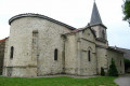
Notre-Dame Collegiate Church
Built between 1145 and the early 13th century by the Clermont Cathedral Chapter on land donated by Robert III, Count of Auvergne, this Romanesque-Gothic transitional collegiate church is unique in Auvergne. The architect’s design reflects influences from the Limousin Romanesque style. Since 1868, the collegiate church has been listed as a historic monument, and by its size is the third-largest Romanesque building in the Puy-de-Dôme department. It houses furnishings listed as historic monuments: a bas-relief depicting the Virgin of Mercy³⁶, a baptismal font and the hinges of the western door.

Medieval fountain
It dates from the 14th century. At that time, it was the town’s only water source. Its supply comes from an underground reservoir 15 feet deep. It is situated on Rue de la Fontaine.

Barberol Treasure
This hoard of coins was discovered in the commune of Herment in April 2001. The 48 coins date from the 14th century. All are made of gold and were minted during the reigns of Kings John II the Good and Charles V the Wise. They are on display during temporary exhibitions.

Notre-Dame-de-Bonne-Nouvelle Chapel
This chapel is the work of Canon Jean Robert. Built in 1466, it is situated on the Grand’Rue, next to the former hospice. The building underwent major restoration work in 1745.

Maison Tardieu
Named after the famous historiographer Ambroise Tardieu, who lived there, this 15th-century townhouse is characterised by its tower and carved balustrades. It is situated on Rue Ambroise-Tardieu.

Painting of Saint Radegonde
This 17th-century painting is mistakenly known as ‘Saint Radegonde’. The artist, who remains unknown, drew inspiration from the theme of vanities, depicting an allegory of virtue. The haughty gaze of this woman, who renounces love, money and power, certainly suggests a more virtuous way of life. It can be seen in the collegiate church.

Natural heritage
The Promenade des Murs (listed site)
The village of Herment is built on top of a hill overlooking the surrounding countryside. The former course of the ramparts is now a promenade lined with lime and elm trees, offering a magnificent view of a horizon of meadows and forests bounded by the Sancy massif, the Auvergne volcanoes, the Cantal plateau and the Limousin mountains. This promenade has been listed in the inventory of sites since 1978.

The Duke of Sully’s Tree (a listed tree of outstanding merit)
This lime tree was planted in 1601 on the initiative of the Duke of Sully to celebrate the birth of Louis XIII, son of King Henry IV. Since 2006, it has been listed in the Auvergne database of remarkable trees. It can be seen in Square du Docteur-Roux.

Communal woodlands and forests
The municipality of Herment has a forest area of 360 hectares, consisting mainly of fir and spruce trees. Its management is entrusted to the National Forestry Office (ONF). The municipality has opted for a forest management approach that complies with the Programme for the Endorsement of Forest Certification (PEFC), a global scheme that assures consumers of the environmental and social credentials of timber products, whilst guaranteeing that the timber originates from sustainably managed forests.

Rivers and ponds
Situated on the watershed between the Loire and Dordogne river basins, Herment is flanked by the Chavanon Gorges, the River Ramade and the River Sioulet. The surrounding countryside is dotted with deep, fish-rich ponds. Notable examples include Farges Pond (12.5 ha), Fayat Pond (11 ha) and Malgane Pond (10 ha).
Source: Wikipedia (excerpts)

Druidic monument
This monument is situated to the east of the village of Montely. It is known as the Rocher des Trois Tourtes. It consists of three enormous rocks stacked one upon the other, tapering in a pyramidal shape so that one can walk round the second rock on the one serving as its base.
The topmost boulder has a hole at its summit; by passing one’s arm through the opening, one sets a stone inside the cavity spinning. Locally, the sound this stone makes is known as ‘the sound of the bell’.
Set back from the monument, leaning against the hillside, lies a ruined but perfectly recognisable Druidic altar. The supporting stones are still standing. Only the stone serving as the tabletop and the one at the front of the altar have been toppled. Although unknown to scholars, this ruin is nonetheless one of the most original and intriguing remnants of the pagan era.
It is worth taking a moment to contemplate it; despite the passing of the centuries, it seems almost as though it were borrowed from those ancient monuments of Egypt, whose solidity defies the passage of time.
One could not have chosen a more desolate and wild spot to captivate the imagination of a people accustomed to credulity.
What machinery could have been used to haul such massive blocks into position and stack them one upon the other?
What was the purpose of these rocks, clearly arranged by human hands?
Did the three mounds serve as sacred platforms from which to harangue the people before sacrificing human victims on the adjoining altar?
Source: Verneugheol’s official website

Reviews and comments

3.6 / 5
Based on 4 reviews

Reliability of the description
3.8 / 5
Ease of following the route
4 / 5
Route interest
3 / 5
Serge_Augusta
Serge_Augusta

Overall rating : 4.7 / 5

Date of your route : Mar 10, 2024
Reliability of the description : ★★★★★ Very good
Ease of following the route : ★★★★★ Very good
Route interest : ★★★★☆ Good
Very busy route : No

A lovely walk. A few uninteresting viewpoints, particularly along the Sioulet.
The route is well signposted.
Although it’s the wet season, the paths are clear and easy to walk on.
As for the ‘Trois Tourtes’ site, it is very cluttered with fallen trees. It would be worth clearing up.
The start of the walk is along a relatively busy district road. Caution: DANGER, although the verges are wide and clear.
Duration of the route: 3 hours.

Machine-translated

Ivan le randonneur
Ivan le randonneur

Overall rating : 4 / 5

Date of your route : Aug 02, 2023
Reliability of the description : ★★★★☆ Good
Ease of following the route : ★★★★★ Very good
Route interest : ★★★☆☆ Average
Very busy route : No

The first part of the route is too long and runs along very busy roads (particularly with heavy goods vehicles) where there are children or animals. DANGER.
The rest of the walk is not a cause for concern.

Machine-translated

Virginie Chavance
Virginie Chavance

Hello Etienne,

we’ve just completed the woodland section of this walk (from point 3 to point 6). It’s now a real eyesore due to the clear-cutting all along the route, including, unfortunately, at the ‘3 Tourtes’ site on the banks of the Sioulet.

I would suggest you remove this walk from the list for a few years.

Kind regards,

Virginie

Machine-translated

Virginie Chavance
Virginie Chavance

Overall rating : 1 / 5

Date of your route : Apr 16, 2023
Reliability of the description : ★☆☆☆☆ Very disappointing
Ease of following the route : ★☆☆☆☆ Very disappointing
Route interest : ★☆☆☆☆ Very disappointing
Very busy route : No

A well-signposted walk, but one that should be removed from the website for a few years. The entire wooded section is an eyesore and a nightmare to walk through. Plots of fir trees have been ravaged by machinery, even at the foot of the famous ‘3 tourtes’, a site that is now a field of ruins.

The forest paths have been badly damaged by machinery...

A walk to avoid if you’re a lover of nature and beautiful, unspoilt landscapes.

Machine-translated

lucaflam
lucaflam

Overall rating : 4.7 / 5

Date of your route : Aug 07, 2022
Reliability of the description : ★★★★★ Very good
Ease of following the route : ★★★★★ Very good
Route interest : ★★★★☆ Good
Very busy route : No

A pleasant walk, despite a stretch on tarmac. The changing scenery, alternating between woodland and meadows, with the chance to stop off at some picturesque hamlets, adds a bucolic touch to this walk.

Machine-translated

Other walks in the area

For more walks, use our search engine .

The GPS track and description are the property of this route's author. Please do not copy them without permission.