The Étang Neuf at Montel-de-Gelat

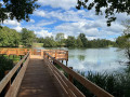
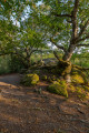
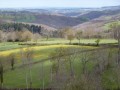
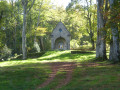
On the border of the Creuse department, you can enjoy a peaceful walk through unspoilt countryside featuring pastures and forests, before finally discovering the lovely 22-hectare Étang Neuf.

Details

n°25938879
Creation:
Last update:
Last review:
  • Walking
    Activity: Walking
  • ↔
    Distance: 3.42 mi
  • ◔
    Average duration: 1h 40 
  • ▲
    Difficulty: Easy

  • ⚐
    Back to start: Yes
  • ↗
    Ascent: + 154 ft
  • ↘
    Descent: - 154 ft

  • ▲
    Highest point: 2,359 ft
  • ▼
    Lowest point: 2,198 ft

Photos

Description of the walk

Between Montel-de-Gelat and Dontreix, head towards the Étang Neuf, which is on the left. There is a car park near the refreshment kiosk.

(S/E) From the starting sign, follow the small road westwards and walk alongside the pond on your right. The road soon veers away from the pond. After a right-hand bend (elevation 678), you’ll reach a triangular junction at a place called Les Corrioux Hauts (cross).

(1) Leave the road and turn right onto a tarmac track. Continue along a wide track and cross the stream that feeds the pond. Ignore a track on the left and head straight on towards the north-east.

(2) You’ll come out onto a road; follow it to the right and pass through the hamlet of Pérol.

(3) Cross the D4 with care and continue along the track opposite, between meadows and coniferous woodland. Enter the woodland. Keep to the right at the first Fork in the road, then ignore a track on the left. Continue along a wide forest track which curves to the right and heads south until you reach a crossroads.

(4) Turn right to follow a path between pastures and woodland.

(5) Cross the D4 again with care and continue along the path opposite. Return to the edge of the pond. Head slightly uphill to the left under the trees. At the road, turn right to return to the starting point (S/E).

Waypoints

  1. S/E : mi 0 - alt. 2,205 ft - Car park near the refreshment kiosk - Étang Neuf (Montel-de-Gelat)
  2. 1 : mi 0.67 - alt. 2,224 ft - Les Corrioux Hauts
  3. 2 : mi 1.47 - alt. 2,215 ft - Route to Pérol
  4. 3 : mi 1.77 - alt. 2,270 ft - Crossing the D4
  5. 4 : mi 2.53 - alt. 2,251 ft - Crossroads
  6. 5 : mi 3.05 - alt. 2,244 ft - Crossing the D4
  7. S/E : mi 3.42 - alt. 2,205 ft - Car park near the refreshment kiosk - Étang Neuf (Montel-de-Gelat)

Notes

For your safety, always take a bottle of water, a hat, warm and waterproof clothing with you, and wear suitable walking shoes.

In winter, some routes are not recommended in bad weather (fog) or may be impassable, or even off-limits depending on conditions.

Some sites are fragile; please stay on the designated paths. Avoid picking wild flowers and disturbing wildlife. Please take your rubbish with you.

On some routes, pets are not allowed.

Reviews and comments

5 / 5
Based on 1 review

Reliability of the description
5 / 5
Ease of following the route
5 / 5
Route interest
5 / 5
User 2983439

Overall rating : 5 / 5

Date of your route : May 26, 2025
Reliability of the description : ★★★★★ Very good
Ease of following the route : ★★★★★ Very good
Route interest : ★★★★★ Very good
Very busy route : Yes

A walk around the Étang Neuf, which is well-suited to an easy, shaded stroll in the heart of the countryside… perfect!
Perhaps a slight regret at having to return along a tarmac road towards the end of the walk… but it’s a quiet road
All in all: a very pleasant walk

Machine-translated

Other walks in the area

For more walks, use our search engine .

The GPS track and description are the property of this route's author. Please do not copy them without permission.