Mirambel Forest

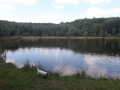
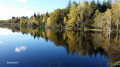
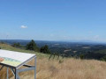
This route takes you through one of the most beautiful deciduous forests on the Millevaches plateau.
The village of Saint-Rémy is also well worth a visit.

Details

1339904
Creation:
Last update:
Last review:
  • Walking
    Activity: Walking
  • ↔
    Distance: 4.71 mi
  • ◔
    Average duration: 2h 25 
  • ▲
    Difficulty: Easy

  • ⚐
    Back to start: Yes
  • ↗
    Ascent: + 315 ft
  • ↘
    Descent: - 312 ft

  • ▲
    Highest point: 2,641 ft
  • ▼
    Lowest point: 2,408 ft

Photos

Description of the walk

To reach the starting point: from the village of Saint-Rémy, take the D21 towards Couffy. At a place called Combefort, turn right towards La Malsoute. At the end of the road, near a shed, take the track on the right which leads to the Plaine des Bois area, with a sign for walks and a wooden hut.

(S/E) Take the track opposite the wooden shelter heading south.

(1) Turn left onto the path leading to the pond. Cross the embankment, keeping the pond on your left.

(2) The path turns to the right after the pond. Follow this path to the next junction.

(3) At the crossroads, turn left and then veer off to the left again.

(4) Cut across the stony track and take the track opposite for 20 metres. Turn onto the path on the right.

(5) At the second junction, turn right onto a wide forest track and ignore thefirst path on the right.

(6) Turn right at a 90° angle and head due west. Turn left at a 90° angle onto a straight, stony track.

(7) Leave this track and turn right onto a narrower path that winds through the woodland.

(8) When you reach the wide gravel track, follow it to the right. It curves in a semicircle to the left. Ignore the side paths. Follow this track as it turns to the right.

(1) Carry on straight ahead to return to the car park where you started (S/E).

Waypoints

  1. S/E : mi 0 - alt. 2,562 ft - La Plaine des Bois car park
  2. 1 : mi 0.18 - alt. 2,575 ft - Junction of the circular loop
  3. 2 : mi 0.7 - alt. 2,474 ft - On the right after the embankment
  4. 3 : mi 0.98 - alt. 2,431 ft - Junction to the left
  5. 4 : mi 1.48 - alt. 2,638 ft - Gravel track
  6. 5 : mi 2.04 - alt. 2,569 ft - Turn right onto the wide forest track
  7. 6 : mi 2.29 - alt. 2,592 ft - Turn right at a 90° angle
  8. 7 : mi 2.8 - alt. 2,562 ft - On the right as you leave the track
  9. 8 : mi 3.26 - alt. 2,421 ft - On the right, a wide gravel track
  10. S/E : mi 4.71 - alt. 2,562 ft - La Plaine des Bois car park

Notes

Picnic table at the start and by the pond

Reviews and comments

4.3 / 5
Based on 3 reviews

Reliability of the description
4.7 / 5
Ease of following the route
4 / 5
Route interest
4.3 / 5
claudiebernard
claudiebernard

We couldn’t find the starting point at La Malsoute. There were no roads and no signposts. However, we followed the signposted cycle path and it wasn’t too bad.

Machine-translated

bddp
bddp

Overall rating : 4.7 / 5

Date of your route : Jul 21, 2020
Reliability of the description : ★★★★★ Very good
Ease of following the route : ★★★★★ Very good
Route interest : ★★★★☆ Good
Very busy route : Yes

A lovely walk, entirely through woodland, very easy and perfect for hot days. There’s a really lovely pond in the middle of the woods. The only slight downside is the noise from the quarry along a significant part of the route.

Machine-translated

pazkale
pazkale

Hello
The route description doesn’t mention following signposts.
It’s easier to follow the route description

Machine-translated

Lasc46
Lasc46

Overall rating : 3.3 / 5

Date of your route : Jan 27, 2020
Reliability of the description : ★★★★☆ Good
Ease of following the route : ★★☆☆☆ Disappointing
Route interest : ★★★★☆ Good

The route is signposted with signs featuring beavers, except that at a certain point the signs disappear. You can’t actually get lost, of course, as you always find your way back onto the trail. But you no longer know which route you’re on – the short one, the medium one or the longest one… The signposting needs reviewing… Thank you

Machine-translated

LoupGalou
LoupGalou

Overall rating : 5 / 5

Date of your route : Jun 01, 2019
Reliability of the description : ★★★★★ Very good
Ease of following the route : ★★★★★ Very good
Route interest : ★★★★★ Very good

Hello,
We really enjoyed this walk; it was very hot, but we felt so comfortable in the woodland.
We had the forest and the pond (time for a picnic and a nap) all to ourselves, accompanied by a chorus of frogs.
The walk was marked with green signs by the local council, so it was impossible to get lost
Thank you very much

Machine-translated

Other walks in the area

For more walks, use our search engine .

The GPS track and description are the property of this route's author. Please do not copy them without permission.