Country:

 City:


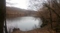
Starting point at La Marchette pond, at the tip of the pond near the leisure shelter.
(S/E) Take the path leading uphill and turn right into the village of Les Vedrennes.
(1) Follow the road uphill to the left as far as the cross.
(2) Take the path on the left until you reach the edge of the woods
(3) Turn right onto the track and carry on to the junction. Continue to the left until the end of the track.
(4) Turn left towards the village of Les Aubards.
(5) Turn right after the first house, and a few metres further on, take the path on the left which crosses the field and then runs alongside the woodland.
(6) Once you reach the road, cross it and head straight on. Turn left behind the house to rejoin the path opposite.
(7) At the end of the path, turn left along the low wall to rejoin the road and admire the Murzeix wall as you head downhill. When you reach the departmental road at the bottom, follow it for about a hundred metres, then turn right. Take the first street on the right into the village and walk uphill to the wash house, then follow the road that climbs to the right.
(8) Just before the bend to the right, take the path on the left until you reach a junction, then take the path that descends to the left towards the village of Barreix.
(9) Cross the road, head straight ahead and follow the path leading down to the right. Take the path opposite and head down to the bridge. Head back up the path on the left until you reach the road.
(10) Take the road on the right, walk through the village of Chamy until you reach the long barns.
(11) Take the ‘Chemin des Bâtisseurs’ on the left. Then follow the path on the right which leads back to the village of Murzeix. Turn right onto the departmental road and continue to the junction with a path on the left at the village exit.
(12) Take this path and head uphill to the road. Turn right and continue to the La Marchette pond (S/E).
 Visorando Member

 Tourist office
 Moderate