Refine your search for walks in Étang-sur-Arroux
Étang-sur-Arroux walks


 Circular walk between Étang and Saint-Didier-sur-Arroux
 Visorando Member
 9.78 mi
 +594 ft
 -564 ft
 5h 00
5h 00
 Moderate
 Departure from Étang-sur-Arroux (Saône-et-Loire)
This pleasant circular route, which is largely shaded and therefore ideal in summer, will take you through the Morvan countryside between Étang-sur-Arroux and Saint-Didier-sur-Arroux. No particular difficulties in dry weather. In wet weather, there is a potentially muddy section north of the Bois du Clou.
Circular route from La Chapelle-sous-Uchon
 4.21 mi
+469 ft
-479 ft
2h 20
4.21 mi
+469 ft
-479 ft
2h 20
 Easy
Departure from La Chapelle-sous-Uchon (Saône-et-Loire)
Easy
Departure from La Chapelle-sous-Uchon (Saône-et-Loire)
A lovely walk starting from the pretty little village of La Chapelle-sous-Uchon, taking us through the hamlets of Murger and Vilclair.
Uchon Rocks Circular Route
7.20 mi
+1,332 ft
-1,339 ft
4h 30
Moderate
Departure from Uchon (Saône-et-Loire)
This route allows you to discover the beautiful rolling countryside around Uchon. Forests of beech, oak, chestnut and Douglas fir alternate with pastures and small ponds. And, of course, you’ll see the many granite boulders – typical of the Uchon mountains – that dot the route, including the famous Rochers du Carnaval and the magnificent viewpoint over the Arroux plain and Mont Beuvray. The route is mostly shaded, making it very pleasant on sunny days.
Champmartin, La Porte de Broye and the Étang du Fou
5.50 mi
+1,076 ft
-1,063 ft
3h 30
Moderate
Departure from Broye (Saône-et-Loire)
A walk through the Broye hills starting from the village, with a gradual climb, passing through Champmartin, the Porte de Broye and the Étang du Fou.
Throughout the route, you’ll enjoy the shade of the trees and a variety of vegetation.
Short Uchon trail
 5.48 mi
+774 ft
-781 ft
3h 10
Easy
Departure from Uchon (Saône-et-Loire)
5.48 mi
+774 ft
-781 ft
3h 10
Easy
Departure from Uchon (Saône-et-Loire)
This short circuit, accessible to all, passes by several ponds and most of Uchon's rocky sites. 85% of the route is in the shade. It's a short walk, but you can enjoy a meal beforehand or afterwards at the Auberge de la Croix de Messire Jean (hostel).
Uchon, the land of rocks
 12.60 mi
+1,762 ft
-1,762 ft
7h 20
12.60 mi
+1,762 ft
-1,762 ft
7h 20
 Difficult
Departure from Uchon (Saône-et-Loire)
Difficult
Departure from Uchon (Saône-et-Loire)
Uchon is considered "the pearl of Morvan": a corner of unspoilt nature.
Louvetière discovery circuit
 3.34 mi
+489 ft
-489 ft
2h 00
Easy
Departure from Broye (Saône-et-Loire)
3.34 mi
+489 ft
-489 ft
2h 00
Easy
Departure from Broye (Saône-et-Loire)
The route proposed here has several objectives, including encouraging walkers to discover short and long-distance hiking trails by following the markings. On this circuit, in addition to the wolf-themed signage specific to the Circuit de la Louvetière, you will also encounter yellow markings that can be found throughout France.
La Grande Verrière - Bibracte
 Local authority
 11.37 mi
+2,116 ft
-1,234 ft
7h 05
Moderate
Departure from La Grande-Verrière (Saône-et-Loire)
11.37 mi
+2,116 ft
-1,234 ft
7h 05
Moderate
Departure from La Grande-Verrière (Saône-et-Loire)
The second stage of this circular Beuvray will take you on a journey of discovery through pretty villages and beautiful landscapes. Little by little, you climb through the forest towards Beuvray, the summit where the majestic Bibracte of the Aedui stood inthe 1st century BC.
The Chemin des Sources in Autun
 10.88 mi
+1,132 ft
-1,138 ft
6h 00
Moderate
Departure from Autun (Saône-et-Loire)
10.88 mi
+1,132 ft
-1,138 ft
6h 00
Moderate
Departure from Autun (Saône-et-Loire)
Start at the Carrefour du Gros Chêne, then a walk through the old town before climbing through the woodland to the Chemin des Sources, which follows the contour line. Return via the Étang des Cloix, then the Chemin des Chèvres and finally along the Roman ramparts.
 Towards the pastures of the South Morvan, setting off from Bibracte
 28.18 mi
+2,067 ft
-2,083 ft
3 hrs
Moderate
Departure from Saint-Léger-sous-Beuvray (Saône-et-Loire)
28.18 mi
+2,067 ft
-2,083 ft
3 hrs
Moderate
Departure from Saint-Léger-sous-Beuvray (Saône-et-Loire)
A lovely cycle ride on a standard bike and/or electric bike, taking you on a journey of discovery through the landscapes of the South Morvan along country lanes. A lovely ride lasting just under 3 hours on an e-bike. Explore the pastures and forests of the Sud-Morvan region, setting off from the Col du Rebout, at the foot of Mont-Beuvray and the archaeological site of the ancient Gallic oppidum of Bibracte, complete with its museum.
Towards the Folin woods, setting off from Bibracte
 29.47 mi
+3,343 ft
-3,323 ft
3 hrs
Moderate
Departure from Saint-Léger-sous-Beuvray (Saône-et-Loire)
29.47 mi
+3,343 ft
-3,323 ft
3 hrs
Moderate
Departure from Saint-Léger-sous-Beuvray (Saône-et-Loire)
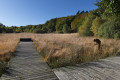
A lovely cycle ride on a standard or electric bike, taking you on a journey of discovery through the forests of Haut-Folin along quiet country lanes. A 1,000-metre climb for a lovely ride lasting just under 3 hours.
Bibracte - La Grande Verrière
 10.88 mi
+837 ft
-1,703 ft
5h 45
Moderate
Departure from Saint-Léger-sous-Beuvray (Saône-et-Loire)
10.88 mi
+837 ft
-1,703 ft
5h 45
Moderate
Departure from Saint-Léger-sous-Beuvray (Saône-et-Loire)
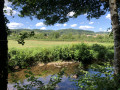
The official name of the hike is: "Towards the Méchet Valley, from Bibracte to La Grande Verrière".From the Bibracte car park, leave the forest and set off to explore the Méchet Valley, with its pretty villages and small heritage sites, a beautiful discovery in the South Morvan. Breathe in the fresh air, you are in the Grand Site de France "Bibracte Morvan des Sommets".
Tour of the ramparts of Bibracte
 4.26 mi
+725 ft
-719 ft
2h 35
Easy
Departure from Saint-Léger-sous-Beuvray (Saône-et-Loire)
4.26 mi
+725 ft
-719 ft
2h 35
Easy
Departure from Saint-Léger-sous-Beuvray (Saône-et-Loire)
The ancient oppidum of Bibracte was the largest city of the Aedui, a very powerful Gallic people one hundred years before our era. The largest rampart dates from the2nd century BCE, is 7 km long and was built before the smaller one, which is 5 km long, thus reducing the space. It was built on the principle of the murus gallicus, a construction made of earth solidified by interlocking layers of horizontal beams with a dry stone facing, an architectural technique admired by Caesar. This beautiful walk gives a glimpse of the grandeur of this ancient city as you follow in the footsteps of the Gauls through the majestic forest of Mont Beuvray.
Towards the pastures of the Southern Morvan
 25.30 mi
+3,783 ft
-3,789 ft
2 days
Moderate
Departure from Saint-Léger-sous-Beuvray (Saône-et-Loire)
25.30 mi
+3,783 ft
-3,789 ft
2 days
Moderate
Departure from Saint-Léger-sous-Beuvray (Saône-et-Loire)
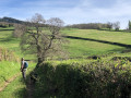
South of Le Beuvray, the landscape changes dramatically: you emerge from the forests and the view stretches further afield; the colour shifts from pine green to the spring green of the hills, and the small pastures bordered by low stone walls are a delight for the white cows. From ponds to mills, following the streams, water is an integral part of the southern Morvan.
The Celts at Mont Beuvray
 5.41 mi
+1,047 ft
-1,024 ft
3h 25
Moderate
Departure from Saint-Léger-sous-Beuvray (Saône-et-Loire)
5.41 mi
+1,047 ft
-1,024 ft
3h 25
Moderate
Departure from Saint-Léger-sous-Beuvray (Saône-et-Loire)
This hike offers an escape to the time of the Eduens in the Morvan Forest. There are many explanatory panels and beautiful views. As it is not very long, it can be complemented by a visit to the Bibracte Museum, known as the "Museum of Celtic Civilisation", in the car park.
Towards the sources of the timber-floating route
 39.69 mi
+5,679 ft
-5,663 ft
3 days
Difficult
Departure from Saint-Léger-sous-Beuvray (Saône-et-Loire)
39.69 mi
+5,679 ft
-5,663 ft
3 days
Difficult
Departure from Saint-Léger-sous-Beuvray (Saône-et-Loire)
A three-day hike starting from Bibracte, with no major difficulties apart from the length of the first stage. By observing the landscape and the place names, you’ll be transported back to the days of the timber raftsmen who used streams and then rivers to transport timber to Paris, via the Yonne and the Seine. A thriving industry that provided work for thousands of people in the Morvan fromthe 16th century until 1926.
Bibracte - Athez
15.40 mi
+2,110 ft
-2,608 ft
8h 55
 Very difficult
Departure from Saint-Léger-sous-Beuvray (Saône-et-Loire)
Very difficult
Departure from Saint-Léger-sous-Beuvray (Saône-et-Loire)
First part of a three-day hike exploring the landscapes of the Southern Morvan. This first stage is long and difficult; it is possible to split it into two by staying overnight at “La Rivière” near Crot Morin. The Gorges de la Canche are a sensitive site classified as a Natura 2000 area; it is essential to preserve it and to be discreet. This magnificent site can only be accessed in good weather, never after a storm, snow or ice. A track allows you to bypass it if necessary.
Autun - Saint-Sernin-du-Bois
 Association / Club / Walk leader
 15.97 mi
+1,926 ft
-1,470 ft
9h 00
Very difficult
Departure from Autun (Saône-et-Loire)
15.97 mi
+1,926 ft
-1,470 ft
9h 00
Very difficult
Departure from Autun (Saône-et-Loire)
This hike marks the start of the Grande Traversée de la Bourgogne du Sud (Great Crossing of Southern Burgundy), which, together with the Grande Traversée de l'Yonne and the Grande Traversée du Morvan, make up the Via Burgundia. Starting from Montereau-Fault-Yonne, this route takes you to Mâcon, crossing history through heritage and diverse landscapes.
Couhard, Montmain and Château du Petit Montjeu
 3.99 mi
+463 ft
-479 ft
2h 15
Moderate
Departure from Autun (Saône-et-Loire)
3.99 mi
+463 ft
-479 ft
2h 15
Moderate
Departure from Autun (Saône-et-Loire)
Lovely route starting from the Pierre de Couhard through a bucolic path leading to the Cascade de Brisecou. Lovely views over Autun and the historic quarter.
Couhard to Saint-Blaise circular forest loop
6.23 mi
+643 ft
-659 ft
3h 25
Moderate
Departure from Autun (Saône-et-Loire)
This beautiful circular walk, which presents no major difficulties, takes you through the woods on the hills above Autun, passing the Pierre de Couhard, the little Brisecou waterfall and the northern and north-eastern ramparts of the Château du Petit Montjeu, which unfortunately cannot be seen or visited. A very shaded walk, making it refreshing in summer.
In the footsteps of our Gallic ancestors: Bibracte and Mont Beuvray
 11.87 mi
+2,146 ft
-2,136 ft
7h 20
Moderate
Departure from Glux-en-Glenne (Nièvre)
11.87 mi
+2,146 ft
-2,136 ft
7h 20
Moderate
Departure from Glux-en-Glenne (Nièvre)
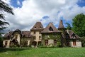
From its summit at 821 metres, Mont Beuvray offers a wide range of activities, including a visit to the archaeological site of the Bibracte oppidum, the Bibracte Museum dedicated to Gallic civilisation, and plenty of walking options such as the tour of the ramparts or long-distance walking routes like theGR®®13or theGR®®131.And if, by chance, mist rolls in at the end of your walk, the atmosphere it creates is sure to give you goosebumps.
A walk around the Rançon and Martinet ponds in the heart of the Planoise forest
 6.47 mi
+489 ft
-479 ft
3h 25
Moderate
Departure from Marmagne (Saône-et-Loire) (Saône-et-Loire)
6.47 mi
+489 ft
-479 ft
3h 25
Moderate
Departure from Marmagne (Saône-et-Loire) (Saône-et-Loire)
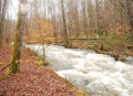
A lovely walk, mostly through state-owned woodland near the Rançon dam and the Étang du Martinet
Forests and streams around La Croix Blanchot
 7.56 mi
+791 ft
-791 ft
4h 10
Moderate
Departure from Marmagne (Saône-et-Loire) (Saône-et-Loire)
7.56 mi
+791 ft
-791 ft
4h 10
Moderate
Departure from Marmagne (Saône-et-Loire) (Saône-et-Loire)
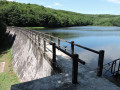
A walk in the heart of nature through mainly shaded areas.
The Bibracte Marauding Trail
 2.00 mi
+220 ft
-220 ft
1h 05
Easy
Departure from Glux-en-Glenne (Nièvre)
2.00 mi
+220 ft
-220 ft
1h 05
Easy
Departure from Glux-en-Glenne (Nièvre)
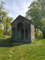
A unique historical site, Bibracte was a fortified town or oppidum, built on the summit of Mont Beuvray at the end of the 2nd century. In addition to its protected natural area (labelled "Grand Site de France" within the Morvan Regional Nature Park), it offers an exceptional archaeological site.
The Chemin de Maraude is a 3 km route combining viewpoints, excavation sites and walks through forests and clearings.
From the Mesvrin valley to the Brume valley
 9.97 mi
+1,821 ft
-1,850 ft
6h 10
Difficult
Departure from Marmagne (Saône-et-Loire) (Saône-et-Loire)
9.97 mi
+1,821 ft
-1,850 ft
6h 10
Difficult
Departure from Marmagne (Saône-et-Loire) (Saône-et-Loire)
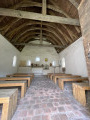
Beautiful views of the Mesvrin and Brume valleys amidst numerous wooded areas.
Marnay Lakes Circular starting from Marmagne
 5.00 mi
+709 ft
-738 ft
2h 55
Moderate
Departure from Marmagne (Saône-et-Loire) (Saône-et-Loire)
5.00 mi
+709 ft
-738 ft
2h 55
Moderate
Departure from Marmagne (Saône-et-Loire) (Saône-et-Loire)
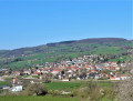
The route offers several views of Marmagne, Saint-Symphorien and the Mesvrin valley, with a long stretch through the woods and a section over the Mesvrin.
On the heights of Haut Rançon
 8.18 mi
+935 ft
-906 ft
4h 35
Moderate
Departure from Marmagne (Saône-et-Loire) (Saône-et-Loire)
8.18 mi
+935 ft
-906 ft
4h 35
Moderate
Departure from Marmagne (Saône-et-Loire) (Saône-et-Loire)
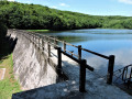
A walk through rolling countryside with beautiful views, passing through the superb Planoise National Forest near the Rançon and its dam, which supplies water to Le Creusot.
Between Marmagne and St Symphorien on the heights of the Mesvrin valley
 6.56 mi
+705 ft
-722 ft
3h 40
Moderate
Departure from Marmagne (Saône-et-Loire) (Saône-et-Loire)
6.56 mi
+705 ft
-722 ft
3h 40
Moderate
Departure from Marmagne (Saône-et-Loire) (Saône-et-Loire)
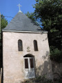
A beautiful, undulating walk with stunning views of Marmagne, Saint-Symphorien and the Mesvrin valley.
Roman Gates Route - Les Chaumottes - Temple de Janus
 3.54 mi
+56 ft
-56 ft
1h 40
Easy
Departure from Autun (Saône-et-Loire)
3.54 mi
+56 ft
-56 ft
1h 40
Easy
Departure from Autun (Saône-et-Loire)
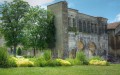
Short historical route north of Autun, taking in the Porte Saint-André, the Temple de Janus, the Porte d'Arroux, the military college and the Église Saint-Jean. A magnificent walk through meadows, with small footbridges crossing the rivers, allowing you to stroll along the banks of the Arroux.
Autun, the Gallo-Roman city
 4.83 mi
+325 ft
-325 ft
2h 30
Easy
Departure from Autun (Saône-et-Loire)
4.83 mi
+325 ft
-325 ft
2h 30
Easy
Departure from Autun (Saône-et-Loire)
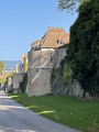
Discover Autun, its suburbs, and its 20 centuries of history and heritage. Take a stroll along its charming winding paths and secret alleyways. Admire its ramparts, ancient monuments, and medieval quarters.
From Pont l'Évêque to Couhard via the Gorges de Brisecou road
 6.29 mi
+686 ft
-686 ft
3h 30
Moderate
Departure from Autun (Saône-et-Loire)
6.29 mi
+686 ft
-686 ft
3h 30
Moderate
Departure from Autun (Saône-et-Loire)
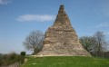
Starting from the lovely Vallon lake, discover magnificent views of Autun from the Gorges de Brisecou forest road.
The Mont Preneley circular route between Glux-en-Glenne and Rangère
 11.75 mi
+1,621 ft
-1,650 ft
6h 50
Difficult
Departure from Glux-en-Glenne (Nièvre)
11.75 mi
+1,621 ft
-1,650 ft
6h 50
Difficult
Departure from Glux-en-Glenne (Nièvre)
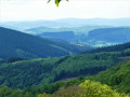
The source of the Yonne (and its archaeological site) and Mont Preneley (the highest point in the Nièvre department) lie at the geographical centre of this circular route. It passes through beautiful forests and some farmland, offering numerous panoramic views of the Morvan. It skirts the elegant Rangère pond, passes through several hamlets and the pretty village of Glux-en-Glenne, and ends at the small yet photogenic waterfalls on the young Yonne.