Country:

 City:
City:


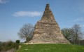
This walk starts at the Pierre de Couhard car park.
(S/E) Before setting off, you can admire the viewpoint with an orientation board showing the main monuments of the town of Autun. Then take the Chemin de la Cascade de Brisecou to the left, heading south-east, following the red and white markings of the GR®131 and GR®137.
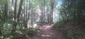
(1) At the waterfall – which is small and may have no water during a drought – cross the Ruisseau de Brisecou, then take the path on the right which runs alongside the stream, climbing gently through peaceful and very bucolic surroundings. You’ll come out onto a road at the Pont de Fer and should follow it carefully for about 200 metres.
(2) Take the track on the right, cross the stream, then follow the path on your left, which also runs alongside the stream. Continue to the bridge near the pumping station.
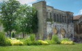
(3) Take the Chemin des Cloix on your right. Walk to the right of the Étang des Cloix and carry on to one of the entrances to the Château du Petit Montjeu, at a place called Le Chalet.
(4) Take the path on the right and walk alongside the wall that completely surrounds the château’s grounds: a private estate covering 750 ha with a wall over 10 km long! Follow this wall until you reach the RD256, at a place called Le Pavillon, where one of the château’s other entrances is located.
(5) Cross the road carefully and take the path almost directly opposite the château entrance. Follow this path as it descends towards Faubourg Saint-Blaise. Please note that there are numerous paths crossing your route: so take care at the various junctions. Join the GR®131, marked with red and white signs.
(6) Follow it straight on and begin a fairly steep descent. Further on, the path takes a sharp bend to the right and rejoins the tarmac before emerging at the junction with Rue Victor Terret.
(7) Carry on straight ahead, walk up Rue du Faubourg Saint-Blaise and continue to the cul-de-sac leading to the Château du Petit Montjeu.
(8) Turn right, leaving the GR®131, walk past the château and carry on along the path until you reach Route de Couhard.
(9) Take a short first turn right then left to join Rue de la Cascade and head back to the car park (S/E).

 Visorando Member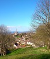

 Easy
Easy 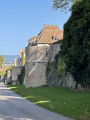
 Association / Club / Walk leader
 Very difficult