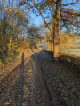
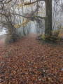
Around Montmort

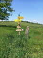
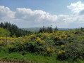
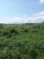
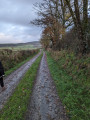
This circular walk, starting from the charming hamlet of Montmort, takes you through lovely woodland on the edge of the Morvan. The route follows mainly footpaths that are ablaze with flowers in spring.

Details

n°43228191
Creation:
Last update:
–
Last review:
  • Walking
    Activity: Walking
  • ↔
    Distance: 6.43 mi
  • ◔
    Average duration: 3h 20 
  • ▲
    Difficulty: Moderate

  • ⚐
    Back to start: Yes
  • ↗
    Ascent: + 440 ft
  • ↘
    Descent: - 453 ft

  • ▲
    Highest point: 1,129 ft
  • ▼
    Lowest point: 850 ft

Photos

Description of the walk

The route starts in the centre of the village on a small square just past the “Le Sanglier Bleu” restaurant. Parking is available.

(S/E) Take the Route de Charbonnat on the right for about 100 m. Follow the path on the left towards the Bois du Nom, cross a stream and continue for about 800 m until you reach a junction.

(1) Turn right and continue along a dirt track, keeping the forest in sight: you can’t go wrong on this lovely path. Enter the woods and carry on straight ahead.

(2) Stay on the main path and carry on for about 1 km until you reach a sign.

(3) Turn right towards “Armecy”. Continue along this path, which is full of flowers in spring, with the Arroux on your left. You’ll come to a junction where a sign points to “Armecy”, slightly to the right.

(4) Ignore this sign and turn left. Carry on for about 500 metres until you reach a junction.

(5) Turn left towards “Toulon”. Continue for 1 km until you reach a tarmac road (Route d’Armecy).

(6) Follow it to the left until you reach a track on the right, about 150 m further on.

(7) Take this track, which climbs steeply. The climb is quite steep until you reach a fork

(8) Turn left at the fork, walk for about 50 m and you’ll reach another fork where you should turn right. The walk takes you through a pine forest. Continue for about 500 m.

(9) Take the path that veers slightly to the right and you’ll come to a tarmac road, near a brick house on the left.

(10) Turn left, towards the house, then veer to the right. Follow the path that veers slightly to the left (the other path leads to the same place but is private), head into the forest and reach a hiking sign (yellow arrows).

(11) Follow the signposted direction to the right (the path opposite is blocked by a barrier). Continue for 800 m until you reach a four-way crossroads.

(12) Continue straight ahead, towards “Montmort”. Follow a slightly uphill path, skirting Mont de Jaux, and emerge onto a small tarmac road.

(13) Keep heading in the same direction towards Montmort along the Route d’Armecy.

(14) Keep to the left, staying on the same road, and carry on straight ahead until you reach the starting point (S/E).


Waypoints

  1. S/E : mi 0 - alt. 1,119 ft - Small square, car park
  2. 1 : mi 0.76 - alt. 988 ft - Junction
  3. 2 : mi 1.31 - alt. 1,102 ft - Junction, go straight on
  4. 3 : mi 1.85 - alt. 876 ft - Junction (sign) - Arroux (rivière)
  5. 4 : mi 2.7 - alt. 860 ft - Turn left at the fork
  6. 5 : mi 2.97 - alt. 873 ft - Turn left towards Toulon
  7. 6 : mi 3.37 - alt. 886 ft - Route d’Armecy
  8. 7 : mi 3.5 - alt. 889 ft - Path leading uphill to the right
  9. 8 : mi 3.72 - alt. 1,076 ft - Path to the left
  10. 9 : mi 3.95 - alt. 1,047 ft - Junction, on the right
  11. 10 : mi 4.12 - alt. 1,073 ft - Tarmac path
  12. 11 : mi 4.3 - alt. 1,083 ft - Path on the right (yellow markings)
  13. 12 : mi 4.82 - alt. 1,043 ft - Crossroads, go straight on
  14. 13 : mi 5.42 - alt. 1,073 ft - Head towards Le Bourg – tarmac road.
  15. 14 : mi 6 - alt. 1,096 ft - T-junction, turn left
  16. S/E : mi 6.43 - alt. 1,119 ft - A small square located just after a restaurant

Notes

“Le Sanglier Bleu” restaurant nearby.

Reviews and comments

4.8 / 5
Based on 2 reviews

Reliability of the description
5 / 5
Ease of following the route
5 / 5
Route interest
4.5 / 5
EMCI13
EMCI13

Overall rating : 5 / 5

Date of your route : Sep 18, 2026
Reliability of the description : ★★★★★ Very good
Ease of following the route : ★★★★★ Very good
Route interest : ★★★★★ Very good
Very busy route : No

A shaded walk. Stunning views.
Route mapped out using GPS.

Machine-translated

Frédérique Michèle
Frédérique Michèle

Overall rating : 4.7 / 5

Date of your route : May 08, 2024
Reliability of the description : ★★★★★ Very good
Ease of following the route : ★★★★★ Very good
Route interest : ★★★★☆ Good
Very busy route : No

A very pleasant, peaceful walk through the woods and fields. Some lovely views of the surrounding hills. If I remember correctly, there was a picnic table between points 5 and 6. At point 10, you need to head a little further to the left; there are two private paths there. At point 14, we took the Soussenot road (slightly more shaded, to the right) so as not to have to follow the same little tarmac road all the way back… We did this walk on a lovely sunny day in May and really enjoyed it. A walk full of flowers – thank you!

Machine-translated

clesol
clesol

Haven't done it yet – don't have time at the moment

Machine-translated

Other walks in the area

For more walks, use our search engine .

The GPS track and description are the property of this route's author. Please do not copy them without permission.