


 Country:

 City:
City:



(S/E) At the junction next to the bus shelter at the hamlet known as “La Croix Blanchot”, take the road leading down to the north, towards Fragny. Continue straight on until you reach a Fork in the road at the hamlet known as La Chaume.
(1) Turn right onto a small road at an old well. Once you reach the last houses, continue along the dirt track. It bends 90° to the right, then again to the left. After passing through a wood and walking past an isolated property, you’ll emerge onto a small road at the bottom of a slope, near a cluster of houses. Turn right and you’ll reach a junction.
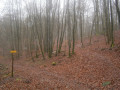
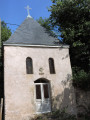
(2) Take the path opposite and enter the Planoise Forest. Keep left atthe first junction. Atthe second, carry on straight ahead and you’ll reach a three-way junction where, on your right, there is a stone building with a metal door (the start of the water pipeline heading towards Le Creusot).
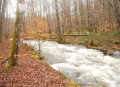
(3) Follow the path slightly to the left, then immediately turn left onto the path leading towards the Rançon (GR®137). Cross the concrete footbridge and continue along the sloping path, with a view of the Rançon on your right. After a flat section, just past a flat marker numbered 72 on the ground, do not take the uphill path; cross the wetland area that branches off to the right amongst the trees, then turn left immediately (a very short climb).
(4) Cross a small footbridge made of wooden logs; once at the top, you’ll come out onto a wide path and turn right down the slope, away from theGR®137. After about twenty metres, climb up the embankment on the left, head into the forest on the eastern side, stay at the same level, and you’ll come to a narrow path marked in blue. Continue along this path; below, to the right, through the trees, you’ll catch sight of the Haut Rançon reservoir and its dam.
Carry on along the path, keeping straight ahead, crossing an area with large stones and then a few fallen tree trunks (which may have been left behind after a strong gale). After a very gentle descent, you’ll come to a small bridge on your right leading over the stream.
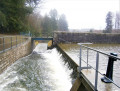
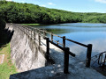
(5) Cross the bridge, then after about twenty metres across a grassy area, turn left. When you reach the foot of the Étang du Martinet dam, follow the very steep path to the right of the dam which runs alongside the waterfalls at the spillway.
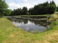
(6) Cross the embankment, then turn right immediately and walk along the edge of the pond. Please note that the path is narrow in places and runs right alongside the water until you reach the northern end of the pond
(7) You’ll come out onto a road; turn right, then take thefirst dirt track on the right and you’ll reach a junction on a new road,
(8) Turn right onto it and head down towards the south-west. The tarmac gives way to a stony track until you reach a gate. Go round it and continue along this track.
(9) When you reach the Haut Rançon reservoir, carry on along the track. On your right, you’ll see a building for the Rançon water intake. Go round the metal barrier, where you’ll find two parallel tracks opposite. Take the one on the left to get a better view of the Rançon below, and you’ll arrive at the crossroads you passed on the way there.
(3) Turn left and carry on straight ahead until you emerge from the woods to reach the hamlet known as “Maison Loye”.
(2) Turn left onto the dirt track, leaving the path you took on the way there. After a long, gently sloping stretch heading south, keep to the right to head south-west and you’ll come to a tarmac section at the hamlet known as Les Thubes.
(10) Turn left, then immediately right at the bus shelter. Return to the starting point at La Croix Blanchot (S/E).
.


 Visorando Member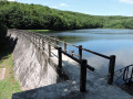

 Difficult
 Easy
Easy 
