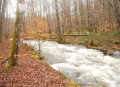
On the heights of Haut Rançon

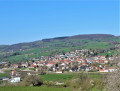
A walk through rolling countryside with beautiful views, passing through the superb Planoise National Forest near the Rançon and its dam, which supplies water to Le Creusot.

Details

4609659
Creation:
Last update:
Last review:
  • Walking
    Activity: Walking
  • ↔
    Distance: 8.18 mi
  • ◔
    Average duration: 4h 35 
  • ▲
    Difficulty: Moderate

  • ⚐
    Back to start: Yes
  • ↗
    Ascent: + 935 ft
  • ↘
    Descent: - 906 ft

  • ▲
    Highest point: 1,765 ft
  • ▼
    Lowest point: 1,040 ft

Photos

Description of the walk

Park in the car park next to Marmagne church. Follow the MAR2 signposts throughout the route.

(S/E) From the church square, take Rue Capet opposite, heading east.

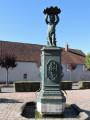
(1) When you reach the junction, between the two Stop signs, cross at the pedestrian crossing on the left to reach the square, passing between the two low walls, and walk past the fountain erected in 1876 by Mr Schneider. Walk along the low wall, then cross the road at the pedestrian crossing to take the small Rue de la Tuilerie opposite. Keep to the right at the next junction to come out onto the Route de la Croix Blanchot.

(2) Cross the road with care (no pedestrian crossing) and take the path opposite towards Saint-Sulpice, which you’ll reach after crossing a small wooden footbridge.
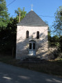
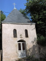
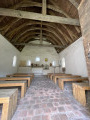
Walk past an 18th-century square chapel and you’ll come to a three-way junction.

(3) Climb the hill via the path on the left.

(4) At the entrance to Les Descloix, turn right.

(5) Continue further into the forest; then, as you emerge from the woods, cross the RD80 with care and take a small, sloping path opposite, at the edge of the woods. When you reach a small road, turn right, then take a wide dirt track on the left.

(6) Cross the RD80 with care, then head straight ahead into the Planoise State Forest. After about 300 metres, turn left onto the main track, then turn right onto the Chemin de la Conduite.

(7) At the end of the descent, through the trees you’ll see the Rançon stream below; turn left. You’ll immediately pass a concrete structure with a metal door on your left, marking the start of the pipeline heading towards Le Creusot. Continue on to Maison Loye.
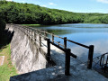
Possible alternative route (detour to the Haut Rançon dam): see the section ‘During the walk or nearby’.

(8) As you emerge from the woods at Maison Loye, take the path on the left.

(9) When you reach Les Thubes, at the bus shelter, turn right onto a road.

(10) Just before the Croix Blanchot junction, turn left onto a path that leads back down to Marmagne.

(11) At the end of the track, at Les Bonnotes, take the road that leads back down to the village via Les Sauvageots.

(12) Continue along the D287 road until you reach the three-way junction you passed on the way there.

(2) Follow the route back in the opposite direction to the outward journey and head for the (S/E).

Waypoints

  1. S/E : mi 0 - alt. 1,040 ft - Church, car park. Near the - Mesvrin (rivière)
  2. 1 : mi 0.1 - alt. 1,050 ft - Square, fountain
  3. 2 : mi 0.31 - alt. 1,070 ft - Junction of the circular loop
  4. 3 : mi 1.5 - alt. 1,207 ft - Saint-Sulpice Chapel, three-way junction
  5. 4 : mi 1.99 - alt. 1,411 ft - The Descloix
  6. 5 : mi 2.67 - alt. 1,611 ft - D680
  7. 6 : mi 3.72 - alt. 1,765 ft - Planoise Forest
  8. 7 : mi 4.55 - alt. 1,542 ft - Turn left - Rançon (rivière)
  9. 8 : mi 4.83 - alt. 1,565 ft - Maison Loye
  10. 9 : mi 5.55 - alt. 1,755 ft - Les Thubes
  11. 10 : mi 5.87 - alt. 1,703 ft - The Blanchot Cross
  12. 11 : mi 6.28 - alt. 1,463 ft - Les Bonnottes
  13. 12 : mi 7.34 - alt. 1,243 ft - Les Sauvageots
  14. S/E : mi 8.18 - alt. 1,040 ft - Church, car park

Worth a visit

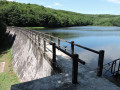
(7) It is possible to take a detour to the Haut Rançon dam; at the bottom of the descent, take the path on the right instead of the left (allow 30 minutes for the round trip).
The Rançon reservoir is fed upstream by the Martinet ponds (a further 10-minute walk if you continue along the same path) and the Noue ponds.
Downstream of the dam, from the Rançon, a tunnel runs to the base of the “Plateau”, followed by a 20-kilometre-long pipeline along the hillside at the level of the Mesvrin valley, carrying the water to Le Creusot via La Marolle.
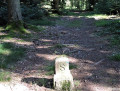
All along its route, the pipeline is marked by boundary stones engraved with Schneider’s ‘S’.
You will find some of these between the waypoints (5) and (7) on the walk.

Reviews and comments

4.6 / 5
Based on 3 reviews

Reliability of the description
4.7 / 5
Ease of following the route
5 / 5
Route interest
4 / 5
User 8373595

Overall rating : 4.3 / 5

Date of your route : Aug 24, 2025
Reliability of the description : ★★★★★ Very good
Ease of following the route : ★★★★★ Very good
Route interest : ★★★☆☆ Average
Very busy route : No

As mentioned in the two previous reviews, there are some interesting sights and beautiful forests to drive through. However, the return journey on tarmac seemed endless and there wasn't a single spot of shade.
The suggested route does not pass by the dam that is photographed. You have to extend the route a little.

Machine-translated

rigault
rigault

Overall rating : 5 / 5

Date of your route : May 08, 2024
Reliability of the description : ★★★★★ Very good
Ease of following the route : ★★★★★ Very good
Route interest : ★★★★★ Very good
Very busy route : No

I highly recommend this route – it has some beautiful scenery and views, and is of moderate difficulty,

Machine-translated

PERRAUT
PERRAUT

Overall rating : 4.3 / 5

Date of your route : Apr 13, 2022
Reliability of the description : ★★★★☆ Good
Ease of following the route : ★★★★★ Very good
Route interest : ★★★★☆ Good
Very busy route : No

A lovely, well-signposted walk along good paths with lovely views over the Mesvrin Valley. The points of interest are very well marked, particularly the dam.
The only drawback is that there is far too much tarmac – over 3 km – before returning to Marmagne, so I suggest that, after point 11 at a place called Les Bruyères, you head to point 4, Les Descloix, and then return via the original route: 4–3–2–1.

Machine-translated

Other walks in the area

For more walks, use our search engine .

The GPS track and description are the property of this route's author. Please do not copy them without permission.