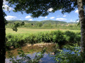
Circular walk between Étang and Saint-Didier-sur-Arroux

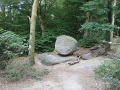
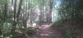
This pleasant circular route, which is largely shaded and therefore ideal in summer, will take you through the Morvan countryside between Étang-sur-Arroux and Saint-Didier-sur-Arroux. No particular difficulties in dry weather. In wet weather, there is a potentially muddy section north of the Bois du Clou.

Details

103821254
Creation:
Last update:
Last review:
  • Walking
    Activity: Walking
  • ↔
    Distance: 9.78 mi
  • ◔
    Average duration: 5h 00 
  • ▲
    Difficulty: Moderate

  • ⚐
    Back to start: Yes
  • ↗
    Ascent: + 594 ft
  • ↘
    Descent: - 564 ft

  • ▲
    Highest point: 1,293 ft
  • ▼
    Lowest point: 938 ft

Description of the walk

The start of this circular walk is at La Vernée farm, at the end of Rue de la Vernée. You can park at the end of this street (which is a tarmac road) on the verge, just before the farm.

(S/E) Walk back down the street, Chemin de la Vernée, to the RD297.

(1) Turn left onto the road, then after about twenty metres take the path on your left.

(2) Turn left onto a charming sunken lane. Halfway along, cross a meadow and remember to close the wooden gates properly behind you. In wet weather, this short stretch can be muddy.

(3) In the Reculon woods, turn right onto the path towards Savigny.

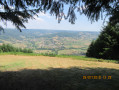
(4) Before reaching Savigny, turn left onto a wide, carriage-accessible track which runs alongside the railway line for much of the way, then leads up to the heights of Boussons: views over the Étang de Boussons.

(5) Take the small road on the left towards Saint-Didier. Pass the pretty Château de Charancy and carry on to Saint-Didier-sur-Arroux.

(6) At the town hall, turn left, pass the Château de Saint-Didier and carry on along the road, passing Le Fourneau and Les Alouettes.

(7) Take the small road leading down to your left towards Le Creux de Vaux, pass it, then head back up the path to the Château de Vaux.

(8) Take a moment to admire it in its picturesque setting, then carry on to Velet.

(9) Turn right, cross the D297 carefully and take the path opposite which turns left and leads to La Vernée farm (S/E)

Waypoints

  1. S/E : mi 0 - alt. 978 ft - La Vernée Farm
  2. 1 : mi 0.53 - alt. 938 ft - Junction with the D297
  3. 2 : mi 0.74 - alt. 942 ft - Sunken path
  4. 3 : mi 1.67 - alt. 1,037 ft - Junction with the path to Savigny
  5. 4 : mi 2.16 - alt. 971 ft - Junction - Braconne (rivière) - Affluent de l'Arroux
  6. 5 : mi 4.71 - alt. 1,010 ft - Junction – Route de Charancy - Étang de Boussons
  7. 6 : mi 5.6 - alt. 1,168 ft - Chateau de St Saint Didier
  8. 7 : mi 6.43 - alt. 1,247 ft - Junction
  9. 8 : mi 7.74 - alt. 1,096 ft - Château de Vaux
  10. 9 : mi 8.78 - alt. 1,066 ft - Velet
  11. S/E : mi 9.78 - alt. 978 ft - La Vernée Farm

Notes

At point (2), the sunken track you’ll take isn’t shown on the IGN map. However, apart from a section that may be muddy in wet weather, this track is clearly visible and well maintained.

Worth a visit

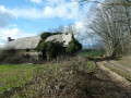
Throughout the route, you’ll come across numerous traditional farmhouses, pass through charming little woods and, in Saint-Didier, see two lovely castles, followed by the Château de Vaux (a lodge and guesthouse), which looks absolutely stunning set amongst the greenery.

Other walks in the area

For more walks, use our search engine .

The GPS track and description are the property of this route's author. Please do not copy them without permission.