Country:

 City:
City:


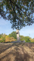
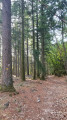

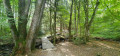
The walk starts from Rue Victor Terret, where you’ll easily find parking spaces.
(S/E) Walk up the street then take the path on the right. The walk begins with a steep climb which can be slippery and difficult to navigate, as the path is cluttered with tree branches and stones.
(1) Leave the return path on your left and head straight on, following the yellow PR® markings. If you’re doing this walk during term time, you’re sure to hear the bell from the Lycée Pro Bonaparte, which you pass above at the start of the route: a lovely view of Autun.
(2) Carry on straight ahead, following the yellow markings, to reach the Croix de la Libération.
(3) Take the tarmac road on the left behind the cross. This somewhat long road leads to the D256, which you should follow carefully to the left for a few dozen metres until you reach the entrance gatehouse of the Château de Montjeu.
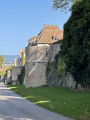
(4) Cross over and follow the path on the right, which runs alongside the castle’s outer wall for about 2 km.
(5) Turn right to continue along this seemingly endless wall! You’ll reach the Chalet, another entrance to the château.
(6) Leave the yellow markings for a moment and take a lovely little path opposite, which will take you round the Étang des Cloix.
(7) At the junction, head left towards the pond, which is a lovely spot to stop for a break if you like: there are picnic tables and even a shelter. (If you’re looking for toilets, simply take the tarmac road a little further on to find a shelter and dry toilets). Return to the road.
(8) Follow the road to the right until you reach the bridge over the Ruisseau de Brisecou: there’s a small car park.
(9) Take the path on the left and continue to the next junction.
(10) Ignore the sign for the Bergerie de Montmain ahead; turn right to cross the bridge and join the D120. Cross carefully and follow the path uphill opposite.
(11) Halfway up the climb, take care not to miss the path on the left leading to the Brisecou Waterfall. You’ll come out onto the forest track; follow this, keeping in the same direction, until you reach the right-hand bend.
(12) Leave the forest road and turn left onto the path leading down to the waterfall. This descent can be quite dangerous if you’re not used to it, if it’s raining or if there are lots of leaves on the ground: hence the name Brisecou, I suppose. So you need to be careful. Once you reach the waterfall: a splendid spot, with no picnic tables but some lovely rocks to sit on.
(13) Set off again, following the Brisecou Stream towards the Bergerie de Montmain. Head for the Pont de Fer: there’s a signpost there.
(14) Cross the D120 and take the path directly opposite towards Montmain.
(15) Turn right. The path climbs slightly and then descends towards the path leading to the sheepfold.
(16) Before you get there, take a small path on the left which leads to the yellow PR® signposted path.
(17) Turn right and follow this path, which curves to the left and descends to the D256, which you’ll reach at a hairpin bend.
(18) Take the D256 to the right, negotiate the bend and continue for about fifty metres.
(19) Head down to the left, following the yellow markings, and you’ll soon rejoin the original route.
(1) Turn right and return to the car park (S/E).
 Visorando Member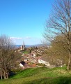

 Association / Club / Walk leader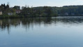
 Very difficult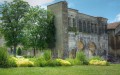
 Easy
Easy