From Marmagne to La Certenue and its magnificent panorama

Reach the highest point of the Mesvrin Valley with its superb views in a peaceful natural setting.

Details

n°5754610
Creation:
Last update:
Last review:
  • Walking
    Activity: Walking
  • ↔
    Distance: 11.20 mi
  • ◔
    Average duration: 6h 25 
  • ▲
    Difficulty: Difficult

  • ⚐
    Back to start: Yes
  • ↗
    Ascent: + 1,486 ft
  • ↘
    Descent: - 1,506 ft

  • ▲
    Highest point: 2,129 ft
  • ▼
    Lowest point: 965 ft

Photos

Description of the walk

Park near the church in Marmagne.

(S/E) Set off towards the south, taking the road downhill alongside the cemetery wall towards La Troche. A replica of a Gallo-Roman stele is set into the wall.

(1) Carry on, cross the railway line and then the bridge over the Mesvrin – a Category1 river – and continue straight ahead to reach the La Troche junction.

(2) Turn onto the dirt track on the right, cross the farmyard of La Tour de Bourdeau, carry on and reach the hamlet known as Bourdeau.

(3) You’ll come out onto the road; take the pavement opposite and turn left to quickly reach the village of Saint-Symphorien-de-Marmagne. Carry on to the town hall (church on the right).

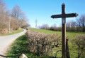
(4) Carry on straight ahead and, when you reach a fountain on the left, turn left onto Rue du Château d’Eau. After a steep slope, pass a wooden cross and begin the descent.

(6) At the junction with the RD120, take the road opposite towards La Certenue. Follow the road past L’Usine, then join aPR® path at Les Essioles.

(7) Carry on, pass Le Collins and arrive at the wooden cross at Montrion.

(8) Follow the road, which branches off to the right and then to the left at the three-way junction.

(9) When you reach a crossroads by a car park, take the dirt track on the left; when you pass a spring known as the ‘miraculous spring’ on your left, take the small path on your right.

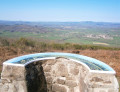
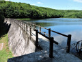
(10) After walking past some fir trees, you’ll be treated to an exceptional view on your left. Look out for the orientation board, with views of the pond, Mesvres, Le Haut Folin, Mont Beuvray and Mont Dardon.

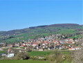
Carry on; when you reach a wooden hut on your right, continue and take the path on the left through the fir trees, which leads to the paragliding launch site. Admire the sweeping views over the Mesvrin and Rançon valleys and the village of Broye.

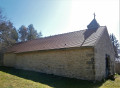
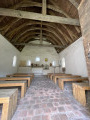
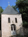
(11) Retrace your steps; just before the wooden hut, turn left. When you reach a stretch of road, turn left to reach the Notre-Dame Chapel.

(12) Retrace your steps and follow the road to the car park,

(9) Turn left onto a dirt track, then after 200 m, turn right.

(13) After passing a ruined house on your right, you’ll come out onto theGR®131; follow it by turning left.

(14) When you reach the hamlet of Les Petits, near a fountain, leave theGR®131and take the road on your right. Pass through the hamlet of Le Theureau and you’ll come out onto a road.

(15) Follow it to the right until you reach the junction with the RD120, crossing a bridge over the Brume.

(16) Turn left, then just before the level crossing, take the dirt track on your right, follow the railway line and you’ll come out onto the Route du Mesvrin

(17) Turn left, take the pavement at the junction and continue to the right. Follow the path running parallel to the D61. At the junction, turn right and head towards the church (S/E)

Waypoints

  1. S/E : mi 0 - alt. 1,043 ft - Église Saint-Martin (Marmagne)
  2. 1 : mi 0.08 - alt. 1,017 ft - Railway line and bridge at the - Mesvrin (rivière)
  3. 2 : mi 0.3 - alt. 1,020 ft - La Troche crossroads
  4. 3 : mi 1.24 - alt. 991 ft - Bourdeau
  5. 4 : mi 1.6 - alt. 1,066 ft - Église Saint-Symphorien (Saint-Symphorien-de-Marmagne)
  6. 5 : mi 1.69 - alt. 1,102 ft - Fountain
  7. 6 : mi 2.23 - alt. 1,007 ft - Junction with the RD120
  8. 7 : mi 3.53 - alt. 1,614 ft - Les Essioles (PR junction)
  9. 8 : mi 4.12 - alt. 1,893 ft - Montrion Cross
  10. 9 : mi 4.9 - alt. 1,985 ft - Crossroads by a car park
  11. 10 : mi 5.38 - alt. 2,047 ft - Viewpoint
  12. 11 : mi 5.66 - alt. 1,991 ft - Paragliding launch site
  13. 12 : mi 6.04 - alt. 2,129 ft - Chapelle Notre-Dame de la Certenue (Mesvres)
  14. 13 : mi 7.06 - alt. 1,729 ft - GR131
  15. 14 : mi 8.05 - alt. 1,184 ft - Les Petits
  16. 15 : mi 8.52 - alt. 984 ft - Road junction
  17. 16 : mi 9.01 - alt. 984 ft - Crossroads RD120
  18. 17 : mi 10.04 - alt. 1,004 ft - Route du Mesvrin
  19. S/E : mi 11.2 - alt. 1,043 ft - Église Saint-Martin (Marmagne)

Always be cautious and plan ahead when you're outdoors. Visorando and the author of this route cannot be held responsible for any accidents occurring on this route.

The GR® and PR® markings are the intellectual property of the Fédération Française de Randonnée Pédestre.

Reviews and comments

3.8 / 5
Based on 2 reviews

Reliability of the description
4.5 / 5
Ease of following the route
4.5 / 5
Route interest
2.5 / 5
Tartera
Tartera

Overall rating : 4.3 / 5

Date of your route : May 04, 2023
Reliability of the description : ★★★★★ Very good
Ease of following the route : ★★★★★ Very good
Route interest : ★★★☆☆ Average
Very busy route : No

The summit of La Certenue and its panoramic views, as well as the stretch between (9) and (13), are interesting, but the rest of the walk is rather disappointing as it follows a tarmac road with little to offer.

Machine-translated

La_Trace_de_Charon
La_Trace_de_Charon
• Edited:

Overall rating : 3.3 / 5

Date of your route : Jul 10, 2021
Reliability of the description : ★★★★☆ Good
Ease of following the route : ★★★★☆ Good
Route interest : ★★☆☆☆ Disappointing
Very busy route : No

Hello,

This is a very personal opinion, but a route that is three-quarters road – including a final stretch that’s entirely on the road with lots of traffic – is not at all what I expect from a hike...

The summit of La Certenue isn’t particularly worth seeing; the extensive clear-cutting and conifer plantations ultimately spoil the visual experience.
The chapel itself (closed most of the time except on certain Sundays in summer | Bad luck – we were there on a Saturday)

A summit at around 600 metres; once at the top, you’ve covered the entire elevation gain of the walk. An ascent entirely on tarmac. A shame, despite the beauty of some of the woods we passed through (e.g. the Charbilly woods)

A point of interest and a real surprise is the ‘Source de la Vierge’ – this spring of incredible purity, with its door, its ladle and the coins left as votive offerings at the bottom. Miraculous… I’m not sure, but in any case, once filtered, it certainly quenched our thirst. In my view, this spot remains the most charming, as you can really sense how steeped in history it is, and how this spring must have been used for centuries upon centuries.

The view, of course

The rest of the route is really lovely, as you head back down via the GR 131, which links Le Creusot to Autun, through a stretch that’s entirely wooded, very damp, and distinctly Celtic! Absolutely brilliant! A real relief for your feet after you’ve just tackled so much road.

But the end! What a nightmare! You’ll have to walk alongside the railway line (which is fine, I suppose) but also along the very busy B-road for the remaining 4 km: exhausting! You reach the end with the noise of cars ringing in your ears…

To conclude, we’d been drawn in by the 18 km, which seemed like an interesting challenge, but honestly, this walk would benefit greatly from starting at Saint Symphorien de Marmagne and making the effort to take the forest paths.
The kilometres are there, but not the quality.

Machine-translated

Other walks in the area

For more walks, use our search engine .

The GPS track and description are the property of this route's author. Please do not copy them without permission.