Uchon Rocks Circular Route

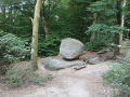
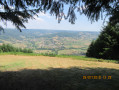
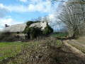
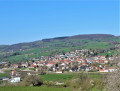
This route allows you to discover the beautiful rolling countryside around Uchon. Forests of beech, oak, chestnut and Douglas fir alternate with pastures and small ponds. And, of course, you’ll see the many granite boulders – typical of the Uchon mountains – that dot the route, including the famous Rochers du Carnaval and the magnificent viewpoint over the Arroux plain and Mont Beuvray. The route is mostly shaded, making it very pleasant on sunny days.

Details

104659268
Creation:
Last update:
Last review:
  • Walking
    Activity: Walking
  • ↔
    Distance: 7.20 mi
  • ◔
    Average duration: 4h 30 
  • ▲
    Difficulty: Moderate

  • ⚐
    Back to start: Yes
  • ↗
    Ascent: + 1,332 ft
  • ↘
    Descent: - 1,339 ft

  • ▲
    Highest point: 2,221 ft
  • ▼
    Lowest point: 1,227 ft
  • ⚐ Country: France
  • ⚐
    Area: Morvan
  • ⚐ City: Uchon (71190)
  • ⚑
    Start/End: N 46.813314° / E 4.251842°
  • ❏
    IGN map(s): Ref. 2824OT, 2826SB, 2925SB
  • Hour-by-hour weather

Description of the walk

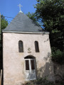
The start of this walk is at the Oratoire de la Belle Croix in Uchon. You can park in the small car park next to it, at the foot of the chapel.

(S/E) With your back to the car park, take the Chemin des Roches, which descends slightly before climbing up to the Rochers du Carnaval.

(1) After taking in the panoramic view over the Arroux valley, continue along the wide path towards the Carnaval car park, then take the small road slightly to your left which leads to the Croix de Messire Jean.

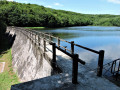
(2) From the Croix de Messire Jean car park, take the wide forest track which descends south-eastwards to the Étang Neuf, a superb setting. Then continue along the track until you reach the junction with a small road.

(3) Turn left onto this road and follow it to the D 228.

(4) Follow it to your left as far as the hamlet of Vauvillard, going round the Étang de Vauvillard on the right.

(5) Turn right onto the small road towards ‘Quartillot’.

(6) At Quartillot du Bas, turn onto the path leading down to your left, towards “Les Theurets”.

(7) Turn slightly left to continue along the track which passes through Les Theurets, then climbs gently until it rejoins the D228.

(8) Follow it to your right for 300 m, until you reach “la Gravetière”.

(9) Leave the D228 by taking the small road on your left, then carry on straight ahead along the Chemin de la Gravetière until you reach the first path on the left.

(10) Turn onto this track, then continue along the small road, which climbs, cross a road and rejoin the D228.

(11) Follow it to the right and, after 600 metres, you’ll arrive back at your starting point (S/E).

Waypoints

  1. S/E : mi 0 - alt. 1,906 ft - Oratoire de la Belle Croix (Uchon)
  2. 1 : mi 0.52 - alt. 2,067 ft - Rochers du Carnaval
  3. 2 : mi 0.95 - alt. 2,211 ft - Messire Jean’s Cross
  4. 3 : mi 1.64 - alt. 2,149 ft - Étang Neuf (Uchon)
  5. 4 : mi 2.46 - alt. 2,024 ft - D228 road
  6. 5 : mi 2.99 - alt. 2,001 ft - Étang de Vauvillard
  7. 6 : mi 3.46 - alt. 1,870 ft - The Lower Quartillot
  8. 7 : mi 4.08 - alt. 1,276 ft - Les Theurets
  9. 8 : mi 5.19 - alt. 1,506 ft - D228 road
  10. 9 : mi 5.39 - alt. 1,447 ft - La Gravetière
  11. 10 : mi 6.01 - alt. 1,250 ft - Junction
  12. 11 : mi 6.97 - alt. 1,719 ft - D228 road
  13. S/E : mi 7.2 - alt. 1,900 ft - Oratoire de la Belle Croix (Uchon)

Notes

There are two fairly steep climbs (one at the start and one at the end), so make sure you wear suitable walking shoes and take plenty of water, depending on the temperature.

Worth a visit

Uchon Signal viewpoint with its orientation table and the Rochers du Carnaval

Other walks in the area

For more walks, use our search engine .

The GPS track and description are the property of this route's author. Please do not copy them without permission.