Circular Grand Mizieux loop to La Celle-en-Morvan

Walk around La Celle-en-Morvan starting from the rose garden. A family walk with two slightly steeper climbs.

Details

3446226
Creation:
Last update:
Last review:
  • Walking
    Activity: Walking
  • ↔
    Distance: 5.73 mi
  • ◔
    Average duration: 3h 15 
  • ▲
    Difficulty: Easy

  • ⚐
    Back to start: Yes
  • ↗
    Ascent: + 715 ft
  • ↘
    Descent: - 715 ft

  • ▲
    Highest point: 1,716 ft
  • ▼
    Lowest point: 1,106 ft

Description of the walk

Park in the town hall car park next to the rose garden.

(S/E) Turn right (Rue de l’Église Saint-Agan) as you leave the village and turn right again at the next junction to follow Rue Creuse due north. Continue to the end of the street, where you’ll find a crossroads with a cross (elevation 370).

(1) Turn left onto Rue du Fluteau (west) and walk for 500 metres. Ignore a turning on the right leading to a few houses; carry on for about 50 metres.

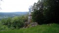
(2) Turn left (due south) onto the path that runs alongside several houses to reach the wayside shrine with a view over Autun. The site is currently being renovated.

(3) Turn back towards the road.

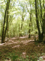
(2) Turn left and head down the path through the woods. Carry on straight ahead until you reach the bridge over the Canche.

(4) Turn left to cross the bridge and walk to the road (D978). Cross the road carefully and take the path opposite, slightly to the right: do not take the one going uphill opposite the road.
Follow the main path as it climbs until you reach a tarmac road; follow this to the left to reach the Grand Mizieux crossroads.

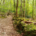
(5) Take a sharp left-hand bend. Continue along the small road, then carry on along the dirt track opposite which leads down into the woods. Stay on this track, which curves to the left further down before joining a tarmac road. Go straight on.

(6) At the cemetery, cross the small footbridge to the right of the car park and walk alongside the cemetery wall, which will be on your left. Then continue straight on along the main path until you reach the Mériaux farm. After the cattle shed, turn left onto the tarmac road and continue for about 200 m.

(7) Turn left onto the small path marked by a sign with a yellow background indicating ‘La Celle-en-Morvan’ and continue until you reach the D978 again.

(8) Cross at the pedestrian crossing to join the road almost directly opposite. Take the first left towards the rose garden. At the Ravatins junction, turn left then right to reach the starting car park (S/E).

Waypoints

  1. S/E : mi 0 - alt. 1,168 ft - Town hall car park
  2. 1 : mi 0.38 - alt. 1,217 ft - Crossroads, wayside shrine – turn left
  3. 2 : mi 0.68 - alt. 1,332 ft - Junction at the wayside shrine
  4. 3 : mi 0.79 - alt. 1,378 ft - Calvary, viewpoint
  5. 4 : mi 1.6 - alt. 1,217 ft - Bridge over the - Canche (rivière)
  6. 5 : mi 2.54 - alt. 1,716 ft - Le Grand Mizieux
  7. 6 : mi 3.8 - alt. 1,188 ft - Cemetery, footbridge on the right
  8. 7 : mi 4.85 - alt. 1,135 ft - Marked path to the left
  9. 8 : mi 5.31 - alt. 1,109 ft - Crossing the D978
  10. S/E : mi 5.73 - alt. 1,168 ft - Town hall car park

Worth a visit

(S/E) Rose garden.

(3) Viewpoint from the wayside cross and above the cemetery at (6).

(5) Well and washhouse at a place known as Le Grand Mizieux.

Reviews and comments

3.7 / 5
Based on 3 reviews

Reliability of the description
3.3 / 5
Ease of following the route
3.3 / 5
Route interest
4.5 / 5
User 25943171

Overall rating : 3.7 / 5

Date of your route : Mar 16, 2026
Reliability of the description : ★★★☆☆ Average
Ease of following the route : ★★★★☆ Good
Route interest : ★★★★☆ Good
Very busy route : Yes

A wonderful journey... a variety of perspectives

Machine-translated

annabelh
annabelh

Overall rating : 4.7 / 5

Date of your route : Apr 13, 2025
Reliability of the description : ★★★★★ Very good
Ease of following the route : ★★★★☆ Good
Route interest : ★★★★★ Very good
Very busy route : No

A lovely route; we enjoyed the variety of paths and scenery, as well as some magnificent views.
The signposting is adequate but requires a bit of care in places.
The difficulty is moderate overall, though there is a fairly steep climb over a short stretch.
Most of the paths are absolutely lovely, well-maintained, pleasant to walk on and shaded.
Please note: towards the end of the route, there is a section that can become flooded, so you’ll need to wear suitable footwear.

Machine-translated

Pauclere
Pauclere

Overall rating : 2 / 5

Date of your route : Aug 06, 2024
Reliability of the description : ★★☆☆☆ Disappointing
Ease of following the route : ★★☆☆☆ Disappointing
Route interest : Not used / Not applicable
Very busy route : No

I couldn’t find the start of the route. I must not have been looking in the right place. In the end, I followed a path that I reckon was fairly close.

Machine-translated

Other walks in the area

For more walks, use our search engine .

The GPS track and description are the property of this route's author. Please do not copy them without permission.