


Refine your search for walks in Dannemarie (Haut-Rhin)
Dannemarie (Haut-Rhin) walks


 Discovering the heritage around Dannemarie
 Visorando Member
 9.64 mi
 +315 ft
 -318 ft
 4h 40
4h 40
 Moderate
 Departure from Dannemarie (Haut-Rhin) (Haut-Rhin)
You’ll discover Dannemarie’s monuments and the surrounding countryside, with a beautiful view of the Ballersdorf viaduct and, further afield, the Sundgau and the Vosges. At the end of the walk, you’ll admire the Relais Nautique along the Rhône–Rhine Canal, followed by the former Gilardoni tile works.
Traubach, heritage and the surrounding natural area
 10.55 mi
+472 ft
-443 ft
5h 15
Moderate
Departure from Traubach-le-Haut (Haut-Rhin)
10.55 mi
+472 ft
-443 ft
5h 15
Moderate
Departure from Traubach-le-Haut (Haut-Rhin)
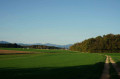
This fairly long but easy walk will take you past the site of the former Hohburg Castle in Traubach, a fountain well in Guevenatten, the fortified church of Saint-Cosme, Notre-Dame de Bellefontaine, the markers of the old border, the Étang du Milieu and, finally, the oratory, a tribute to the Virgin Mary by a sailor.
Sundgau route: Balschwiller-Gildwiller
 4.51 mi
+269 ft
-259 ft
2h 20
Moderate
Departure from Balschwiller (Haut-Rhin)
4.51 mi
+269 ft
-259 ft
2h 20
Moderate
Departure from Balschwiller (Haut-Rhin)
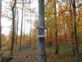
For geologists, this part of the Sundgau facing the Porte de Bourgogne is called the Fossé de Dannemarie. The landscape is gently undulating, with only one wooded hill emerging. At its summit stands the church of Gildwiller, where gazes and prayers converge.
Hindlingen Stork Walk
 2.62 mi
+98 ft
-102 ft
1h 20
2.62 mi
+98 ft
-102 ft
1h 20
 Easy
Departure from Hindlingen (Haut-Rhin)
Easy
Departure from Hindlingen (Haut-Rhin)
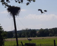
Enjoy a short walk starting from the stork park in the village of Hindlingen. Follow the Largue and discover the pretty half-timbered houses in the village of Friesen!
Walk of the little huts in Chavanatte
 4.67 mi
+98 ft
-69 ft
2h 15
Easy
Departure from Chavanatte (Territoire-de-Belfort)
4.67 mi
+98 ft
-69 ft
2h 15
Easy
Departure from Chavanatte (Territoire-de-Belfort)
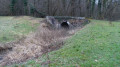
A lovely walk in the Sundgau region at Chavanatte, 20 km south-east of Belfort. You’ll discover beautiful scenery along the Suarcine and magnificent half-timbered houses.
This walk is easily accessible to all and can be split into three circular routes.
It is signposted.
From Montreux-Vieux to Montreux-Châteaux via Reppe and Fontaine
19.29 mi
+236 ft
-246 ft
9h 05
 Very difficult
Departure from Montreux-Vieux (Haut-Rhin)
Very difficult
Departure from Montreux-Vieux (Haut-Rhin)
This is a long, completely flat walk that straddles the Franche-Comté and Alsace regions. It is a challenging walk due to its length, but it offers the chance to see many points of interest such as the Marnière and Belle Île ponds, the Notre-Dame de Bellefontaine Chapel, the Tilleul de Turenne, the Petit-Croix Church and, finally, the Sainte-Catherine Chapel and the feudal motte of Montreux-Château. The entire walk alternates between woodland, villages and countryside.
Sundgau Route: the Carspach loop
 7.68 mi
+361 ft
-354 ft
3h 50
Moderate
Departure from Carspach (Haut-Rhin)
7.68 mi
+361 ft
-354 ft
3h 50
Moderate
Departure from Carspach (Haut-Rhin)
Fancy a stroll through the woods for a few hours? This route is perfect for you.
Although it’s not difficult, it still lets you discover some of the “secrets” of this part of the Sundgau and make the most of a lovely time spent outdoors.
Sundgau circuit in Friesen-Ueberstrass
 4.81 mi
+236 ft
-226 ft
2h 25
Easy
Departure from Friesen (Haut-Rhin)
4.81 mi
+236 ft
-226 ft
2h 25
Easy
Departure from Friesen (Haut-Rhin)
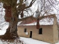
Friesen boasts an exceptional array of half-timbered houses built between 1499 and 1876. Thanks to meticulous inventory work, the walk allows you to see many reminders of a rural world that disappeared forever after the Second World War. A country lane then leads to the Notre-Dame de Grünenwald chapel and Ueberstrass, following in the footsteps of the Knights of Malta.
Chavannes-sur-l'Étang pond trail
 6.27 mi
+66 ft
-66 ft
2h 55
Easy
Departure from Chavannes-sur-l'Étang (Haut-Rhin)
6.27 mi
+66 ft
-66 ft
2h 55
Easy
Departure from Chavannes-sur-l'Étang (Haut-Rhin)
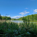
A superb hike on the border between Belfort and Haut Rhin. You will discover a landscape of countryside and forests with magnificent ponds. As a bonus, there is a discovery trail with information panels about the trees of our region.
The Ammertzwiller Remembrance Trail
 6.57 mi
+299 ft
-299 ft
3h 15
Moderate
Departure from Ammerzwiller (Haut-Rhin)
6.57 mi
+299 ft
-299 ft
3h 15
Moderate
Departure from Ammerzwiller (Haut-Rhin)
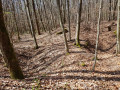
The Great War (1914–1918) left its mark, and the village of Ammertzwiller bears witness to this. Walk along the forest paths and learn more about this conflict by discovering various relics and stories on this remembrance route.
Along the Suarcine in Suarce
 1.81 mi
+52 ft
-52 ft
0h 55
Easy
Departure from Suarce (Territoire-de-Belfort)
1.81 mi
+52 ft
-52 ft
0h 55
Easy
Departure from Suarce (Territoire-de-Belfort)
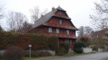
A lovely walk in the Sundgau region at Suarce, 20 km south-east of Belfort. You’ll discover beautiful scenery along the Suarcine and magnificent half-timbered houses.
This 3 km walk is easily accessible to everyone.
It is signposted.
Notre-Dame de l'Unterholz by Bernwiller
 3.81 mi
+39 ft
-39 ft
1h 45
Easy
Departure from Bernwiller (Haut-Rhin)
3.81 mi
+39 ft
-39 ft
1h 45
Easy
Departure from Bernwiller (Haut-Rhin)
This route invites you to discover the village of Bernwiller and its surroundings, with a quick detour into the forest to sit for a moment in front of the small Notre-Dame de l'Unterholz Chapel and admire it.
Sundgau route: around the Illberg
 5.01 mi
+440 ft
-449 ft
2h 40
Easy
Departure from Altkirch (Haut-Rhin)
5.01 mi
+440 ft
-449 ft
2h 40
Easy
Departure from Altkirch (Haut-Rhin)
An easy walk that allows you to take in the forest air.
Not far from Altkirch town centre, there are some beautiful views and the Erlen pond, where you can sit and enjoy the surroundings.
Sundgau circuit in Hirtzbach
 5.34 mi
+413 ft
-404 ft
2h 50
Moderate
Departure from Hirtzbach (Haut-Rhin)
5.34 mi
+413 ft
-404 ft
2h 50
Moderate
Departure from Hirtzbach (Haut-Rhin)
Hirtzbach is well worth a visit. The castle, English park and opulent residences of Unterdorf are neatly lined up on either side of the stream, whose banks are beautifully flowered in summer. Along the way, a rural and wooded detour leads to the site of the vanished village of Sankt-Glückern and the Landfürstenweyer, the Princes' Pond, with its still waters.
Sundgau route: the forgotten bunkers
 8.59 mi
+443 ft
-449 ft
4h 20
Easy
Departure from Hirtzbach (Haut-Rhin)
8.59 mi
+443 ft
-449 ft
4h 20
Easy
Departure from Hirtzbach (Haut-Rhin)
A hike starting from Hirtzbach that passes through Largitzen and Heimersdorf.
There are many remnants of theFirst World War along the route.
Sundgau route: between woods and ponds
 9.89 mi
+600 ft
-597 ft
5h 05
Moderate
Departure from Hirtzbach (Haut-Rhin)
9.89 mi
+600 ft
-597 ft
5h 05
Moderate
Departure from Hirtzbach (Haut-Rhin)
A hike through the beautiful Sundgau forests dotted with ponds, with no major difficulties except for the walking time.
There are many places to stop for a snack along the route.
The Aspach Planet Trail
2.02 mi
+157 ft
-148 ft
1h 05
Easy
Departure from Aspach (Haut-Rhin) (Haut-Rhin)
The Chemin des Planètes, created by the Astroaspach club in partnership with the municipality of Aspach, is a 3 km route that offers an original way to discover our solar system through educational panels depicting the distance between the planets to scale: 1 metre walked represents 2,100,000 km in space. From the Sun to Neptune, what a journey!Along the way, you can also enjoy a stroll through the Litten Forest, its chapel (1862) and the village’s rural surroundings, walk through the narrow streets of Aspach and, at the end of the trail, cross the Jardin des Libellules (a community garden dedicated to water conservation and biodiversity).
The Marnière circular in Foussemagne
 4.11 mi
+30 ft
-30 ft
1h 55
Easy
Departure from Foussemagne (Territoire-de-Belfort)
4.11 mi
+30 ft
-30 ft
1h 55
Easy
Departure from Foussemagne (Territoire-de-Belfort)
This is a very pretty hike that will allow you to discover a charming village and its suburbs, an old synagogue and an "Arromanches" type bridge. It passes near the Porte d'Alsace area with the Fosses discovery trail, where you will learn to recognise the trees of our region. Not to mention the Étang de la Marnière, a vast wetland with flora and fauna to discover.
The hike is signposted.
The snowdrops of Saint-Bernard
 7.46 mi
+157 ft
-157 ft
3h 35
Moderate
Departure from Heidwiller (Haut-Rhin)
7.46 mi
+157 ft
-157 ft
3h 35
Moderate
Departure from Heidwiller (Haut-Rhin)
It is in late February and early March that you should go to meet spring in the forest of Saint-Bernard. This is where the snowdrops appear, signalling the end of winter.
Saint-Nicolas circular route: the Haut Bois route
 8.33 mi
+236 ft
-210 ft
4h 00
Moderate
Departure from Vauthiermont (Territoire-de-Belfort)
8.33 mi
+236 ft
-210 ft
4h 00
Moderate
Departure from Vauthiermont (Territoire-de-Belfort)
This route will take you deep into the natural forest environment and offer you a glimpse of a wide variety of agricultural landscapes.
Located 15 km east of Belfort, this circular walk is a little long but fairly easy.
It is signposted.
Circular walk around the castle mound at Montreux-Château
 6.59 mi
+102 ft
-98 ft
3h 05
Moderate
Departure from Montreux-Château (Territoire-de-Belfort)
6.59 mi
+102 ft
-98 ft
3h 05
Moderate
Departure from Montreux-Château (Territoire-de-Belfort)
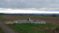
A lovely walk starting in Montreux-Château, located 15 km east of Belfort.
A pretty village with a chapel built near the site of a motte-and-bailey castle. You’ll discover a rural landscape with views of the Swiss Jura.
The walk passes the spot where Adolphe Pégoud, a flying ace, was shot down in 1915.
This walk is signposted.
Circular Courlis and Rhône-Rhine Canal
 7.77 mi
+69 ft
-66 ft
3h 40
Moderate
Departure from Montreux-Château (Territoire-de-Belfort)
7.77 mi
+69 ft
-66 ft
3h 40
Moderate
Departure from Montreux-Château (Territoire-de-Belfort)
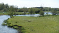
A pleasant hike in Montreux-Château, 15 km east of Belfort.
It will allow you to discover some very pretty villages:
- Autrage and Novillard with their pretty half-timbered houses.
- Petit-Croix with the Pégoud monument.
- Montreux-Château with its beautiful chapel and the motte castrale, the remains of a medieval castle.
The route is marked with a blue disc.
Larivière Circular
6.93 mi
+66 ft
-69 ft
3h 15
Moderate
Departure from Larivière (Territoire-de-Belfort)
A beautiful discovery of the region around the village of Larivière. In the clearing 10 km north-east of Belfort, this walk will introduce you to a varied landscape of forests, ponds, cultivated fields and pastures.
The First World War bunker trail at Burnhaupt-le-Bas
 5.41 mi
+59 ft
-59 ft
2h 30
Easy
Departure from Burnhaupt-le-Bas (Haut-Rhin)
5.41 mi
+59 ft
-59 ft
2h 30
Easy
Departure from Burnhaupt-le-Bas (Haut-Rhin)
Along this trail of bunkers, explore fortifications dating back to the First World War, built by the German army. After the fighting in the summer and autumn of 1914, the Haute-Alsace front stabilised on along the line of Cernay-Dannemarie. The commune of Burnhaupt-le-Bas remains on the German side. In December 1914 and January 1915, the French offensive in this sector regularly broke the German lines at the cost of many lives.
Walk from Normanvillars to Boron, Grosne and Vellescot
 6.91 mi
+197 ft
-197 ft
3h 20
Moderate
Departure from Boron (Territoire-de-Belfort)
6.91 mi
+197 ft
-197 ft
3h 20
Moderate
Departure from Boron (Territoire-de-Belfort)
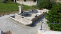
A family-friendly hike to discover the culture and nature of a region full of surprises.
The route is marked with red discs.
The Tour des Deux Seppois
 4.99 mi
+236 ft
-236 ft
2h 30
Easy
Departure from Seppois-le-Bas (Haut-Rhin)
4.99 mi
+236 ft
-236 ft
2h 30
Easy
Departure from Seppois-le-Bas (Haut-Rhin)
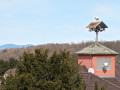
A route inviting you to explore the two neighbouring villages of Seppois-le-Bas and Seppois-le-Haut. You will also enjoy sections through the forest, including the Gobenwald.
The Riedweiher Pond via Galfingue
 5.69 mi
+177 ft
-177 ft
2h 45
Easy
Departure from Galfingue (Haut-Rhin)
5.69 mi
+177 ft
-177 ft
2h 45
Easy
Departure from Galfingue (Haut-Rhin)
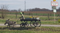
The Riedweiher Pond, located near Galfingue, lies right in the middle of a small, very picturesque communal woodland. The walk takes you through the village and along the paths of this grove. As most of the paths are not signposted by the Club Vosgien, I recommend using the map in addition to the description.
The Felon friends’ outing to Lachapelle-sous-Rougemont
 4.72 mi
+66 ft
-72 ft
2h 15
Easy
Departure from Lachapelle-sous-Rougemont (Territoire-de-Belfort)
4.72 mi
+66 ft
-72 ft
2h 15
Easy
Departure from Lachapelle-sous-Rougemont (Territoire-de-Belfort)
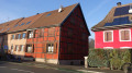
A pleasant walk through the countryside and woodland. Beautiful views of the Vosges peaks.
Easily accessible from the D83 (formerly the N83), about fifteen kilometres north-east of Belfort.
Numerous information boards provide details of the local heritage, wildlife, flora and landscapes.
The route is marked with a Red Ring.
The lower fields of Petitefontaine. The Birds of Prey Walk.
 3.27 mi
+82 ft
-82 ft
1h 35
Easy
Departure from Lachapelle-sous-Rougemont (Territoire-de-Belfort)
3.27 mi
+82 ft
-82 ft
1h 35
Easy
Departure from Lachapelle-sous-Rougemont (Territoire-de-Belfort)
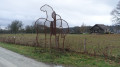
A signposted walk suitable for families through the countryside and forest. Beautiful views of the Vosges peaks without having to climb them. Easily accessible from the D83 (formerly the N83), about 15 km north-east of Belfort. Numerous information boards provide details of the heritage, wildlife, flora and landscapes.
The route is marked with a Blue Ring.
Circular starting from Lachapelle-sous-Rougemont
 Local authority6.34 mi
+115 ft
-115 ft
3h 00
Moderate
Departure from Lachapelle-sous-Rougemont (Territoire-de-Belfort)
Local authority6.34 mi
+115 ft
-115 ft
3h 00
Moderate
Departure from Lachapelle-sous-Rougemont (Territoire-de-Belfort)
Discover a splendid circular hiking loop starting from Lachapelle-sous-Rougemont in the Belfort gap, on the border with Alsace, 15 kilometres north-east of Belfort.
You will admire landscapes of cultivated fields, meadows and magnificent forests, not to mention the stork nests at Petitefontaine.
You can stop for refreshments at Lac de la Seigneurie.
Enjoy exceptional views of the Southern Vosges mountain range and the Swiss Jura.
Ideal for walking enthusiasts keen to discover the region's natural and cultural heritage.
The route is signposted.
Circuit du Sundgau: The Etangs de Bisel walk
 7.30 mi
+98 ft
-98 ft
3h 25
Moderate
Departure from Bisel (Haut-Rhin)
7.30 mi
+98 ft
-98 ft
3h 25
Moderate
Departure from Bisel (Haut-Rhin)
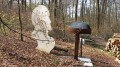
Speaking of this part of the Sundgau, André Gide wrote:"One is constantly surprised, as one crosses the forest, to find oneself in the presence of an unsuspected sheet of water, mysteriously asleep in the shelter of the beech forests; rushes adorn narrow sandy beaches at the edge of large fields of water lilies. There are also several reminders of the First World War and the front line that separated Largitzen from Bisel.
Notre-Dame du Chêne route in Heimsbrunn
 2.64 mi
+16 ft
-20 ft
1h 15
Easy
Departure from Heimsbrunn (Haut-Rhin)
2.64 mi
+16 ft
-20 ft
1h 15
Easy
Departure from Heimsbrunn (Haut-Rhin)
This forest route allows you to discover the Chapel of Notre-Dame du Chêne, the Steinbaechlein and hundred-year-old oak trees.
The surroundings of Heimsbrunn
 4.67 mi
+69 ft
-69 ft
2h 10
Easy
Departure from Heimsbrunn (Haut-Rhin)
4.67 mi
+69 ft
-69 ft
2h 10
Easy
Departure from Heimsbrunn (Haut-Rhin)
Heimsbrunn, a charming village to the west of Mulhouse, offers many lovely spots, including, in particular, the Notre-Dame-du-Chêne Chapel, as well as views of the Vosges, forest trails and pretty residential areas! Let us guide you!
La Seigneurie and its lake from Petitefontaine
 4.54 mi
+92 ft
-92 ft
2h 10
Easy
Departure from Petitefontaine (Territoire-de-Belfort)
4.54 mi
+92 ft
-92 ft
2h 10
Easy
Departure from Petitefontaine (Territoire-de-Belfort)
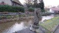
A pleasant hike near Petitefontaine, 20 km north-east of Belfort. You will discover a charming little village and countryside landscapes of forests with numerous ponds. You can take a short detour to admire Lac de la Seigneurie.
The hike is marked with a Green Ring.
The storks’ passage through Petitefontaine via the ponds
 3.50 mi
+98 ft
-98 ft
1h 40
Easy
Departure from Petitefontaine (Territoire-de-Belfort)
3.50 mi
+98 ft
-98 ft
1h 40
Easy
Departure from Petitefontaine (Territoire-de-Belfort)
A lovely walk that takes you through countryside and woodland, dotted with some very pretty ponds. There are plenty of footpaths and very little tarmac along this route.
The circular route is signposted with a Red Ring.