Country:
 City:
City:


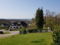
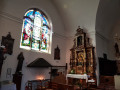
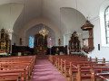
The starting point of the walk is in front of the village vicarage in Ammertzwiller, on Rue de l’Église. Parking spaces are available there.
The walk follows the entire ‘Route de la Mémoire’ trail, marked with the ‘Red Ring’ symbol.
(S/E) With your back to the church, walk to the end of the street. At the stop sign at the T-junction, turn left into Rue de la Forêt. Continue straight on along this street until you leave the village. When the path runs alongside the Krebsbach stream on the right, as well as an arboretum, at a Y-junction, continue diagonally to the left. Carry on until you reach a departmental road. Cross carefully and continue straight on along a dirt and grass track. Carry on until you reach another departmental road.
(1) Cross carefully once more and carry on straight ahead, towards the Abri Fortin. At the top of the track, head down to the right, still following the signposts. Carry on until you reach a junction with a wider track. Turn left and, a few metres further on, ignore a track that turns left. Turn right onto a small path. Turn slightly left to reach a crossroads.
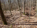
(2) Ignore the path marked with a Blue Triangle and carry on straight ahead along a narrow path over rough terrain, crossing a small wooden bridge. The path is not straight but is well signposted. You’ll be able to see numerous remnants of the war here. After the path bends slightly to the left, you’ll reach a wider path marked with a Blue Rectangle; turn left.
(3) At a four-way junction with a picnic table and a wayside shrine, turn right; then, immediately afterwards, at the Y-junction, continue along the main path, veering slightly to the left. After passing a path leading into the woods on your left, you’ll reach a four-way junction. Turn right and follow the zigzagging path. At another four-way junction, turn left and then immediately right.
(4) At the end of the path, at the T-junction, turn left. Continue along this path until you reach the village of Gildwiller via Rue des Vergers. The dirt track gives way to a tarmac road. Continue along this road until it ends at a Y-junction, where the village hall is located. From there, carry on straight ahead along the D26, down Rue Principale, towards Burnhaupt-le-bas.
(5) Follow the main road as it bends to the left and carry on towards Burnhaupt-le-bas. About a hundred metres further on, turn right towards the Chemin de Croix. Leave the village, walk past a picnic area and enter the forest via a dirt track. Ignore the fitness trail, which turns left twice, and carry on straight ahead along the Chemin de Croix. At the top, back in the village, go through a gate.
(6) Join the tarmac road, head straight up to the left and walk past the church and its war memorial on your right. Carry on straight ahead along Rue du Mont where two roads merge to form a single road. After the Maison des Scouts de France, on the right-hand side of the path, turn right. Walk past a water tank and ignore two paths that turn right.
(7) Head downhill to the left along the path marked with a Red Ring and a Blue Rectangle. Carry on until you reach a small scrap metal bridge and a departmental road. Turn right towards Ammertzwiller. Follow the departmental road until you reach a roundabout. Cross the departmental road carefully and carry on straight ahead, towards Ammertzwiller, along the D26II.
(8) After the wayside cross, carry on until you enter the village via Rue de Mulhouse. Walk past a pumping station decorated with coats of arms and turn right into Rue du 11 Juillet at the bus stop. Walk past the Mina Loch and carry on to the end of the street, which bends left twice.
(9) At the junction, carry on straight ahead, back onto Rue de Mulhouse. Ignore a dead-end turning off to the right, then Rue de la Prairie on the left. Cross the Krebsbach stream and walk alongside a building marked ‘Service Incendie’. When Rue de Mulhouse bends to the right, carry on straight ahead into Rue de l’Église. When you reach the village church, go round it on the left to return to the car park at the starting point (S/E).

 Visorando Member
 Easy
Easy