Sundgau route: around the Illberg

An easy walk that allows you to take in the forest air.

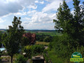
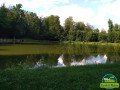
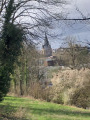
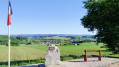
Not far from Altkirch town centre, there are some beautiful views and the Erlen pond, where you can sit and enjoy the surroundings.

Details

2232312
Creation:
Last update:
Last review:
  • Walking
    Activity: Walking
  • ↔
    Distance: 5.01 mi
  • ◔
    Average duration: 2h 40 
  • ▲
    Difficulty: Easy

  • ⚐
    Back to start: Yes
  • ↗
    Ascent: + 440 ft
  • ↘
    Descent: - 449 ft

  • ▲
    Highest point: 1,286 ft
  • ▼
    Lowest point: 1,047 ft
  • ⚐ Country: France
  • ⚐ City: Altkirch (68130)
  • ⚑
    Start/End: N 47.619065° / E 7.231398°
  • ❏
    IGN map(s): Ref. 3621ET
  • Hour-by-hour weather

Photos

Description of the walk

Park in the Sundgau media library car park.

(S/E) Return to Rue des Vallons, then turn left. After 150 metres, turn left up Rue de la Roselière.

(1) When you reach the crossroads, turn right onto Rue des Bosquets, which is a gravel path, and follow the signs for "aire de pique-nique" (picnic area).

(2) After the picnic area, continue along the path that goes up into the woods on the left and follow the Green Ring markings, which will later join the Blue Ring.

(3) After about 1.5 km, when you reach the forest path, turn left and leave the Anneau Bleu.

(4) A few metres further on, leave the Green Ring and turn right, following the Yellow Ring.

(5) When you reach the "Buchweg", turn right and continue to follow the Yellow Ring.

(6) Cross the road and follow the path on the left that enters the woods, still marked with the Yellow Ring.

(7) When you come out of the woods, turn right and go down to the Erlen Pond, walk around it and go straight up the path to the road.

(8) Turn right and follow the road to the reservoir (admire the scenery on the right), then walk down Rue du 2e Cuirassiers to the roundabout.

(9) Cross the road and go up Rue du 7 Août until you reach the junction with Avenue du Maréchal Foch.

Turn left for a few metres, then immediately right at number 16a to reach the media library (S/E).


Waypoints

  1. S/E : mi 0 - alt. 1,099 ft - Media library car park
  2. 1 : mi 0.3 - alt. 1,109 ft - Turn right towards the picnic area.
  3. 2 : mi 0.49 - alt. 1,115 ft - Picnic area
  4. 3 : mi 1.46 - alt. 1,194 ft - Forest path on the left
  5. 4 : mi 1.54 - alt. 1,240 ft - On the right, Yellow Ring
  6. 5 : mi 2.11 - alt. 1,257 ft - Turn right onto Buchweg.
  7. 6 : mi 2.62 - alt. 1,240 ft - Crossing the road
  8. 7 : mi 3.2 - alt. 1,089 ft - Fork in the path at the pond
  9. 8 : mi 4 - alt. 1,207 ft - Turn right towards the reservoir.
  10. 9 : mi 4.71 - alt. 1,047 ft - Crossing the road
  11. S/E : mi 5.01 - alt. 1,099 ft - Media library car park

Notes

There are numerous water points and picnic areas along the route, so be sure to wear sturdy shoes and bring a water bottle and filter.
The hike is easy and allows you to get away from it all for a few hours.

Reviews and comments

4.6 / 5
Based on 7 reviews

Reliability of the description
4.4 / 5
Ease of following the route
4.9 / 5
Route interest
4.4 / 5
dinamaria
dinamaria

Overall rating : 4.3 / 5

Date of your route : Mar 22, 2026
Reliability of the description : ★★★★☆ Good
Ease of following the route : ★★★★☆ Good
Route interest : ★★★★★ Very good
Very busy route : Yes

The descent to Erlen Pond is quite tricky: there’s a lot of mud and water, and it’s difficult to walk along the edge of the path.

Machine-translated

User 3401616

Overall rating : 5 / 5

Date of your route : Oct 16, 2025
Reliability of the description : ★★★★★ Very good
Ease of following the route : ★★★★★ Very good
Route interest : ★★★★★ Very good
Very busy route : Yes

A very beautiful hike.
Superb views of Altkirch.
I only knew the town centre, so it was nice to discover other places.
Very well signposted, as described. Thank you to the author 😊

Machine-translated

Yukulovicz
Yukulovicz

Overall rating : 4.3 / 5

Date of your route : Oct 10, 2023
Reliability of the description : ★★★☆☆ Average
Ease of following the route : ★★★★★ Very good
Route interest : ★★★★★ Very good
Very busy route : No

A pleasant walk in a beautiful forest with some lovely views. The description lacks detail and focuses only on the waypoints, which is sometimes insufficient. However, the route via the app completely compensates for this minor issue.

Machine-translated

chlac
chlac

Overall rating : 5 / 5

Date of your route : Jul 17, 2023
Reliability of the description : ★★★★★ Very good
Ease of following the route : ★★★★★ Very good
Route interest : ★★★★★ Very good
Very busy route : No

A very pleasant end to the day. An hour and forty minutes of walking in the shade, almost alone. Thank you for this route.

Machine-translated

Samos68
Samos68
• Edited:

Overall rating : 4 / 5

Date of your route : Aug 15, 2022
Reliability of the description : ★★★★☆ Good
Ease of following the route : ★★★★★ Very good
Route interest : ★★★☆☆ Average
Very busy route : No

A pleasant, uncrowded walk, with just one downside: there were no water points along the route, despite what was indicated.

Machine-translated

81wi0834
81wi0834

Overall rating : 4.7 / 5

Date of your route : Sep 12, 2021
Reliability of the description : ★★★★★ Very good
Ease of following the route : ★★★★★ Very good
Route interest : ★★★★☆ Good
Very busy route : No

A lovely Sunday morning stroll. The author should have included the address of the Sundgau Media Library; we had to search for a while as we don't know Altkirch...

Machine-translated

DanielFR
DanielFR

Overall rating : 4.7 / 5

Date of your route : Mar 01, 2021
Reliability of the description : ★★★★★ Very good
Ease of following the route : ★★★★★ Very good
Route interest : ★★★★☆ Good
Very busy route : No

We shortened the route to 6.5 km due to the curfew (did not go down to the pond).
Nevertheless, this route is a pleasant walk around Altkirch. We didn't know it and enjoyed the forest walk and the views of the surrounding hills.
During the week, we didn't meet anyone except near the Vita trail.
Thank you to the creator of this route!

Machine-translated

Other walks in the area

For more walks, use our search engine .

The GPS track and description are the property of this route's author. Please do not copy them without permission.