Along the Suarcine in Suarce

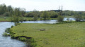
A lovely walk in the Sundgau region at Suarce, 20 km south-east of Belfort. You’ll discover beautiful scenery along the Suarcine and magnificent half-timbered houses.
This 3 km walk is easily accessible to everyone.
It is signposted.

Details

1698624
Creation:
Last update:
Last review:
  • Walking
    Activity: Walking
  • ↔
    Distance: 1.81 mi
  • ◔
    Average duration: 0h 55 
  • ▲
    Difficulty: Easy

  • ⚐
    Back to start: Yes
  • ↗
    Ascent: + 52 ft
  • ↘
    Descent: - 52 ft

  • ▲
    Highest point: 1,283 ft
  • ▼
    Lowest point: 1,230 ft
  • ⚐ Country: France
  • ⚐ City: Suarce (90100)
  • ⚑
    Start/End: N 47.565608° / E 7.071348°
  • ❏
    IGN map(s): Ref. 3621ET
  • Hour-by-hour weather

Photos

Description of the walk

Park in the car park opposite the stadium, coming from Vellescot, at the entrance to the village.
The walk is signposted with a Blue Ring.

(S/E) As you leave the car park, head south-east and do not cross the bridge over the D13. Continue straight on along the path called Rue de la Gare. Pass a path on the right and then a dead end on the left to reach the D13 on the outskirts of the village.

(1) Turn left and cross the Suarcine.

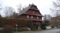
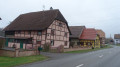
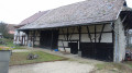
(2) Turn right onto Grand-Rue. Admire the beautiful half-timbered houses.
Take the first left onto Rue de l’Eglise, walk past the cemetery and cross Rue d’Alsace.
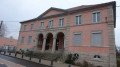
Two buildings are worth noting along this stretch: the church and the town hall, both on your right. You’ll reach Rue des Vosges (D34).

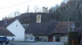
(3) Turn left and, at the ‘give way’ sign, turn right towards Vellescot. Note the chimney of the former sawmill and the many half-timbered houses on Rue Principale (D13).

Leave the village, cross the bridge over the Suarcine and arrive back at your starting point opposite the stadium (S/E).

Waypoints

  1. S/E : mi 0 - alt. 1,230 ft - Car park opposite the stadium on the D13
  2. 1 : mi 0.66 - alt. 1,257 ft - D13, on leaving the village
  3. 2 : mi 0.88 - alt. 1,247 ft - Junction of Rue Principale and Grand-Rue
  4. 3 : mi 1.44 - alt. 1,260 ft - Rue des Vosges D34
  5. S/E : mi 1.81 - alt. 1,230 ft - Car park opposite the stadium on the D13

Notes

Visorando was provided with information by Mr Chevalley, a volunteer at Balisage90, based on leaflets published by the Sud Territoire Community of Communes.

Worth a visit

The Sundgau
Nicknamed ‘Petite Sologne Belfortaine’ due to its numerous fishing ponds fringed by lush forests, the Sundgau reveals a surprising variety of landscapes.
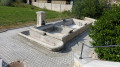
At the heart of a naturally bountiful region, the Bourbeuse Valley boasts remarkable ecological diversity. Architectural features such as half-timbered farmhouses, wash houses and fountains bear witness to a rich history.

Set off to discover Suarce

The commune of Suarce, covering an area of 1,181 hectares, forms part of the canton of Grandvillars. It lies at an altitude of 360 metres, in the geographical region known as the “wet Sundgau”, characterised by its gently rolling hills, extensive forests and numerous ponds.
The river ‘la Suarcine’ runs through the village from one end to the other.
Although it suffered damage during the last war (even the church was partly destroyed), the village nevertheless retains many old half-timbered houses and can be considered one of the most characteristic in the Territoire de Belfort.
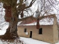
The present church is the work of the Swiss architect Dumas from Fribourg. It is cylindrical in shape with an open bell tower 25 metres high. Its construction, punctuated by long periods of delay due to poor workmanship, was completed on 22 August 1971.
A village hall is available for use by the many local societies.
Every year on 15 August, the Festival Committee organises the Donkey Festival.

The Sawmill

A steam-powered sawmill was founded by Joseph Prétat around 1896. It ceased operations around 1920. The mill’s chimney and the timber workshop, now used as a woodshed, still stand.
Source: Patrimoine90:

Rue de la Gare: local railway
On 6 August 1913, the Belfort–Réchésy line (the longest at 35 km) entered service.
This line connected the stations at: Belfort, Vézelois, Brebotte, Velescot, Suarce, Lepuix and, of course, Réchésy.
Unfortunately, however, it was closed in 1932.
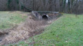
All that remains is the narrow-gauge railway bridge on the D13, 200 metres west of the starting car park.

Reviews and comments

4.7 / 5
Based on 2 reviews

Reliability of the description
5 / 5
Ease of following the route
5 / 5
Route interest
4 / 5
DOPPLER Bernard
DOPPLER Bernard

Overall rating : 5 / 5

Date of your route : Jan 01, 2024
Reliability of the description : ★★★★★ Very good
Ease of following the route : ★★★★★ Very good
Route interest : ★★★★★ Very good
Very busy route : No

A lovely family-friendly route

Machine-translated

Fred Martin 2590
Fred Martin 2590

Overall rating : 4.3 / 5

Date of your route : Apr 19, 2021
Reliability of the description : ★★★★★ Very good
Ease of following the route : ★★★★★ Very good
Route interest : ★★★☆☆ Average
Very busy route : Yes

A short walk to explore the village

Machine-translated

Other walks in the area

For more walks, use our search engine .

The GPS track and description are the property of this route's author. Please do not copy them without permission.