Hindlingen Stork Walk

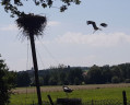
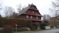
Enjoy a short walk starting from the stork park in the village of Hindlingen. Follow the Largue and discover the pretty half-timbered houses in the village of Friesen!

Details

13075705
Creation:
Last update:
Last review:
  • Walking
    Activity: Walking
  • ↔
    Distance: 2.62 mi
  • ◔
    Average duration: 1h 20 
  • ▲
    Difficulty: Easy

  • ⚐
    Back to start: Yes
  • ↗
    Ascent: + 98 ft
  • ↘
    Descent: - 102 ft

  • ▲
    Highest point: 1,250 ft
  • ▼
    Lowest point: 1,122 ft
  • ⚐ Country: France
  • ⚐ City: Hindlingen (68580)
  • ⚑
    Start/End: N 47.576947° / E 7.140831°
  • ❏
    IGN map(s): Ref. 3621ET
  • Hour-by-hour weather

Photos

Description of the walk

(S/E) From the stork enclosure, head uphill towards the village (away from the forest). At the first junction, continue towards the village by turning left and cross the bridge over the Largue. Carry on straight ahead, ignoring the two roads branching off to the right (Rue de la Rivière and Rue des Prés).

(1) At the end of the street, turn left onto Rue Principale. Then, a few dozen metres further on, cross carefully at the pedestrian crossing and turn right onto Rue de Lepuix, heading towards the town hall. Walk past the Church of Sainte-Anne in Hindlingen. When you reach the junction with the war memorial, take Rue du Cuir on the left. Continue along this road, ignoring the small streets branching off to the right. When the tarmac road gives way to a dirt track, take it and carry on straight ahead.

(2) At the fork in the road, take the left-hand track. The track runs behind the fire station, which is protected by a barrier with a ‘No Entry’ sign. About 250 metres further on, ignore a tarmac road turning left, then a dirt track turning right, and carry on straight ahead. The track passes between several small ponds and then climbs slightly.

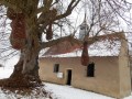
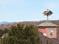
(3) When you reach the village of Friesen and the road becomes tarmac again, carry on straight ahead, towards the bell tower. When you reach Friesen Church, turn left downhill, then, at the next junction, turn right onto Rue du Cuir.

(4) Turn left onto Rue de Lepuix. When the road splits, leave the D17 and take the D7bis on the left, towards Dannemarie. Immediately afterwards, opposite house number 51, turn right onto Rue Saint-Michel, towards the cycle path. Cross the bridge over the Largue.

(5) About 150 m further on, take the Largue Cycle Path on your left. At the start of the path, you’ll find a ‘Friesen’ walking sign and a road sign indicating ‘No Entry’ (except for authorised vehicles). Stay on this path for 1,400 metres. Just before passing under a bridge, turn left to return to your starting point. (S/E)

Waypoints

  1. S/E : mi 0 - alt. 1,152 ft - Hindlingen Stork Enclosure
  2. 1 : mi 0.3 - alt. 1,138 ft - On the left: Main Street. Towards the bridge at the - Largue (rivière) - Affluent de l'Ill
  3. 2 : mi 0.85 - alt. 1,175 ft - Dirt track leading to Friesen
  4. 3 : mi 1.07 - alt. 1,227 ft - Arrival in Friesen
  5. 4 : mi 1.36 - alt. 1,217 ft - On the left: Rue de Lepuix
  6. 5 : mi 1.74 - alt. 1,161 ft - On the left: Largue Cycle Path
  7. S/E : mi 2.62 - alt. 1,152 ft - Hindlingen Stork Enclosure

Notes

There is a picnic table at the starting point.

Reviews and comments

5 / 5
Based on 2 reviews

Reliability of the description
5 / 5
Ease of following the route
5 / 5
Route interest
5 / 5
DOPPLER Bernard
DOPPLER Bernard

Overall rating : 5 / 5

Date of your route : Jan 08, 2024
Reliability of the description : ★★★★★ Very good
Ease of following the route : ★★★★★ Very good
Route interest : ★★★★★ Very good
Very busy route : No

Route nature with an interesting visit to the little stork park!

Machine-translated

pa6_6
pa6_6
• Edited:

Overall rating : 5 / 5

Date of your route : Jul 25, 2022
Reliability of the description : ★★★★★ Very good
Ease of following the route : ★★★★★ Very good
Route interest : ★★★★★ Very good
Very busy route : No

A leisurely stroll amongst storks and ponds. There are some lovely houses typical of the region to admire in the villages. We did this in sweltering heat, and instead of following the tarmac cycle path back, we took the GR 532, which offers a more ‘wooded’ route home.

Machine-translated

Other walks in the area

For more walks, use our search engine .

The GPS track and description are the property of this route's author. Please do not copy them without permission.