Country:
 City:
City:


Parking is available at the car park at the start of Rue du Hohrain in Heimsbrunn.
(S/E) From Rue du Hohrain, head to the T-junction with Rue des Perdrix. Turn left towards the roundabout. At the roundabout, go straight on into Rue Jean-Jacques Henner. Follow this street, ignoring Rue Nathan Katz on your left. The street curves to the left. When you reach house number 19, take the dead-end road on the right. At the end of this short stretch, at the T-junction, take the dirt and gravel track on the right for a few metres.
(1) Immediately afterwards, at the entrance gate to a large farm, with a silo and a shed, turn left onto a tarmac track towards Galfingue. Walk past the Heimsbrunn municipal green waste collection point. Continue to a crossroads where three paths meet. Take the dirt and gravel track on the right, continuing to the junction by the high-voltage power lines.
(2) Turn right, ignoring the hiking signposts. This path climbs slightly before descending again straight away. At the end of this path, at the T-junction, turn left. Ignore two paths in succession that branch off to the right and continue towards the forest. When you reach the first trees, ignore the first path that runs alongside the forest to the right to reach a crossroads.
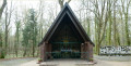
(3) At the entrance to the forest, turn right towards the Notre-Dame-du-Chêne Chapel and follow the ‘Yellow Ring’ signposts from here on. Continue along this path, crossing the Gross Runzgraben, until you reach the county road. At the road, turn right and cross the bridge.
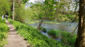
(4) Immediately after the bridge, take a small path; at its entrance there is a sign prohibiting access to horse riders, mountain bikers, motorcyclists, etc. A few steps further on, the path splits in two. Ignore the path that runs alongside the stream and take the path that turns left. The path is narrow and winding. Just after crossing a small scrap-metal bridge, you’ll come to a clearing with a wooden structure forming part of an outdoor fitness circuit. Carry on straight ahead, continuing to follow the Yellow Ring markings. After a second piece of fitness equipment, you’ll come to two T-junctions in quick succession. Turn left at each one, heading towards the Notre-Dame-du-Chêne Chapel.
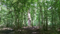
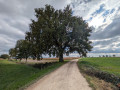
(5) Beyond the chapel lies the county road. Briefly leave the Yellow Ring markings and cross the road carefully to take a path leading straight ahead. About a hundred metres further on, you’ll find a remarkable tree. Turn round to return to the chapel. Behind it, you’ll rejoin the Yellow Ring signposts and the T-junction you passed earlier. This time, take the path on the left, heading east towards “Heimsbrunn-Église via the fitness trail”.
(6) Cross a road and continue straight on in the same direction. You’ll pass a mobile phone mast. At the end of this path is the finish of the fitness trail and a T-junction. Turn left, still heading towards Heimsbrunn Church. When you reach a Stop sign, turn right and cross a wooden bridge running alongside the district road. Shortly afterwards, you’ll enter the village via Rue de Belfort. Continue to follow the main road as it climbs and bends to the left, ignoring Rue de France which turns right. During this climb, use the pedestrian crossing and then walk past the Sainte-Anne residential home. You’ll arrive at the junction opposite the cemetery wall.
(7) Turn left onto Rue de la Cure to go round the church and the town hall. Carry on uphill towards the car park. After passing the church and its cemetery, leave the ‘Yellow Ring’ signposting and carry on straight ahead. At the end of this road, head down to the right until you reach a Stop sign and Rue de Belfort. Turn left, then cross at the pedestrian crossing to reach the foot of the village fire station. At the roundabout, turn right onto Rue de Galfingue and you’ll arrive at the school.
(8) Cross at the pedestrian crossing controlled by traffic lights and turn left onto Rue de Hochstatt, heading towards the sports complex. Continue along this road, which climbs slightly, ignoring the various side streets branching off to the right or left. Walk past the village hall and the village stadium and carry on. Once you have passed the last house in the village (No. 18), turn right, following the ‘Green Ring’ and ‘Yellow Triangle’ signposts. When you reach houses again and the road becomes tarmac once more, ignore the first path leading uphill to the left, and then Rue des Mésanges on the right. Just before you reach the roundabout, turn left onto Rue du Hohrain to complete the circular route (S/E).

 Visorando Member


 Moderate