Sundgau Route: the Carspach loop

Fancy a stroll through the woods for a few hours? This route is perfect for you.

Although it’s not difficult, it still lets you discover some of the “secrets” of this part of the Sundgau and make the most of a lovely time spent outdoors.

Details

2286234
Creation:
Last update:
Last review:
  • Walking
    Activity: Walking
  • ↔
    Distance: 7.68 mi
  • ◔
    Average duration: 3h 50 
  • ▲
    Difficulty: Moderate

  • ⚐
    Back to start: Yes
  • ↗
    Ascent: + 361 ft
  • ↘
    Descent: - 354 ft

  • ▲
    Highest point: 1,309 ft
  • ▼
    Lowest point: 981 ft
  • ⚐ Country: France
  • ⚐ City: Carspach (68130)
  • ⚑
    Start/End: N 47.613213° / E 7.209864°
  • ❏
    IGN map(s): Ref. 3621ET
  • Hour-by-hour weather

Photos

Description of the walk

Park in the cemetery car park on Rue des Champs in Carspach.

(S/E) With your back to the cemetery, take Rue des Champs, then turn left at the roundabout and head up Rue du 7 Août.

(1) At the end of Rue du 7 Août, at the fork, leave Rue de la Forêt to your left and turn right onto the path marked with a Yellow Rectangle (GR®532variant) and a Red Ring, crossing the fields for about 1.5 km. The path takes a wide bend to the left and reaches a short tarmac section.

(2) Continue left for a few dozen metres towards the woods and, before entering the woods, follow the Yellow Rectangle-White-Yellow markings to the right for about 1 km, leaving the Red Ring markings to the left.

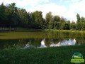
(3) At the junction, by the ponds, continue straight on for about 1 km along the unmarked south-facing path until you reach the next pond.

(4) After the pond and the hut, turn immediately right, then, after crossing the stream, turn left. At the next junction, turn right one last time to reach a signposted path at the crossroads.

(5) At the crossroads, turn left towards Croix de Saint-Michel, following the Green Ring and Blue Cross markings.

(6) After the Croix de Saint-Michel, when you reach the tarmac road, turn left and follow the Blue Cross markings. This leads to a crossroads after about 1.5 km.

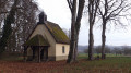
(7) Turn left and follow the Green Saltire and Blue Ring signs, then turn right, following only the Blue Ring signposted path. At the bottom of the descent, you reach the Chapelle Saint-Léger.

(8) After the Saint-Léger Chapel (also called Saint Glücker on the IGN map), turn right following the Blue Ring markings, then, at the farm, turn left following the Blue Rectangle (variant ofthe GR®531) and Blue Ring markings.

(9) After about 500m on the tarmac, turn left following the Blue Ring markings and ignoring the Blue-White-Blue Blue Rectangle markings which continue straight ahead. After a right-angle bend to the left and then to the right, you will rejoin the tarmac.

(10) Turn right towards Carspach, following the Blue Ring and Red Ring markings.

(11) Once in Carspach, turn left onto Rue des Tilleuls until you reach the cemetery car park (S/E).


Waypoints

  1. S/E : mi 0 - alt. 994 ft - Cemetery car park
  2. 1 : mi 0.46 - alt. 1,007 ft - Near GR°°®°°532
  3. 2 : mi 1.32 - alt. 1,037 ft - Short tarmac section
  4. 3 : mi 2.01 - alt. 1,070 ft - Intersection of the ponds
  5. 4 : mi 2.95 - alt. 1,158 ft - Pond + hut
  6. 5 : mi 3.64 - alt. 1,211 ft - Marked path to Croix de St-Michel
  7. 6 : mi 3.92 - alt. 1,240 ft - On the tarmac, turn left
  8. 7 : mi 4.9 - alt. 1,286 ft - Left then right, on the Blue Ring
  9. 8 : mi 5.82 - alt. 1,109 ft - Chapelle Saint-Léger
  10. 9 : mi 6.48 - alt. 1,030 ft - To the left, Blue Ring markings
  11. 10 : mi 7.04 - alt. 1,056 ft - T-junction
  12. 11 : mi 7.55 - alt. 1,001 ft - On the left, Rue des Tilleuls
  13. S/E : mi 7.68 - alt. 994 ft - Cemetery car park

Notes

There are plenty of water points and picnic spots along the route; make sure you wear good walking shoes and bring a water bottle and filter.
The walk is easy and offers a chance to get away from it all for a few hours.

Always be cautious and plan ahead when you're outdoors. Visorando and the author of this route cannot be held responsible for any accidents occurring on this route.

The GR® and PR® markings are the intellectual property of the Fédération Française de Randonnée Pédestre.

Reviews and comments

4.5 / 5
Based on 5 reviews

Reliability of the description
4.6 / 5
Ease of following the route
4.8 / 5
Route interest
4 / 5
cathy.payfert@gmail.com

I've already left a review
11 Nov 2024 at 17:42

Overall rating: 4.7 / 5

Date of the hike: 11 Nov 2024
Accuracy of the description: ★★★★★ Very good
Ease of following the route: ★★★★★ Very good
Interest of the hiking route: ★★★★☆ Good
Busy route: No

We completed this walk on 8 November 2024, which allowed us to discover woodland and countryside scenery. Despite the fog and damp conditions, the paths remained easily passable. We completed the route in 2 hours 30 minutes.
It’s a lovely walk.

Machine-translated

User 28389462

Overall rating : 5 / 5

Date of your route : Mar 26, 2026
Reliability of the description : ★★★★★ Very good
Ease of following the route : ★★★★★ Very good
Route interest : ★★★★★ Very good
Very busy route : No

Very clear description

Machine-translated

cathy.payfert@gmail.com

Overall rating : 4.7 / 5

Date of your route : Nov 11, 2024
Reliability of the description : ★★★★★ Very good
Ease of following the route : ★★★★★ Very good
Route interest : ★★★★☆ Good
Very busy route : No

We went for a walk on 8 November 2024, which gave us the chance to explore the woodland and countryside scenery. Despite the fog and damp conditions, the paths remained easily passable. We completed the route in two and a half hours.
It’s a lovely walk.

Machine-translated

Baridon
Baridon

Overall rating : 4.3 / 5

Date of your route : May 26, 2024
Reliability of the description : ★★★★☆ Good
Ease of following the route : ★★★★☆ Good
Route interest : ★★★★★ Very good
Very busy route : Yes

A pleasant walk in the style of a public walk. No real difficulty.

Machine-translated

jackybois
jackybois

Overall rating : 4 / 5

Date of your route : Jul 25, 2020
Reliability of the description : ★★★★☆ Good
Ease of following the route : ★★★★★ Very good
Route interest : ★★★☆☆ Average
Very busy route : No

A lovely walk, mostly through the woods. Which is lovely on a sunny day.
Just a suggestion: it would be helpful to specify the picnic spots so we can plan our route better. We stopped to eat on an old tree stump and then, 300 metres further on, we found a spot with a table and benches.
Thank you

Machine-translated

Daniel V
Daniel V
• Edited:

Overall rating : 4.3 / 5

Date of your route : Sep 08, 2020
Reliability of the description : ★★★★★ Very good
Ease of following the route : ★★★★★ Very good
Route interest : ★★★☆☆ Average

Some bits are nice, others not so much.

Machine-translated

Other walks in the area

For more walks, use our search engine .

The GPS track and description are the property of this route's author. Please do not copy them without permission.