


piccolopripri

 Visorando Member
 Premium user
 - Gender: woman
Sign up:
Published route(s)
 Pic d'Oliferne from Coisia
 9.62 mi
 +2,300 ft
 -2,300 ft
 6h 25
6h 25
 Average
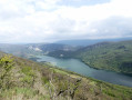
 Departure from Coisia (Jura)
This hike begins with a steep climb, rewarded by numerous panoramic views of Lake Coiselet. It continues along a pleasant ridge with beautiful views and ends with a visit to the ruins of the medieval castle of Oliferne, which offers a 360° view, before descending back to the starting point.
 Circular of Arcan to Grand Taureau
 7.88 mi
+1,073 ft
-1,096 ft
6h 04
Average
Departure from Pontarlier (Doubs)
7.88 mi
+1,073 ft
-1,096 ft
6h 04
Average
Departure from Pontarlier (Doubs)
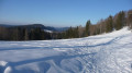
Circular snowshoe loop above Pontarlier towards the Grand Taureau (altitude 1,323 m). Gentle climb. Steeper return which can be avoided by following the road, which is partly snow-covered. View of the Alps in good weather. View of Pontarlier and further north. Only part of the route is marked. Much of the route is used in winter.
Les Aiguilles de Baulmes
 7.00 mi
+1,555 ft
-1,578 ft
5 hrs
Average
Departure from Sainte-Croix (Canton de Vaud) (Vaud)
7.00 mi
+1,555 ft
-1,578 ft
5 hrs
Average
Departure from Sainte-Croix (Canton de Vaud) (Vaud)
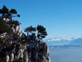
A circular hike that follows the ridge of the Aiguilles de Baulmes. Magnificent views all along the way of the Alps, which seem very close, and, at both ends, of some of the peaks of the Jura. It is not guaranteed that you will be able to follow the tracks all along the route.
Fountains, wash houses, feudal mound and discovery trail from Placey
 7.40 mi
+610 ft
-630 ft
3h 55
Average
Departure from Placey (Doubs)
7.40 mi
+610 ft
-630 ft
3h 55
Average
Departure from Placey (Doubs)
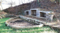
A few hours in a peaceful area. The terrain is hilly, with views stretching far into the distance. We discover villages with their beautiful fountains and wash houses. We finish at the feudal mound and its discovery trail.
Heritage and panoramic views between Pagnoz and Marnoz
 5.35 mi
+725 ft
-725 ft
3h 05
5.35 mi
+725 ft
-725 ft
3h 05
 Easy
Departure from Pagnoz (Jura)
Easy
Departure from Pagnoz (Jura)
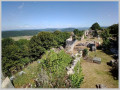
A 30-minute climb will take you to the feudal castle of Vaulgrenant, where you can enjoy a 360° panorama. Then you will walk between valleys and woods, with ever-changing views of Mont Poupet. After Marnoz, you will discover a very pleasant path leading back to Pagnoz. It allows you to walk along the railway line without realising it (except at the beginning). A hike away from the beaten track and through varied landscapes.
Lac Noir, its source, two viewpoints and the stubble fields.
 4.07 mi
+1,165 ft
-1,152 ft
2h 55
Average
Departure from Orbey (Haut-Rhin)
4.07 mi
+1,165 ft
-1,152 ft
2h 55
Average
Departure from Orbey (Haut-Rhin)
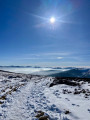
A varied hike starting from Lac Noir, winding through the beautiful Vosges forest and taking you to the Hans rock, which overlooks Lac Blanc. The return route, which is less busy, allows you to discover the lake’s source and the stubble fields near Gazon du Faing.
PLEASE NOTE: The notice dated August 2026 indicates a diversion at the end of the route, adding an extra 2 km.
Montrond-le-Château and its diverse landscapes
5.55 mi
+262 ft
-285 ft
2h 45
Easy
Departure from Montrond-le-Château (Doubs)
Two completely different sections:
- the climb to the castle ruins, with a superb view and an orientation table. A short but relatively steep climb.
- the very flat section, through a forest notable for its multitude of sharp limestone pavements and deep sinkholes, which will be enjoyed in all seasons.
A GPS is recommended to follow the route through the forest, but the 2022 update is more detailed.
A short stretch of road, with virtually no traffic.
The Bois des Saussottes, the fountain as seen from Velesmes-Essarts
3.36 mi
+207 ft
-200 ft
1h 45
Easy
Departure from Velesmes-Essarts (Doubs)
An easy walk apart from a short climb halfway along the route. Very gentle descent. Very easy to follow. A forest walk offering shade if it’s hot (except in the village). Surely very pleasant too when the autumn colours are at their best. Option to extend the walk to the point (3), on the Routelle side.
Bois d’Amont towards Chalet Gaillard (near Roche Bernard)
 4.83 mi
+801 ft
-778 ft
1.5 hrs
Average
Departure from Bois-d'Amont (Jura)
4.83 mi
+801 ft
-778 ft
1.5 hrs
Average
Departure from Bois-d'Amont (Jura)
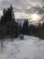
A snowshoe hike, very well signposted. A well-trodden trail (at least due to the number of visitors). Mostly set in open countryside on the edge of the woods. A tasty refreshment stop awaits you on arrival, with a warm welcome for those who wish it. You can easily extend the walk to La Roche Bernard (1.6 km one way) and return via the same route.
Mont Pelé, starting from Bugny
 5.07 mi
+784 ft
-807 ft
3 hrs
Easy
Departure from Bugny (Doubs)
5.07 mi
+784 ft
-807 ft
3 hrs
Easy
Departure from Bugny (Doubs)
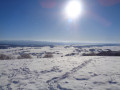
A snowshoe hike in a quiet area. Unusual views over the Hautepierre area. A view of Mont Blanc if you’re lucky. Vast snowfields to explore.
The GPX track may prove useful in areas without signposting.
Saône to Besançon with return by train
7.73 mi
+364 ft
-837 ft
3h 50
Average
Departure from Saône (Doubs)
A touch of holiday spirit as you take the train. A varied route passing through the Marais de Saône (information about the marsh), exploring the Creux sous Roche, and the Notre-Dame de la Libération viewpoint.
Grand Colombier via Chanduraz
 5.72 mi
+1,588 ft
-1,562 ft
4h 00
Average
Departure from Virieu-le-Petit (Ain)
5.72 mi
+1,588 ft
-1,562 ft
4h 00
Average
Departure from Virieu-le-Petit (Ain)
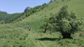
This little-used route offers an original approach to the Grand Colombier, with a rocky final ascent that adds a bit of spice to the hike! Nevertheless, it is manageable for the average hiker. The Chanduraz promontory, overlooking Lake Bourget, is well worth the effort... Not to mention the view from the Granges du Colombier.
Below the Moine, Col de Séron and summit of La Chaux from Lake Rétaud
 7.45 mi
+2,382 ft
-2,352 ft
5h 30
Average
Departure from Ormont-Dessus (Vaud)
7.45 mi
+2,382 ft
-2,352 ft
5h 30
Average
Departure from Ormont-Dessus (Vaud)
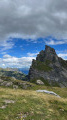
A loop with a mountain atmosphere facing the imposing Diablerets massif, with a return trip to the Col de Seron. In the second part, you will have a view of the Oberland peaks in the distance. Not to mention the small Lac Rétaud in its setting, to be admired at the end of the day.
Circular routes around Cabo de São Vicente
 7.66 mi
+292 ft
-279 ft
3h 45
Easy
Departure from Faro District
7.66 mi
+292 ft
-279 ft
3h 45
Easy
Departure from Faro District
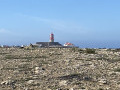
A superb route offering the chance to explore the rugged coastline amidst unspoilt nature.
The cliffs and dunes of Almograve in the Alentejo
 5.10 mi
+131 ft
-138 ft
2h 30
Easy
Departure from Odemira (Beja District)
5.10 mi
+131 ft
-138 ft
2h 30
Easy
Departure from Odemira (Beja District)
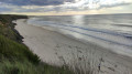
A circular route off the beaten track, along the cliff edge on the way out, facing the ocean and its waves, which invites contemplation. You never tire of it!
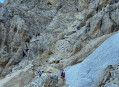
Vajolet Pass at Carezza
 6.44 mi
+2,251 ft
-3,875 ft
4h 55
Average
Departure from San Giovanni di Fassa - Sèn Jan (Provincia di Trento)
6.44 mi
+2,251 ft
-3,875 ft
4h 55
Average
Departure from San Giovanni di Fassa - Sèn Jan (Provincia di Trento)
After starting on an easy path, sometimes lined with pine trees, you’ll cross the Rosengarten/Catinaccio rock massif via a steep path that presents no technical difficulty. You’ll climb alongside Via Ferrata enthusiasts, whom you’ll leave behind at the pass. A whole new landscape then opens up before you. The route continues through a greener, less steep landscape.
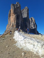
The Tour des Tre Cime (the 3 peaks)
 4.48 mi
+896 ft
-873 ft
2h 50
Easy
Departure from Auronzo di Cadore (Belluno)
4.48 mi
+896 ft
-873 ft
2h 50
Easy
Departure from Auronzo di Cadore (Belluno)
You will drive around the famous Tre Cime massif, neither too far nor too close, so you can admire it from all angles. Part of the route is very quiet, even in summer. No difficulty, just pure pleasure!
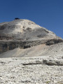
From Sas de Pordoi to the Boe Refuge, a barren, rocky landscape
 3.58 mi
+705 ft
-692 ft
2h 15
Easy
Departure from Canazei (Belluno)
3.58 mi
+705 ft
-692 ft
2h 15
Easy
Departure from Canazei (Belluno)
You’re on ‘the terrace of the Dolomites’. A stunning, surprising setting – I’ll let you discover it for yourself!
An easy walk, popular with families. In good weather, there’s a 360° view. There’s a welcoming mountain hut/restaurant at either end of the walk. If you’re lucky, you might see people in wingsuits jumping and flying off the cliff at Sas de Pordoi
Pirey towards Mont and Fort de Pouilley
5.54 mi
+581 ft
-587 ft
3h 05
Easy
Departure from Pirey (Doubs)
A peaceful family route near Besançon. Discover a restored caborde (stone shelter) and a wide viewpoint with an orientation table.
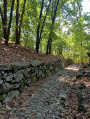
From Lake Orta to the Croix d'Egro viewpoint
 6.25 mi
+1,519 ft
-1,512 ft
4h 10
Average
Departure from Pella (Novara)
6.25 mi
+1,519 ft
-1,512 ft
4h 10
Average
Departure from Pella (Novara)
After a well-earned climb, the Croix d'Egro offers a magnificent view of the entire lake. Most of the route is through forest, with passages through hamlets with azaleas, etc. The return trip to the viewpoint is relatively steep but well worth it!
Plan de l’Aiguille and Lac Bleu
 1.63 mi
+394 ft
-390 ft
1h 05
Easy
Departure from Chamonix-Mont-Blanc (Haute-Savoie)
1.63 mi
+394 ft
-390 ft
1h 05
Easy
Departure from Chamonix-Mont-Blanc (Haute-Savoie)
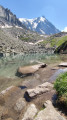
A short, easy walk at the foot of the Aiguilles de Chamonix, including the Aiguille du Midi, with views of the nearby Mont Blanc in particular. Ideal for families or on hot days. The little Lac Bleu, nestled at the foot of the Aiguilles de Chamonix, makes for a very pleasant break, safe for children… accompanied by their parents.
Tour of the Chinyero volcano
 4.48 mi
+453 ft
-440 ft
2h 25
Easy
Departure from Santiago del Teide (Province de Las Palmas)
4.48 mi
+453 ft
-440 ft
2h 25
Easy
Departure from Santiago del Teide (Province de Las Palmas)
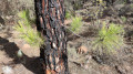
An easy family hike that allows you to admire the last volcano to emerge in Tenerife by walking around it. You will walk among the volcanic fallout on a good path. The massif is dotted with pine trees, some denser than others.
On the heights of Masca, from the Cruz de Hilda viewpoint
 2.88 mi
+974 ft
-971 ft
2h 10
Easy
Departure from Buenavista del Norte (Province de Las Palmas)
2.88 mi
+974 ft
-971 ft
2h 10
Easy
Departure from Buenavista del Norte (Province de Las Palmas)
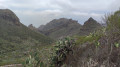
This short route allows you to enjoy this area with its magnificent scenery. The view stretches far into the distance, and the cliffs are impressive. A pleasant route that climbs steadily amidst prickly pears and other vegetation. Even in winter, it’s a pleasure to walk here, whilst being far from the crowds of tourists in Masca.
There is the option to extend the walk further along this good path, for 1.5 km, to Cumbre Bolico. Personally, I was stopped in my tracks by the fog that rolled in at the end of the day.
A palette of colours at the foot of El Teide
 4.45 mi
+919 ft
-919 ft
2h 50
Average
Departure from La Orotava (Province de Las Palmas)
4.45 mi
+919 ft
-919 ft
2h 50
Average
Departure from La Orotava (Province de Las Palmas)
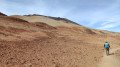
After walking for 800 m, you’d think you were in the middle of the desert. Sandy terrain (but you don’t sink in), a gradient of colours, gentle undulating terrain, and dark rocks providing a striking contrast. A real treat!
A 6 km family walk if you do a return trip to the point (2). A relatively steep climb of 200 m in elevation if you do the full route. El Teide is very close by.
A variety of landscapes between El Teide and Montaña Guajara
 6.91 mi
+492 ft
-499 ft
3h 35
Average
Departure from La Orotava (Province de Las Palmas)
6.91 mi
+492 ft
-499 ft
3h 35
Average
Departure from La Orotava (Province de Las Palmas)
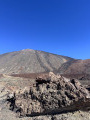
An easy hike on a good path. You’ll enjoy superb views of El Teide and the surrounding area. Then you’ll encounter rugged, eroded rocks in a variety of shapes and colours as you approach Montaña Guajara (alt. 2,717 m), the highest peak in the vast caldera. Towards the end of the route, you’ll see viper’s bugloss, those tall plants endemic to Tenerife that bloom red (in the right season). As a bonus, there’s a safe car park.
Loop between flower-filled mountain pastures and woods, passing by Lake Majingsee.
 5.15 mi
+1,411 ft
-1,404 ft
3h 35
Average
Departure from Leukerbad (Valais)
5.15 mi
+1,411 ft
-1,404 ft
3h 35
Average
Departure from Leukerbad (Valais)
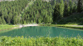
This loop allows you to discover vast mountain pastures covered with flowers in season, admire the larch and other conifers in the woods you pass through, stroll along the shores of Lake Majingsee, and continue on to the rocky outcrop overlooking Leukerbad.
Daubensee tour from the Gemmipass
 3.96 mi
+669 ft
-673 ft
2h 25
Easy
Departure from Leukerbad (Valais)
3.96 mi
+669 ft
-673 ft
2h 25
Easy
Departure from Leukerbad (Valais)
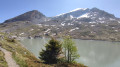
This circuit is suitable for almost everyone. Before starting your circuit, you can admire the peaks of the Bernese Alps from a footbridge equipped with an orientation table. You can take a leisurely walk around the lake surrounded by mountains. Several options allow you to adapt the circuit to your level.
The Flüekapelle and Lake Majingsee, through woods and mountain pastures
 7.22 mi
+2,280 ft
-2,277 ft
5h 20
Average
Departure from Leukerbad (Valais)
7.22 mi
+2,280 ft
-2,277 ft
5h 20
Average
Departure from Leukerbad (Valais)
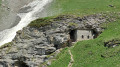
Alternating between woods with imposing trees, alpine pastures carpeted with alpine flowers in season and rhododendrons in bloom (late June-early July). View of the impressive rock face overlooking Leukerbad and extending eastwards on the opposite slope to the circuit. Passage at Majingsee, ideal for contemplation. In the woods, birdsong will accompany you depending on the time of year.
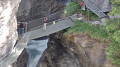
Dala Springs Trail and return via Weidstubli
 2.40 mi
+928 ft
-912 ft
1h 55
Easy
Departure from Leukerbad (Valais)
2.40 mi
+928 ft
-912 ft
1h 55
Easy
Departure from Leukerbad (Valais)
Climbing up the Dala Gorge, you will discover a bubbling river, learn about the thermal springs, walk overlooking the gorge and climb metal stairs near a waterfall. The return trip involves a slight climb, but this can be avoided.
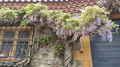
From Vieux Ternand to the chapel of Ronzière
 3.36 mi
+614 ft
-607 ft
2h 05
Easy
Departure from Ternand (Rhône)
3.36 mi
+614 ft
-607 ft
2h 05
Easy
Departure from Ternand (Rhône)
This route allows you to discover Old Ternand, a superb medieval fortified village perched on a peak. Halfway along the route, you can admire the Ronzière chapel and the adjoining property before passing by a pond with water lilies. This route can complement the very interesting circular Heritage Loop through Ternand, Saint-Paule and Saint-Laurent d'Oingt. Starting from Old Ternand allows you to visit it at your leisure after the hike. You can spot this rocky peak in the distance if you go on other hikes in the area.
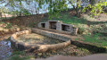
The Fontaine de Vauchon fountain from Cordiron
 3.35 mi
+135 ft
-138 ft
1h 40
Easy
Departure from Burgille (Doubs)
3.35 mi
+135 ft
-138 ft
1h 40
Easy
Departure from Burgille (Doubs)
An easy route through the countryside. Peaceful, wide open, gently rolling landscapes. Woods and fields. Two beautiful fountains and a fortified castle, one of the last in Franche-Comté to still have a standing keep.
Castle, viewpoint and chasms at Montrond
4.77 mi
+427 ft
-420 ft
2h 35
Easy
Departure from Montrond-le-Château (Doubs)
A varied hike with flat sections, a passage through woods, and two climbs up the Montrond hill. At the top, you can enjoy the vast panorama. At the bottom, you will discover two wells that have been cleared quite recently. Given the size of the cavities visible from the platforms, they can be considered chasms, with a vast underground network that you can learn about on the explanatory panels. You will take part of the Sentier du Triton trail, which will offer you a few riddles. In short, a hike for young and old alike.
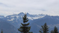
Le Vanil des Cours
 5.32 mi
+2,047 ft
-2,037 ft
4h 15
5.32 mi
+2,047 ft
-2,037 ft
4h 15
 Difficult
Departure from Cerniat (Canton of Fribourg)
Difficult
Departure from Cerniat (Canton of Fribourg)
A short route, but the higher you go, the steeper the slope becomes. A mix of forest, mountain pastures and sweeping panoramic views typical of the area. A wide view of the Alps and the Jura from the summit. A lovely discovery. The actual climb to Le Vanil is quite challenging.
Lods circular route to Roche de Hautepierre
 7.62 mi
+1,949 ft
-1,942 ft
5h 10
Average
Departure from Lods (Doubs)
7.62 mi
+1,949 ft
-1,942 ft
5h 10
Average
Departure from Lods (Doubs)
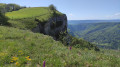
In a particularly remarkable setting, where the Loue has carved out a wide, deep gorge, this circular route passes through one of the “most beautiful villages in France”: Lods, nestled in the valley. Steep climbs take us, after a 510-metre ascent, to the Roche de Hautepierre and its sweeping panorama. From there, the route follows charming paths through unspoilt countryside. The descent is gentle. As a bonus, we discover the curious Roche de Sainte-Foy rock formation and the “village of character” of Mouthier-Hautepierre, which is also full of charm and boasts a rich architectural heritage.
The Bisse du Ro, starting from Crans-Montana
 5.06 mi
+3,071 ft
-3,081 ft
5h 00
Easy
Departure from Icogne (Valais)
5.06 mi
+3,071 ft
-3,081 ft
5h 00
Easy
Departure from Icogne (Valais)
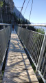
You’ll walk alongside what is probably the oldest bisse. Since 1947, as maintenance had become too dangerous, the water no longer flows through it; it has been diverted. The information boards along the path are well worth reading. The path can be quite impressive as you often follow a platform right in the middle of the cliff face, as shown in one of the photos. Of particular note is a Himalayan-style footbridge – wide but nonetheless impressive, 124 metres long – built in 2020. The route is very well secured. You can extend the walk to the Tseuzier dam and return by bus, or otherwise return via the same route.
Please note: given the terrain, the elevation gain shown is significantly overestimated. Expect around 150 metres.
Lac Bleu near Arolla Val d’Hérens
 2.41 mi
+984 ft
-991 ft
2h 00
Average
Departure from Evolène (Valais)
2.41 mi
+984 ft
-991 ft
2h 00
Average
Departure from Evolène (Valais)
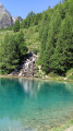
A small, turquoise-blue lake, surrounded by Swiss stone pines and venerable larch trees – this is the destination of your hike. With views of the peaks as a bonus. You’ll pass through hamlets with magnificent wooden chalets featuring slate roofs. A cosy Valais-style café and restaurant awaits you beside the lake. This route is short, but you’ll get a good workout given the elevation gain.
From La Forclaz to Les Mayens de Bréonna
 2.71 mi
+1,106 ft
-1,112 ft
2h 15
Average
Departure from Evolène (Valais)
2.71 mi
+1,106 ft
-1,112 ft
2h 15
Average
Departure from Evolène (Valais)
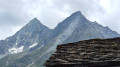
A short but fascinating route. It climbs steadily, avoiding the hairpin bends of the white track used by 4x4s. Magnificent views of the Dent Blanche and the neighbouring peaks. The traditional Mayens are an absolute must-see, as is the very well-preserved centre of the village of La Forclaz. The descent through the larch trees is pleasant.
Can be extended via the Tsalè refreshment hut – Total: 6 km, 480 m