Saône to Besançon with return by train

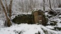
A touch of holiday spirit as you take the train. A varied route passing through the Marais de Saône (information about the marsh), exploring the Creux sous Roche, and the Notre-Dame de la Libération viewpoint.

Details

20187330
Creation:
Last update:
Last review:
  • Walking
    Activity: Walking
  • ↔
    Distance: 7.73 mi
  • ◔
    Average duration: 3h 50 
  • ▲
    Difficulty: Moderate

  • ⚐
    Back to start: No
  • ↗
    Ascent: + 364 ft
  • ↘
    Descent: - 837 ft

  • ▲
    Highest point: 1,581 ft
  • ▼
    Lowest point: 794 ft
  • ⚐ Country: France
  • ⚐ City: Saône (25660)
  • ⚑
    Start: N 47.209617° / E 6.101937°
  • ⚑
    End: N 47.240438° / E 6.03367°
  • Accessible from the train station Gare de Besançon-Mouillère.
  • ❏
    IGN map(s): Ref. 3323ET
  • Hour-by-hour weather

Description of the walk

(S) Leave the car park in front of Saône station, turn left onto Rue de la Gare, which heads towards the centre of Saône. Ignore the two streets branching off to the left. Take the next one (Rue du Moulin). Don’t linger in front of the house where a dog is barking, to keep the neighbours happy! At the gate on the right, look out for the path laid out for walkers that allows you to cross it. Continue along the path, at a right angle to the street.

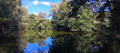
At the bridge, continue straight ahead along the path, then, at a crossroads, turn right into the field. This will take you to the “circular water loop”, then on to the viewpoint over the Creux sous Roche.
(Alternative route if the marsh is dry: turn right after the bridge, take the path that zigzags and climbs up to the left towards the viewpoint over the Creux sous Roche)

(1). You are now looking down on the Creux sous Roche (information panel).
Retrace your steps along the signposted “water circular loop” which runs alongside a fence. Continue along this circular loop. When it veers to the right, leave it and follow the GR®595 towards “la boucle des milieux naturels”. Leave it when it veers to the right. Continue until you come to a wide path. Follow it to the left to the hamlet of La Couvre.

(2) Follow the small road to the left, continue straight on, go under the dual carriageway and ignore the road to the left. Arrive at the village of La Vèze and turn right twice. Here is the first climb. Continue to the roundabout, cross it carefully and go up the road opposite (park-and-ride car park on the right).

(3) Immediately after, take the path on the left which climbs quite steeply. Ignore the path branching off to the right and carry on. At the next junction, take the path on the right which descends, marked in yellow and red, towards the Chapelle des Buis and Besançon. Descend to the road and take the D144 almost directly opposite.

(4) At a bend, take the path on the right, which is still signposted.

(5) At the next crossroads, head up to the left towards Notre-Dame de la Libération and the Chapelle des Buis (signposted).

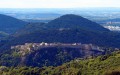
(6) Once on the road, walk to and from the Notre-Dame de la Libération esplanade. There is a sweeping view over Besançon.

(6) Note the marked path on the right. Follow it down. At the next junction, turn left. At the road, turn left.

(7) At the crossroads (elevation 339), turn right (you could continue straight on tothe GR®®145but that would make the route longer). After about 350 m, take the path on the left then turn right to follow theGR®®145which descends towards the town centre. A few steps to negotiate (you could have continued along the road to visit the Grotte Saint-Léonard (signposted – see map; be careful as it can be slippery).

Much further on, on the road, look out for a narrow path signposted to the right. It leads to a lovely viewpoint but ends with a tricky descent if it’s muddy. Ignore it and continue along the road (alternative: follow it; it joins the road further on. Lovely viewpoint along the way).

(8) At the junction with three roads, take the one on the right which descends towards the Doubs. Take care! Keep an eye out, as there is an option to cut across two bends and take some steps. At the bottom, follow the pavement to the left towards the town. Cross at a pedestrian crossing and follow the path for pedestrians and cyclists along the banks of the Doubs.

(9) Walk behind the FRAC (museum, Regional Contemporary Art Foundation) and the CRR (Regional Conservatoire), then take the Pont de Bregille to cross the Doubs. Walk along the left-hand pavement of the bridge to the pedestrian crossing.
As you leave the bridge, turn left and walk through Parc Micaud, well known to the people of Besançon.

(10) Take the underpass on the right, then follow the path on the left leading to La Mouillère station (E).

Waypoints

  1. S : mi 0 - alt. 1,270 ft - Gare de Saône
  2. 1 : mi 0.96 - alt. 1,227 ft - Creux sous Roche, information board - Marais de Saône
  3. 2 : mi 2.35 - alt. 1,286 ft - The hamlet of La Couvre
  4. 3 : mi 4 - alt. 1,401 ft - La Vèze park-and-ride
  5. 4 : mi 4.76 - alt. 1,490 ft - Leave the road
  6. 5 : mi 4.92 - alt. 1,509 ft - Crossroads, signpost - Ancien Fort de l'Est des Buis (Besançon, Morre, Fontain et Beure)
  7. 6 : mi 5.18 - alt. 1,552 ft - A path leads down to the right, very close by. Towards - Notre Dame de la Libération (Morre)
  8. 7 : mi 5.63 - alt. 1,312 ft - Crossroads
  9. 8 : mi 6.51 - alt. 1,027 ft - Large crossroads. Towards the - Doubs (rivière)
  10. 9 : mi 7.29 - alt. 804 ft - FRAC and Conservatoire (music), go round the back - Canal du Rhône au Rhin
  11. 10 : mi 7.61 - alt. 801 ft - Underpass – Rhône-Rhine Canal
  12. E : mi 7.73 - alt. 817 ft - Gare de Besançon-Mouillère

Notes

The Saône marsh is a marshy, peaty area. The walk through the marsh should be done in dry weather. A light rain in the days leading up to the walk will make the paths muddy, or even worse, at the start of the route.
During high water, the marsh is covered in water. Forget it!

It may be easier to do thefirst part by train, i.e. setting off from Besançon and walking back from Saône. That way, you can be sure you won’t have to wait too long for the train.
Timetables at: www.thetrainline.com/

An easy walk. Some sections require sturdy footwear.

This route passes through a protected area, which may be subject to special regulations:

Worth a visit

Information on the marsh:
http://www.maraisdesaone.fr/decouvrir-ou...
In Saône, (on foot or) by car, visit the Grande Fontaine and the Œil de Bœuf located in the centre of the village on Rue de la Cassotte. The Œil de Bœuf and the Fontaine du Bas act as balancing chimneys on the underground watercourse; they fill up with a slight delay during floods. Information board.
After the village of La Vèze, a park-and-ride facility is available if you need to park your car.
If you start by taking the train from Besançon, there is free parking at La Rodia (free but sometimes full), 1 km – a 15-minute walk from the station via Avenue de Chardonnet.
You can stay on the train until Viotte station.

Notre Dame de la Libération: after the Second World War, Archbishop Maurice-Louis Dubourg had a place of commemoration and remembrance built, as he had promised he would if the city had not been ravaged by bombing. View of the city from the esplanade. Car park.

Always be cautious and plan ahead when you're outdoors. Visorando and the author of this route cannot be held responsible for any accidents occurring on this route.

The GR® and PR® markings are the intellectual property of the Fédération Française de Randonnée Pédestre.

Reviews and comments

5 / 5
Based on 1 review

Reliability of the description
5 / 5
Ease of following the route
5 / 5
Route interest
5 / 5
hervé-manu
hervé-manu

Overall rating : 5 / 5

Date of your route : Oct 04, 2023
Reliability of the description : ★★★★★ Very good
Ease of following the route : ★★★★★ Very good
Route interest : ★★★★★ Very good
Very busy route : Yes

A lovely day. After a short train ride, we had a very pleasant journey back to Besançon through the marshes, with lovely views of Besançon and the Doubs Valley.

Machine-translated

Other walks in the area

For more walks, use our search engine .

The GPS track and description are the property of this route's author. Please do not copy them without permission.