Country:
 City:
City:


Coming from the north of Montrond, walk past the church towards Épeugney. A little further on, a signpost indicates the Motte du Château car park. Follow these signs (i.e. turn right) to reach the car park, which is opposite the school and the town hall.
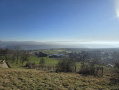
(S/E) On leaving the car park, turn right towards the church, then right onto the Grande Rue, then immediately left, then right. At the next fork, turn left. At the following fork, take the track on the left which climbs, fairly steeply, up to the reservoir and then on to the castle esplanade at an elevation of 525 metres (information boards, orientation table).
Alternative route: an ENS (sensitive natural area) information sign just before the climb. Follow the ENS markers (posts with arrows), so walk alongside the pond on the right and, further on, climb (quite steeply) to rejoin the ‘normal’ path. Don’t forget to read the educational information!
(1) Head back down the same way. At the bottom, take Rue de l’Église to the end. Turn left onto Grande Rue and, shortly after, right onto Rue de la Mairie (car park signposted). Return to the town hall car park.
(S/E) Continue straight on until you reach Rue de la Gare. Note the old station building. Follow this street to the left. After the last house, the street veers to the right. Further on, it becomes a footpath and splits into two.
(2) Take the path on the right and continue straight ahead. Pass a four-way junction without changing direction, and continue straight ahead on this path. Walk alongside the horse park
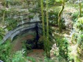
(3) At the crossroads at the end of the park, follow the path on the left which runs alongside a pine forest. At a fork, turn right. Continue straight on, ignoring a path on the right, two paths on the left (small marker visible on the ground), and a path on the right with a deep sinkhole opposite. Immediately after, you’ll reach a junction.
(4) Note the sinkhole on the right and the No. 40 and E markers on a tree. Continue for about 30 m and turn left at a right angle onto the wide path. Pass by a deep sinkhole and continue straight ahead. Further on, the path curves sharply to the right, crosses a track and joins a wide forest path. Continue straight on along this path until you reach a very large clearing with several possible routes.
(5) Take the path furthest to the right. Pass signposts 38–39, ignore the path branching off to the right and pass signpost 35.
(6) At information boards 37-38, do not take the path on the right. Note the sinkhole on the right. Immediately after, at a fork, take the path on the left and continue. You will arrive in a field.
(7) Turn right into the field. Follow the first path you come to.
Alternative route: take thesecond path and follow it for quite a while. The path veers slightly to the left, then follow the path on the right which leads back to the bumpy track, which is passable by car but less pleasant than the forest paths.
(8) At a junction, follow the wide path on the left. Note the low wall visible on the right, then the large boulders to the left of the path. At the crossroads, turn left to rejoin the path taken on the way out.
(4) When you reach the fork, look back to your right and note the signs marked 40 and E. Continue straight ahead. At a fork, it doesn’t matter which path you take; they both lead back to the same place. You’ll arrive at the horse paddock.
(:3) Take the road on the left, then the one on the right in front of the sheds. Beyond this, you can see Montrond Hill with the statue of the Virgin Mary in the distance (at least in winter).
Continue on, then further on, take the street on the right (an extension of Rue du Tacot) and then, shortly after, Rue de la Mairie, which leads back to the car park (S/E).


 Visorando Member


 Moderate