Bois d’Amont towards Chalet Gaillard (near Roche Bernard)

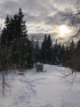
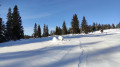
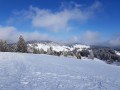
A snowshoe hike, very well signposted. A well-trodden trail (at least due to the number of visitors). Mostly set in open countryside on the edge of the woods. A tasty refreshment stop awaits you on arrival, with a warm welcome for those who wish it. You can easily extend the walk to La Roche Bernard (1.6 km one way) and return via the same route.

Details

18451000
Creation:
Last update:
Last review:
  • Snowshoeing
    Activity: Snowshoeing
  • ↔
    Distance: 4.83 mi
  • ◔
    Duration according to the author: 1.5 hrs 
  • ▲
    Difficulty: Moderate

  • ⚐
    Back to start: Yes
  • ↗
    Ascent: + 801 ft
  • ↘
    Descent: - 778 ft

  • ▲
    Highest point: 4,055 ft
  • ▼
    Lowest point: 3,734 ft

Photos

Description of the walk

From the centre of Bois d’Amont, take the Route du Risoux towards the Combettes car park. Stop at a junction where the Impasse des Combettes branches off to the right: parking available. Note: when there’s been heavy snowfall, the Route du Risoux isn’t cleared beyond this point.

(S/E) Turn right onto Impasse des Combettes, carrying your snowshoes. Put your snowshoes on straight away and follow a path to the left, marked by orange snowshoes hanging from the trees: you’ll need to follow these markers all the way to Chalet Gaillard. The path starts with a steep climb, then the route levels out.

(1) At the junction, turn right, following the rustic wooden signpost marked ‘Chalet Gaillard’. Follow this well-marked path, which alternates between very gentle ascents and descents.

(2) At the crossroads, turn right at a right angle and carry on. There are yellow markings as well as snowshoe tracks.

(3) Turn left at the junction with theGRP® Tour de la Haute Bienne. Follow it. Further on, be sure to note the sign for the protection of biotopes, which urges you to respect the wildlife and not to stray from the tracks.

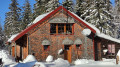
(4) You’ll see a building on the right in the meadow called ‘La Caserne’. Continue to the Chalet Gaillard, where there are three buildings. Take a moment to admire the large house on the right.

(5) Follow the route back in the opposite direction to return to the starting car park (S/E).

Waypoints

  1. S/E : mi 0 - alt. 3,734 ft - Start of Impasse des Combettes
  2. 1 : mi 0.22 - alt. 3,898 ft - Junction
  3. 2 : mi 0.6 - alt. 4,035 ft - Prodhon crossroads
  4. 3 : mi 0.94 - alt. 3,917 ft - GRP junction
  5. 4 : mi 1.78 - alt. 3,970 ft - Vast expanse – La Caserne
  6. 5 : mi 2.41 - alt. 4,052 ft - Chalet Gaillard
  7. S/E : mi 4.83 - alt. 3,734 ft - Start of Impasse des Combettes

Notes

Chalet Gaillard is a mountain refuge and stopover lodge, offering the option of having lunch or staying on a half-board basis. You can also simply enjoy a delicious homemade pastry. It’s advisable to book in advance for meals and accommodation. Very friendly welcome

Just past Chalet Gaillard, a cross-country ski trail branches off to the left, signposted ‘Plan de la Citerne’ in particular.
Returning this way means following the ski trail, which runs the full width of the road. It’s very, very monotonous and a bit risky. In fact, it’s off-limits to snowshoes – and rightly so. So it’s better to return along the route you took on the way there, which is more picturesque and less monotonous.

Worth a visit

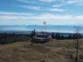
The Roche Bernard viewpoint is situated 1.6 km from our finishing point; there’s no change in altitude. The direction is signposted and the path is also very well-used. It offers a remarkable view over the Chapelle des Bois valley and the lakes of Bellefontaine and Les Mortes.

Roche du Creux near the viewpoint (3): Accessible in winter? A beautiful viewpoint over the Orbe valley. Take care to stay well away from the unsecured sheer drop.

Reviews and comments

5 / 5
Based on 2 reviews

Reliability of the description
5 / 5
Ease of following the route
5 / 5
Route interest
5 / 5
Gigi 2A
Gigi 2A

Overall rating : 5 / 5

Date of your route : Jan 15, 2024
Reliability of the description : ★★★★★ Very good
Ease of following the route : ★★★★★ Very good
Route interest : ★★★★★ Very good
Very busy route : Yes

A lovely snowshoe hike. The start is a bit steep, but after that the climb is gradual. The route is well signposted, as it follows a section of the GTJ. We arrived at a lovely chalet where you can enjoy a coffee and pastries, or even lunch if you fancy. We opted for a picnic at the top of the climb. You need to keep an eye out for changes in direction at certain junctions, where the app comes in very handy 😉

Machine-translated

mauricejeannine
mauricejeannine

Overall rating : 5 / 5

Date of your route : Jun 07, 2023
Reliability of the description : ★★★★★ Very good
Ease of following the route : ★★★★★ Very good
Route interest : ★★★★★ Very good
Very busy route : No

We didn’t follow the route described exactly, as we set off from Chapelle-des-Bois – where we were stopping for a short break – heading towards Bois d’Amont via La Roche Champion; and, just before reaching La Roche Bernard, we turned off at the junction signposted for Chalet Gaillard and Bois d’Amont. A very lovely route through the forest, all gentle downhill. From Chalet Gaillard (reopening mid-June – check dates), the forest track becomes narrower, wilder and more picturesque, whilst remaining well signposted. We set off from Chapelle-des-Bois at 9.45 am and arrived in Bois d’Amont at 1.45 pm, stopping for a picnic shortly after Chalet Gaillard.

Machine-translated

Other walks in the area

For more walks, use our search engine .

The GPS track and description are the property of this route's author. Please do not copy them without permission.