Plan de l’Aiguille and Lac Bleu

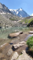
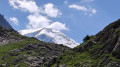
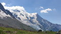
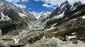
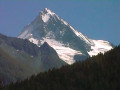
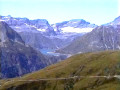
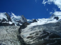
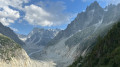
A short, easy walk at the foot of the Aiguilles de Chamonix, including the Aiguille du Midi, with views of the nearby Mont Blanc in particular. Ideal for families or on hot days. The little Lac Bleu, nestled at the foot of the Aiguilles de Chamonix, makes for a very pleasant break, safe for children… accompanied by their parents.

Details

58798139
Creation:
Last update:
Last review:
  • Walking
    Activity: Walking
  • ↔
    Distance: 1.63 mi
  • ◔
    Average duration: 1h 05 
  • ▲
    Difficulty: Easy

  • ⚐
    Back to start: Yes
  • ↗
    Ascent: + 394 ft
  • ↘
    Descent: - 390 ft

  • ▲
    Highest point: 7,575 ft
  • ▼
    Lowest point: 7,228 ft

Photos

Description of the walk

Take the Aiguille du Midi cable car and get off at the Plan de l’Aiguille intermediate station.

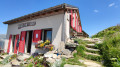
(S/E) On leaving the cable car station, head towards the small chalet which serves as a bar. Turn off just before you reach it, heading towards the signpost.

(1) Follow the path down to the left to the Refuge du Plan de l’Aiguille.

(2) After taking a break at the refuge, turn back to the original fork in the path.

(1) Carry on straight ahead and take the first path on the left leading to Lac Bleu; this path is marked with yellow signs.

(3) At the signpost, take the path on the right which leads to Lac Bleu.

(4) Do feel free to head down to the water’s edge to enjoy this peaceful spot. When setting off again, head to the right with your back to the lake and follow the path which curves further on to the left.

(3) Follow the path back along the same route you took on the way there until you reach the cable car station (S/E).

Waypoints

  1. S/E : mi 0 - alt. 7,543 ft - Plan de L’Aiguille cable car station
  2. 1 : mi 0.03 - alt. 7,539 ft - Signpost
  3. 2 : mi 0.41 - alt. 7,228 ft - Plan de l’Aiguille mountain refuge
  4. 3 : mi 1.05 - alt. 7,503 ft - Signpost, Lac Bleu circular loop
  5. 4 : mi 1.17 - alt. 7,566 ft - Lac Bleu
  6. S/E : mi 1.63 - alt. 7,543 ft - Plan de L’Aiguille cable car station

Notes

The walk starts from Plan de l’Aiguille, the midway station of the Aiguille du Midi cable car. Everyone can choose whether or not to go up to the Aiguille du Midi to admire the panoramic views.
For the cable car, booking seats is virtually essential. Otherwise, you’ll have to wait an hour, two hours or more for seats to become available in an upward-bound cabin.
Plan de l’Aiguille mountain refuge: a warm welcome. You can have a drink there (in the sun, if there is any), or enjoy a meal in the shade of the parasols or indoors. Tempting tarts.
Descent by cable car: we hadn’t booked, but were able to get down without any problems.

Worth a visit

No shade at Lac Bleu. But you can easily dip your feet in the water if it’s hot.

Reviews and comments

5 / 5
Based on 2 reviews

Reliability of the description
5 / 5
Ease of following the route
5 / 5
Route interest
5 / 5
Sylvie34
Sylvie34

Overall rating : 5 / 5

Date of your route : Jun 27, 2026
Reliability of the description : ★★★★★ Very good
Ease of following the route : ★★★★★ Very good
Route interest : ★★★★★ Very good
Very busy route : No

A lovely little lake and plenty of tame marmots amongst the rocks above the lake in the morning (around 9 am); we were on our own.
We went back a few days later around midday; there were quite a few people there and no marmots to be seen (perhaps put off by the heat rather than the people . . . )

Machine-translated

Sylvie34
Sylvie34

Overall rating : 5 / 5

Date of your route : Jun 26, 2026
Reliability of the description : ★★★★★ Very good
Ease of following the route : ★★★★★ Very good
Route interest : ★★★★★ Very good
Very busy route : Yes

A lovely walk in very hot weather (34° in Chamonix). At the last junction, we took the shortest route indicated by the signposts, which was marked as having some tricky sections, but we didn’t find it difficult at all.
We returned on the Montenvers train.
If you want to have a picnic, do so before entering the forest or when you arrive at the train station, as there’s nowhere to do so along the route.

Machine-translated

Other walks in the area

For more walks, use our search engine .

The GPS track and description are the property of this route's author. Please do not copy them without permission.