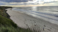
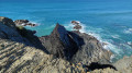
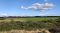
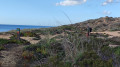
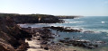
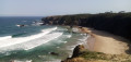
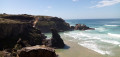
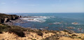
The cliffs and dunes of Almograve in the Alentejo

A circular route off the beaten track, along the cliff edge on the way out, facing the ocean and its waves, which invites contemplation. You never tire of it!

Details

28639311
Creation:
Last update:
Last review:
  • Walking
    Activity: Walking
  • ↔
    Distance: 5.10 mi
  • ◔
    Average duration: 2h 30 
  • ▲
    Difficulty: Easy

  • ⚐
    Back to start: Yes
  • ↗
    Ascent: + 131 ft
  • ↘
    Descent: - 138 ft

  • ▲
    Highest point: 125 ft
  • ▼
    Lowest point: 3 ft

Photos

Description of the walk

Parking is available just before the junction when approaching from Cavaleiro (a village to the south)

(S/E) Take the street called Travessa do Thalo, then turn right. Next, turn left onto Avenida da Praia and continue to the cliff.

(1) Walk along the cliff, turning right, following the dual markings: blue-green and yellow-red.

(2) After a descent, ignore the blue-green markings that branch off to the right. Carry on straight ahead, passing between the two bodies of water, and follow the Yellow-Red marked path which climbs up through the rocks and reaches the top of the cliff. Continue along the marked path, ignoring any paths coming from the right. You’ll come to a cross-path which leads to a house about a hundred metres to the left.

(3) Turn right, following the yellow-red markings, and you’ll reach a four-way junction.

(4) Turn sharply right, then keep left at the three-way junction immediately afterwards.

(5) A few metres after a 90° left-hand bend, turn right and carry on straight ahead until you reach the road.

(6) Turn right and, once at the large roundabout, turn left to return to the car park, which is very close by (S/E).

Waypoints

  1. S/E : mi 0 - alt. 98 ft - Car park
  2. 1 : mi 0.52 - alt. 43 ft - Arrival at the cliffs
  3. 2 : mi 0.91 - alt. 13 ft - Ignore the blue-green signposting; go straight on
  4. 3 : mi 2.81 - alt. 66 ft - Yellow and red markings on the right
  5. 4 : mi 3.39 - alt. 125 ft - Right-angle turn
  6. 5 : mi 4.12 - alt. 105 ft - Turn right at the fork
  7. 6 : mi 4.85 - alt. 59 ft - Arrival at the road
  8. S/E : mi 5.1 - alt. 98 ft - Car park

Notes

The route is very well signposted in yellow-green and/or yellow-red, so you shouldn’t have any trouble finding your way back if you pay attention.
It’s an easy route, but you’ll often be walking on sand up to the northernmost point. This can be a bit of a slog and slow you down. If possible, opt for hiking sandals, which are lighter than closed-toe shoes.
Much of the return journey takes place under a canopy of vegetation, which must be lovely in summer. There are some sandy sections, but far fewer than on the outward journey.
Review from a walker in January 2024: it’s impossible to cross at (2) at high tide. In that case, from the start of the outbound route, head to point (6) and follow the path shown on the map to (2), then continue the route towards (3), etc.
If I remember correctly, the path on the left after (6) was signposted. This option doesn’t mean you miss out on a very long stretch of the coast, and the route to the point (1) isn’t particularly interesting – you’re walking alongside the road.

Worth a visit

Other routes can be found at www.rotavicentina.com
There are some lovely round trips available from Zambujeira do Mar or Odeicexe (starting from the estuary), following the coast, with opportunities to swim at secluded beaches.

Reviews and comments

4.2 / 5
Based on 3 reviews

Reliability of the description
4.5 / 5
Ease of following the route
3.5 / 5
Route interest
4.7 / 5
piccolopripri
piccolopripri

Overall rating : 5 / 5

Date of your route : Jan 16, 2024
Reliability of the description : Not used / Not applicable
Ease of following the route : Not used / Not applicable
Route interest : ★★★★★ Very good
Very busy route : No

I’m sorry for the inconvenience this has caused you. I’ve added the practical information, including details of the high tide and an alternative plan.

Machine-translated

Minamina.
Minamina.

Overall rating : 3.7 / 5

Date of your route : Jan 10, 2024
Reliability of the description : ★★★★☆ Good
Ease of following the route : ★★☆☆☆ Disappointing
Route interest : ★★★★★ Very good
Very busy route : No

We tried this walk, which starts off very well – with magnificent cliffs and coastline – but when we reached point 2, it was impossible to get through: the stream flowing into the sea was too wide and deep; it was high tide and there was no way round it. Disappointed, we followed the blue-green signposts back to the village, but the route was completely uninteresting.
This walk is impossible to do at high tide.

Machine-translated

jph64
jph64

Overall rating : 4.7 / 5

Date of your route : Sep 18, 2023
Reliability of the description : ★★★★★ Very good
Ease of following the route : ★★★★★ Very good
Route interest : ★★★★☆ Good
Very busy route : No

A lovely route, not at all difficult and not very busy at this time of year. Three-quarters of the route is through the sand of the dunes. Views of the cliffs.

Machine-translated

Other walks in the area

For more walks, use our search engine .

The GPS track and description are the property of this route's author. Please do not copy them without permission.