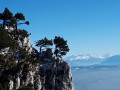
Mont Pelé, starting from Bugny

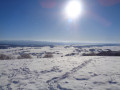
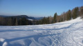
A snowshoe hike in a quiet area. Unusual views over the Hautepierre area. A view of Mont Blanc if you’re lucky. Vast snowfields to explore.
The GPX track may prove useful in areas without signposting.

Details

18568657
Creation:
Last update:
Last review:
  • Snowshoeing
    Activity: Snowshoeing
  • ↔
    Distance: 5.07 mi
  • ◔
    Duration according to the author: 3 hrs 
  • ▲
    Difficulty: Easy

  • ⚐
    Back to start: Yes
  • ↗
    Ascent: + 784 ft
  • ↘
    Descent: - 807 ft

  • ▲
    Highest point: 3,428 ft
  • ▼
    Lowest point: 2,779 ft

Photos

Description of the walk

In winter, the safest way to get to Bugny is to come from La Vrine (north of Pontarlier). There is a car park by the church with limited spaces. If necessary, you can park further away by taking Rue du Tilleul.

(S/E) Set off with your snowshoes in hand, passing in front of the school, then turn left onto Rue du Tilleul. At the next junction, follow Rue de l’Essolette to the right.

(1) After the houses, keep parallel to the road, following the tracks through the fields on the right. You’ll come across signposting.

(2) Follow the signs for Mont Pelé and the yellow-and-blue markings. Begin the climb to the right and reach a viewpoint overlooking the Roche de Hautepierre.

(3) Continue the climb to the small cairn on Mont Pelé.

(4) Leave the trail markers and continue through the fields in the same north-easterly direction, then turn left towards the north. When you reach a fence, walk alongside it without crossing it.
The GPX track may be useful at this point. Use the wooded areas on the map to find your bearings, but it’s fairly straightforward.
Heading down this long slope covered in lovely snow is a real pleasure!

(5) Two options:
- turn left to follow the path leading to La Ramée.
- continue down the snow-covered field to the path at the bottom, which is lined with barbed wire.

(6) Cross the barbed-wire fence (couldn’t see a designated crossing). Take the path on the left; it leads back to La Ferrière. Pass under the power line and, further on, you’ll come across the yellow-and-blue markings.

(7) Continue down the wide path heading south-west. Pass under a second power line.

(8) Leave the signposted route. Continue due south.

(9) Just before a bend, leave the wide path and head into the fields towards La Ferrière farm. Then rejoin the road, turn left, snowshoes in hand, passing under a power line.

(1) Continue along the road and, at the entrance to the village, turn right onto Rue Principale and head for the car park (S/E).

Waypoints

  1. S/E : mi 0 - alt. 2,818 ft - Car park in front of the church and school
  2. 1 : mi 0.31 - alt. 2,831 ft - Crossroads at the end of the circular loop
  3. 2 : mi 0.6 - alt. 2,841 ft - Signposting – Climb to the right
  4. 3 : mi 0.98 - alt. 3,150 ft - Viewpoint
  5. 4 : mi 1.55 - alt. 3,428 ft - Mont Pelé
  6. 5 : mi 2.46 - alt. 3,114 ft - Alternative route
  7. 6 : mi 2.57 - alt. 2,995 ft - Wide path
  8. 7 : mi 3.06 - alt. 3,110 ft - Signposting
  9. 8 : mi 3.54 - alt. 2,894 ft - End of signposting
  10. 9 : mi 3.77 - alt. 2,884 ft - Leave the path
  11. S/E : mi 5.07 - alt. 2,822 ft - Car park in front of the church and school

Notes

(S/E) The car park in front of the church is small.
There is no shelter available.
It takes about 2 hours to reach the summit.

Reviews and comments

3.9 / 5
Based on 4 reviews

Reliability of the description
3.8 / 5
Ease of following the route
3.3 / 5
Route interest
4.8 / 5
harry
harry

Overall rating : 4.3 / 5

Date of your route : Jan 28, 2026
Reliability of the description : ★★★★☆ Good
Ease of following the route : ★★★★☆ Good
Route interest : ★★★★★ Very good
Very busy route : No

Hiking in the snow with beautiful sunshine, it was magnificent. Shortly after setting off, there was a lovely climb with superb views. Arrival at the summit of Mont Pelé YESSS, the view, weather permitting, overlooking Mont Blanc. The rest of the route was pure bliss. Accessible to the vast majority of hikers, I already did it on snowshoes last year. And there's no doubt I'll do it again in the summer. I highly recommend it. Harry

Machine-translated

mimito
mimito

Overall rating : 4 / 5

Date of your route : Feb 17, 2025
Reliability of the description : ★★★★☆ Good
Ease of following the route : ★★★☆☆ Average
Route interest : ★★★★★ Very good
Very busy route : No

A beautiful panoramic view whilst picnicking on Mont Pelé, looking out over the village and Mont Blanc, as we were blessed with a blue sky.
The 2-kilometre climb up Mont Pelé (steep) offers a view of Hautepierre and its valley at marker 3.

Machine-translated

Mme Jeannin
Mme Jeannin

Overall rating : 3.7 / 5

Date of your route : Aug 19, 2024
Reliability of the description : ★★★★☆ Good
Ease of following the route : ★★★☆☆ Average
Route interest : ★★★★☆ Good
Very busy route : No

We did this route last Sunday. The view is lovely, but it’s not a 360° view because of the trees!
The path runs through a plot of land that was cleared of trees quite a few years ago, and it’s now overgrown with brambles, weeds, bushes and so on – all unkempt and reaching three-quarters of a man’s height. It won’t be long before it becomes impassable!

Machine-translated

carole70
carole70

Overall rating : 3.7 / 5

Date of your route : Jan 23, 2023
Reliability of the description : ★★★☆☆ Average
Ease of following the route : ★★★☆☆ Average
Route interest : ★★★★★ Very good
Very busy route : No

A very enjoyable snowshoe walk, although the signposts are hard to spot in the snow.
I’d recommend this walk

Machine-translated

For more walks, use our search engine .

The GPS track and description are the property of this route's author. Please do not copy them without permission.