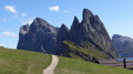
Vajolet Pass at Carezza

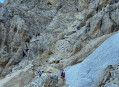
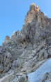
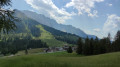
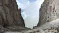
After starting on an easy path, sometimes lined with pine trees, you’ll cross the Rosengarten/Catinaccio rock massif via a steep path that presents no technical difficulty. You’ll climb alongside Via Ferrata enthusiasts, whom you’ll leave behind at the pass. A whole new landscape then opens up before you. The route continues through a greener, less steep landscape.

Details

36231870
Creation:
Last update:
Last review:
  • Walking
    Activity: Walking
  • ↔
    Distance: 6.44 mi
  • ◔
    Average duration: 4h 55 
  • ▲
    Difficulty: Moderate

  • ⚐
    Back to start: No
  • ↗
    Ascent: + 2,251 ft
  • ↘
    Descent: - 3,875 ft

  • ▲
    Highest point: 8,304 ft
  • ▼
    Lowest point: 5,354 ft

Photos

Description of the walk

Park in the large car park at the foot of the Paolina chairlift, by the roadside, on the way up from Lake Carezza towards Passo di Costalunga (Karerpass). From there, take the cable car up.

The trails are well signposted throughout the hike.

(S) Follow trail 552 along the hillside; it’s a very pleasant route that climbs gently towards the Col du Vajolet (Vaiolon Pass). You’ll reach a crossroads with several routes, marked by a signpost.

(1) Follow trail no. 9, which climbs to the Col du Vajolet; it is quite steep, with steps and two ladders that present no difficulty. You’ll reach the pass.

(2) Take path 551 opposite, then turn right onto a gentle descent, following the white-and-red markings on the ground. You’ll reach another junction of paths.

(3) Head straight on towards Rotwand Hütte. Follow a well-marked descent to reach Rotwand Hütte.

(4) Walk past the hut and continue along path no. 548 towards Passo Carezza (Karer Pass). You’ll reach a small inn.

(5) Continue down the slope until you reach a multi-way junction.

(6) Keep left and follow the descending path 548. (See practical information regarding a path on the right). Alternatively, you will reach a car park by the roadside.

(7) Walk alongside the road to the right, taking the parallel path, and further on you’ll reach the lower station of the Paolina chairlift (E).

Waypoints

  1. S : mi 0 - alt. 6,985 ft - Top of the Paolina chairlift
  2. 1 : mi 0.8 - alt. 7,218 ft - Signpost
  3. 2 : mi 1.62 - alt. 8,268 ft - Vajolet Pass
  4. 3 : mi 2.35 - alt. 7,641 ft - Signpost
  5. 4 : mi 3.04 - alt. 7,490 ft - Rotwand Hütte.
  6. 5 : mi 4.05 - alt. 6,647 ft - Inn
  7. 6 : mi 4.88 - alt. 6,030 ft - Multi-way junction
  8. 7 : mi 5.2 - alt. 5,745 ft - Car park by the roadside
  9. E : mi 6.44 - alt. 5,354 ft - Car park and base of the Paolina chairlift

Notes

There is a mini-market where you can buy a packed lunch, behind the Grand Hotel Carezza; it is attached to the hotel. The hotel is situated by the roadside, just before the car park.
On the ascent to the pass: steps that are generally in very good condition. One or two ladders that aren’t too daunting, unless you’re afraid of heights or aren’t used to them. A steep section on the descent.
Food and refreshments are available at the Rotwand Hütte and at the inn further down.

Worth a visit

Between (6) and (7), take care: a path marked ‘private’ or ‘No Entry’ branches off to the right. Logically, asecond path branches off a little further on (or just before) to the right and joins the road between (7) and (E). I must have missed it. I recommend taking this path.

At the Karer Pass, there are places to stay and a restaurant.
Nearby: Lake Carezza, just off the road. Very charming but, unfortunately, very busy.

Reviews and comments

4.7 / 5
Based on 2 reviews

Reliability of the description
4 / 5
Ease of following the route
5 / 5
Route interest
5 / 5
pierka
pierka

Overall rating : 5 / 5

Date of your route : Jun 29, 2026
Reliability of the description : ★★★★★ Very good
Ease of following the route : ★★★★★ Very good
Route interest : ★★★★★ Very good
Very busy route : Yes

Breathtaking views. A hike that’s quite different from other walks in the Dolomites. Sections away from the crowds of tourists who flock to the mountains

Machine-translated

CRE73
CRE73

Overall rating : 4.3 / 5

Date of your route : Aug 27, 2025
Reliability of the description : ★★★☆☆ Average
Ease of following the route : ★★★★★ Very good
Route interest : ★★★★★ Very good
Very busy route : No

Completed in August 2025. A very beautiful hike offering stunning panoramic views and a variety of terrain. It is not very busy compared to the Dolomites, except for the section between point 3 and the refuge.
I think it should be classified as difficult rather than moderate, because:
- the passage before the pass is quite exposed (ladders with gaps, narrow but wired ledge, scree) and requires a head for heights. In addition, when we were there, the start of the first wooden ladder was being repaired. There are also a few ravine crossings on a very narrow path.
- After the pass, the descent before point 3 is very steep. Part of it is equipped with cables and wooden steps, but there are still several sections where you need to use your hands.
Between point 3 and the refuge, there is no steep descent as indicated in the description. It is a fairly wide, almost flat path on the mountainside.
Before point 7, just before the car park, we took a path that branched off to the right and joined the road just after the pass. It is very pleasant and offers a view of the pass itself.

Machine-translated

Other walks in the area

For more walks, use our search engine .

The GPS track and description are the property of this route's author. Please do not copy them without permission.