


philrandovilaine

 Visorando Member
 Premium user
 - Location: Férel (56130)
- Gender: man
Sign up:
Published route(s)
 La Cour aux Loups
 9.07 mi
 +72 ft
 -102 ft
 4h 15
4h 15
 Moderate
 Departure from Herbignac (Loire-Atlantique)
Although Herbignac is not the commune in Brière with the most thatched cottages, the villages along this route offer some fine examples.
The Herbignac Potters’ Trail
8.17 mi
+79 ft
-79 ft
3h 50
Moderate
Departure from Herbignac (Loire-Atlantique)
Passing through clay extraction sites and former pottery villages, this route pays tribute to one of Herbignac’s traditional trades, which continued until the mid-20th century.
The banks of the Brière at Marlais
8.21 mi
+39 ft
-39 ft
3h 50
Moderate
Departure from Herbignac (Loire-Atlantique)
This route runs between the Brière and Mès marshes. These two protected wetlands are home to numerous birds, which you may spot along the way.
From one port to another along the Vilaine
6.34 mi
+420 ft
-436 ft
3h 15
Moderate
Departure from Camoël (Morbihan)
Running along the left bank of the Vilaine, this path follows the riverbank closely, linking the two ports of Arzal and La Roche-Bernard, and offering a multitude of landscapes and views of the Basse-Vilaine. In summer, you can also return by boat or canoe.
The paths of Saint-Dys
7.32 mi
+112 ft
-92 ft
3h 30
Moderate
Departure from Férel (Morbihan)
The commune of Férel comprised five ‘frairies’ (sub-parishes), including that of Saint-Dys (or Teiz), which covers the wooded south-western part of the commune’s territory. The suggested route follows country lanes and forest tracks around Coët Castel and Ally.
The dolmens of Trilla
 4.56 mi
+912 ft
-922 ft
2h 55
Moderate
Departure from Ansignan (Pyrénées-Orientales)
4.56 mi
+912 ft
-922 ft
2h 55
Moderate
Departure from Ansignan (Pyrénées-Orientales)
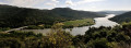
On the heights between Ansignan and Lac de Caramany, the village of Truilla clings to its granite mountain. The first inhabitants used the boulders scattered across the area to build their tombs. The trail winds through this landscape of ridges and granite chaos, connecting two of these dolmens lost in the heart of the vineyards.
Recent information: fences have been installed between points 6 and 7, preventing access.
Saint-Jaume Gorges and Fenouillet Fortresses
 5.51 mi
+1,047 ft
-1,056 ft
3h 25
Moderate
Departure from Caudiès-de-Fenouillèdes (Pyrénées-Orientales)
5.51 mi
+1,047 ft
-1,056 ft
3h 25
Moderate
Departure from Caudiès-de-Fenouillèdes (Pyrénées-Orientales)
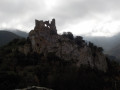
When the valley was unsafe, the men would retreat to the heights. The hills surrounding the Boulzane and Agly valleys are dotted with prestigious strongholds (Puylaurens, Fenouillet, Quéribus, etc.). And getting there was no easy task, as the Gorges de Saint-Jaume demonstrate.
Route des Coulées
7.52 mi
+138 ft
-138 ft
3h 35
Moderate
Departure from Férel (Morbihan)
The plateau on which the village of Férel lies is situated at an altitude of 30 to 50 metres above sea level. It overlooks the southern bank of the Vilaine, sometimes quite steeply, and the streams flow along the bottoms of wooded valleys (the Coulées), which are ideal for walks in all seasons.
Pont Mahé Bay and Dunes
4.57 mi
+36 ft
-49 ft
2h 10
 Easy
Departure from Pénestin (Morbihan)
Easy
Departure from Pénestin (Morbihan)
Straddling the departments of Morbihan and Loire-Atlantique, Pont Mahé Bay is a vast sandbank at low tide and a renowned spot for board sports once the sea has returned. Connecting the two headlands that mark its boundaries is a pleasant way to cross administrative borders
La Roche-Bernard bridge loop
 3.07 mi
+518 ft
-499 ft
1h 50
Moderate
Departure from La Roche-Bernard (Morbihan)
3.07 mi
+518 ft
-499 ft
1h 50
Moderate
Departure from La Roche-Bernard (Morbihan)
An hour-and-a-half circuit with a few tricky sections. This pleasant walk alternates seamlessly between passages at water's edge and ridge-climbing, and also spans two bridges some 50 m above the Vilaine. The bridge circuit allows you to discover a small section of the river as it crosses the Sillon de Bretagne. Get your calves ready!
Locmariaquer: a path strewn with stones
 8.07 mi
+30 ft
-30 ft
3h 45
Moderate
Departure from Locmariaquer (Morbihan)
8.07 mi
+30 ft
-30 ft
3h 45
Moderate
Departure from Locmariaquer (Morbihan)
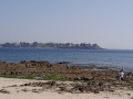
The upper jaw that closes the Gulf of Morbihan is dotted with stone teeth. The circuit around the Pointe de Locmariaquer stretches from the ocean to the peaceful shores of the Gulf, stopping off at several of the sites that have made this megalithic site famous.
NB: It appears that the passage between points 5 and 6 is no longer possible. Follow theGR® 34 markings, which have themselves been modified.
 The Oust Valley towards Malestroit: between towpath and greenway
28.70 mi
+243 ft
-220 ft
3 hrs
Easy
Departure from Saint-Congard (Morbihan)
The Oust Valley is designated a “Grand Site National”, and cycling through it is a great way to explore it.
The Malestroit region offers several ways to explore it, whether by following the Nantes-Brest Canal along the towpath, or by crossing the countryside along the Voie Verte, a cycle path built on the former Questembert-Mauron railway line.
From Ranrouët Castle to La Brière
7.49 mi
+26 ft
-26 ft
3h 30
Moderate
Departure from Herbignac (Loire-Atlantique)
The Château de Ranrouët is a medieval gem nestled on the edge of the marshes. Here, there is no fortified rock, but a slight elevation in the greenery. The marshes that surround it provided protection, and the proposed route winds through the surrounding countryside where land and water constantly mix.
The Gagneries de la Chapelle des Marais circuit
8.32 mi
+10 ft
-10 ft
3h 50
Moderate
Departure from La Chapelle-des-Marais (Loire-Atlantique)
Farming in the marshes has always relied on mowing and grazing the meadows when they were no longer covered in water. Cows prefer dry land to the aquatic environment, and providing them with winter refuge areas is key to ensuring the continuation of this farming practice. This route invites you to discover the pastures of La Chapelle des Marais.
Pointe and woods of Penbron
 4.02 mi
+20 ft
-20 ft
1h 50
Easy
Departure from La Turballe (Loire-Atlantique)
4.02 mi
+20 ft
-20 ft
1h 50
Easy
Departure from La Turballe (Loire-Atlantique)
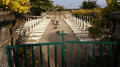
The Pointe de Pen Bron is only a stone's throw from Le Croisic, but the channel that separates it and feeds a large part of the Guérande salt marshes is a dangerous stretch of sea. The sand spit that juts out between the ocean and the Traict is a remarkably peaceful place, offering a way to be in the middle of the waves while keeping your feet on solid ground.
The Trévaly Marshes
5.83 mi
+62 ft
-62 ft
2h 45
Easy
Departure from La Turballe (Loire-Atlantique)
The Trévaly Marshes occupy the westernmost part of the Guérande salt basin. This route takes you through them and up the hillside to the foot of the mill, where you can discover this exceptional landscape.
Walk in the marshes around Kercabellec
8.17 mi
+36 ft
-36 ft
3h 45
Moderate
Departure from Mesquer (Loire-Atlantique)
Mesquer has a coastline opening onto the Bay of Vilaine and the open sea, but around Kercabellec, a small port between the village and Quimiac, there is a much more secret route between the marshes and the Merquel and Rostu tidal flats. Immerse yourself in this unique landscape where salt and shellfish farming are closely intertwined.
Route of the Mills in Marzan
6.17 mi
+479 ft
-472 ft
3h 15
Easy
Departure from Marzan (Morbihan)
Located opposite La Roche-Bernard, on the other bank of the Vilaine, the commune of Marzan stretches across a plateau overlooking the river. On these heights, exposed to sea winds, the remains of several windmills can still be seen. Streams have carved out the rock and flow at the bottom of the valleys. Where it was possible to dam them, water mills were built. The proposed route takes you from one to the other through varied and pleasant countryside.
From Fescal to the Vilaine
 6.57 mi
+505 ft
-505 ft
3h 30
Moderate
Departure from Péaule (Morbihan)
6.57 mi
+505 ft
-505 ft
3h 30
Moderate
Departure from Péaule (Morbihan)
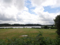
North of La Roche-Bernard, the Vilaine has carved its bed into a rocky plateau, and the streams that join it have also settled in fairly steep valleys. The remains of windmills on the heights and watermills along the streams mark this route, which winds around the former estate of Fescal Castle. This route runs mainly through wooded areas, interspersed with wooded hedgerow landscapes.
Around La Roche-Bernard
5.30 mi
+272 ft
-266 ft
2h 40
Easy
Departure from La Roche-Bernard (Morbihan)
Although La Roche-Bernard is an urban centre that locals refer to as a ‘town’, its area (40 ha) and population (approx. 700 inhabitants) make it one of the smallest county towns in France. It is surrounded by the communes of Nivillac, Herbignac and Férel, across which the majority of the urban area is spread. The proposed route takes you around the area.
Circuit de Trévineuc
6.27 mi
+591 ft
-568 ft
3h 25
Easy
Departure from Nivillac (Morbihan)
Le port de Foleux marque la limite occidentale des marais de Redon. À cet endroit, la Vilaine se resserre et se fraie un passage entre les reliefs du Sillon de Bretagne. Le circuit proposé permet de découvrir la rive Sud de ce goulet. Il parcourt le bord de l'eau et joue aux montagnes russes à travers le relief assez accidenté de Nivillac.
La Brière between Sandun and Saint-André-des-Eaux
 8.21 mi
+59 ft
-62 ft
3h 50
Moderate
Departure from Guérande (Loire-Atlantique)
8.21 mi
+59 ft
-62 ft
3h 50
Moderate
Departure from Guérande (Loire-Atlantique)
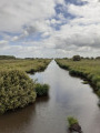
La Brière, France's second largest freshwater marsh, is a secret land hidden behind the surrounding hedgerows. The suggested route allows you to explore it from the land bordering it to the west and even catch a glimpse of it from the Sandun hill, which rises to a height of 28 metres. A real mountain in this flat country!But be careful, marshes are best explored when the water level allows it.Circuit temporarily closed
On the Causse de Sauveterre from Molines
7.86 mi
+1,762 ft
-1,749 ft
5h 10
Moderate
Departure from Ispagnac (Lozère)
To the west, the Ispagnac valley is closed off by the Causse de Sauveterre, which overlooks it by about 500 metres. The route takes you up from this pleasant countryside to the much harsher landscape of the causse. The two hamlets of Paros and Mas André mark this route, which winds through the woods for almost half of its length.
The Causse Méjean from Saint-Chély du Tarn
 10.23 mi
+2,175 ft
-2,149 ft
6h 35
Moderate
Departure from Sainte-Enimie (Lozère)
10.23 mi
+2,175 ft
-2,149 ft
6h 35
Moderate
Departure from Sainte-Enimie (Lozère)
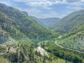
In the heart of the Tarn Gorges, Saint-Chély du Tarn is a little gem nestled in the cirque of the same name. Its wealth comes from the limestone plateau above and the bridge that crosses the river. What a contrast between the cool, green gorge and the arid plateau! But these are two sides of the same interactive landscape. It's up to you to discover them.
Mont Lozère from Finiels
 9.37 mi
+2,031 ft
-2,034 ft
6h 05
Moderate
Departure from Le Pont-de-Montvert (Lozère)
9.37 mi
+2,031 ft
-2,034 ft
6h 05
Moderate
Departure from Le Pont-de-Montvert (Lozère)
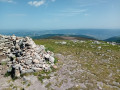
Mont Lozère rises to 1,699 metres, making it the highest point in the Cévennes. However, its geological nature sets it apart from the rest of the massif. This imposing granite wall closes off the schist valleys of the Cévennes and heralds the high plateaus of southern Auvergne. It also offers magnificent views of all the peaks of the southern Massif Central, as far as Mont Ventoux. Best explored in good weather.
The Bieissette Chestnut Grove and the gardens of Ispagnac
3.82 mi
+801 ft
-801 ft
2h 25
Easy
Departure from Ispagnac (Lozère)
Located at the crossroads of the Grands Causses, Mont Lozère and the Cévennes valleys, the Ispagnac valley boasts a wide variety of geological features. Limestone, granite and schist blend together, creating diverse landscapes shaped by the nature of the subsoil. This trail, which runs along the foot of the Causse Méjean, offers you a walk through a schistose terroir.
Saint-Cornely route
 6.84 mi
+692 ft
-699 ft
3h 45
Moderate
Departure from Péaule (Morbihan)
6.84 mi
+692 ft
-699 ft
3h 45
Moderate
Departure from Péaule (Morbihan)
Saint Cornely is the patron saint of horned animals. It is therefore fitting that his chapel is located in a very agricultural part of Péaule. But during this walk, which criss-crosses the plateau above the Vilaine, you will have other things to do than count cows and other quadrupeds. Keep your eyes open, there is much to see in this meander of the Vilaine
Between bocage and Vilaine in Arzal
7.06 mi
+223 ft
-210 ft
3h 25
Moderate
Departure from Arzal (Morbihan)
The village of Arzal stretches from the foot of the church's pointed bell tower to the edge of the dam. Upstream, the river has become a huge body of water where thousands of boats are moored, while downstream, the maritime character of the estuary remains. The proposed route allows you to discover both aspects of the river and the bocage that overlooks it.
Coast and marshes around Saint-Guénolé
5.83 mi
+26 ft
-26 ft
2h 40
Easy
Departure from Penmarch (Finistère)
Cap Caval stretches out into the sea facing the ocean waves. From this flat land where even the bell towers are low, only the two lighthouses at the tip emerge. This piece of land seems to be on the verge of being swallowed up by the waves, and the Chapelle de la Joie, standing on the sea wall, offers a fragile defence against the fury of the ocean.
Vieille Roche Route
5.78 mi
+112 ft
-128 ft
2h 45
Easy
Departure from Camoël (Morbihan)
In the past, the Vilaine was crossed by ferry downstream of La Roche-Bernard. This was the case between Vieille Roche in Camoël and Arzal. The construction of the dam in the 1970s significantly changed these practices, as a fixed link now allows people to cross from one bank to the other. The suggested route allows you to explore the dam and the paths along the left bank of the Vilaine around Camoël.
Sea, marshes and countryside around Caire
8.82 mi
+138 ft
-121 ft
4h 10
Moderate
Departure from Assérac (Loire-Atlantique)
The beach and marshes of Pont Mahé, the Pointe de Pen Bé, the area around the Étang du Pont de Fer and the moors of Monchoix each offer a unique perspective on the landscapes of Asserac. Walking through this agricultural landscape that borders the coast serves as a reminder that the seashore was once a natural environment before urbanisation took over.
Tour de Larmor in Pénestin
 6.98 mi
+56 ft
-56 ft
3h 15
Easy
Departure from Pénestin (Morbihan)
6.98 mi
+56 ft
-56 ft
3h 15
Easy
Departure from Pénestin (Morbihan)
Pénestin is just a stone's throw away from being an island. Although its ocean side faces the Atlantic, it is only connected to the hinterland by a strip of land wedged between two marshes. The suggested route takes you through the southern part of the area, formerly known as Larmor, between the Pont Mahé marshes and the cliffs of Lanchale and Le Bile.
Birdwatching walk around the Lesté marsh
2.20 mi
+36 ft
-36 ft
1h 05
Easy
Departure from Pénestin (Morbihan)
Sheltered behind the sea wall and the dunes of L’Espernel, the Lesté marsh is a true wildlife reserve. Its network of canals and old sea walls suggests that it was once developed as a salt pan. But nature has reclaimed the area, and the site is now home to hundreds of birds seeking tranquillity, as well as a few cows, which help to maintain it.
Tour of Haut Pénestin
 4.94 mi
+98 ft
-105 ft
2h 20
Easy
Departure from Pénestin (Morbihan)
4.94 mi
+98 ft
-105 ft
2h 20
Easy
Departure from Pénestin (Morbihan)
The Pointe du Halguen marks the southern limit of the Vilaine estuary. This promontory overlooking the ocean is also the northern end of the ochre cliffs that line the ocean front of Pénestin. A lovely walk is available around the village of Haut Pénestin, where long stretches of sandy beach precede secluded coves and abandoned salt marshes.
The Petit Poucet trail on the Cham des Bondons
9.07 mi
+1,250 ft
-1,237 ft
5h 15
Moderate
Departure from Les Bondons (Lozère)
Menhirs are found in Brittany. The proof: the name itself is of Breton origin (maen hir = long stone). And even more so when they are made of granite.
But if I told you that one of Europe's main megalithic sites is in Lozère, would you believe me?
The standing stones along this route at the foot of Mont Lozère are like those scattered by Tom Thumb: just follow them to find your way.
Route de Pinieux, in Limerzel
 7.84 mi
+692 ft
-702 ft
4h 10
Moderate
Departure from Limerzel (Morbihan)
7.84 mi
+692 ft
-702 ft
4h 10
Moderate
Departure from Limerzel (Morbihan)
The village of Limerzel is built on the slope of the granite plateau that marks the south-eastern edge of the Landes de Lanvaux. The commune’s territory is criss-crossed by several watercourses that have carved out a rather rugged landscape.
The suggested route winds its way around the wooded area surrounding Pinieux Castle and the valley bordering it to the north.
Sea and marshes in the Forest of Olonne
 6.11 mi
+43 ft
-43 ft
2h 50
Easy
Departure from Olonne-sur-Mer (Vendée)
6.11 mi
+43 ft
-43 ft
2h 50
Easy
Departure from Olonne-sur-Mer (Vendée)
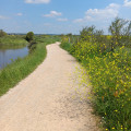
The Olonne forest stretches across the dune massif that borders the ocean between Brem-sur-Mer and Les Sables d'Olonne. This massif completely isolates the marshes located between the forest and the first hills where the vineyards of the Vendée fiefdoms flourish. This circuit offers a walk between the ocean and the banks of the Vertonne through the flat, open landscapes of the marshes, the more rugged forest and the immensity of the sea.
Seneca Tower from Luri
 8.10 mi
+2,375 ft
-2,375 ft
5h 50
Moderate
Departure from Luri (Haute-Corse)
8.10 mi
+2,375 ft
-2,375 ft
5h 50
Moderate
Departure from Luri (Haute-Corse)
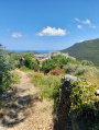
Perched at an altitude of over 500 metres, the Tower of Seneca overlooks the Col de Santa Lucia. It protected both the Pinu coastline and the coastline bordering the Luri valley on the other side of Cap Corse. To reach it, the route suggests approaching it via the ridges overlooking it to the north and returning via the village of Luri.
A circular route starting from Nivillac
5.74 mi
+295 ft
-295 ft
2h 55
Easy
Departure from Nivillac (Morbihan)
On either side of La Roche-Bernard, the Vilaine flows through the South Armorican Fold, the first range of hills behind the coastline. Here, the river has carved out a steep-sided valley, and the proposed route allows you to explore the section immediately upstream of the Morbihan Bridge. The wooded slopes, varying in steepness, line the mirror-like surface formed by the dark waters of the Vilaine.
A walk around the Férel bell tower
 5.67 mi
+69 ft
-72 ft
2h 40
Easy
Departure from Férel (Morbihan)
5.67 mi
+69 ft
-72 ft
2h 40
Easy
Departure from Férel (Morbihan)
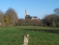
Situated about ten kilometres inland from the coast, on a plateau sloping down from the banks of the Vilaine to the first marshes of Briéron, the commune of Férel has managed to preserve its bocage landscape and a network of paths offering a wide range of walking options. This route offers an almost constant view of the bell tower, which, being tall and sharply pointed, is one of the area’s main landmarks.
From Tamarone to the Tour d'Agnelo
8.16 mi
+1,237 ft
-1,243 ft
4h 50
Moderate
Departure from Haute-Corse
Like a pointing finger, Cap Corse seems to point in the direction of Genoa, which was for a long time the dominant power in Corsica. The Republic left behind a series of stone towers that were intended to provide initial coastal defence.
Between Macinaghju and the island of Giraglia, four of them still stand guard. The proposed route connects them.
The Ambel Plateau as seen from the Gervanne Valley
12.04 mi
+3,507 ft
-3,504 ft
8h 35
 Difficult
Departure from Omblèze (Drôme)
Difficult
Departure from Omblèze (Drôme)
Situated at the southernmost tip of the Vercors, the Ambel Plateau overlooks the Drôme and the small valleys leading up to it. The Gervanne Valley, once past the Gorges d’Omblèze, is a lovely starting point from which to explore the vast expanse of this high plateau, perched at nearly 1,500 metres. Steppe lovers, don’t miss out.
Roho moors and marshes
 6.71 mi
+453 ft
-459 ft
3h 30
Moderate
Departure from Saint-Dolay (Morbihan)
6.71 mi
+453 ft
-459 ft
3h 30
Moderate
Departure from Saint-Dolay (Morbihan)
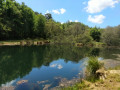
The village of Saint-Dolay overlooks the plateau that borders the south bank of the Vilaine. This flat landscape is cut by a valley with sometimes steep slopes, where the Moulin Neuf stream flows. While moors cover the slopes and heights of the valley, marshes and peat bogs cover the bottom. Add to this variety of vegetation a remarkable geological diversity, and you will have many reasons to explore this route.
Route des Popinettes
8.19 mi
+623 ft
-633 ft
4h 20
Moderate
Departure from Questembert (Morbihan)
The landscape around Questembert is characterised by wooded, steep-sided valleys through which pretty streams flow. For a long time, these streams powered a multitude of mills, which you can discover along the route, between two breaks in the rich countryside criss-crossed by beautiful tree-lined paths. As for the popinettes, perhaps we passed them without knowing what they were!
Camino del Gracioseiros
 5.08 mi
+1,332 ft
-1,335 ft
3h 30
Moderate
Departure from Haría (Province de Las Palmas)
5.08 mi
+1,332 ft
-1,335 ft
3h 30
Moderate
Departure from Haría (Province de Las Palmas)
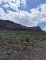
Before it became easier to reach the island of Lanzarote via the port of Orloza, the inhabitants of La Graciosa crossed El Rio, the inlet that makes it an island, at its narrowest point. Then all they had to do was climb the Risco de Famara wall to reach the first inhabited areas. For the hiker, this may be a sporty idea, but on a day-to-day basis, it must have been quite an ordeal!
La Géria vineyard
 4.94 mi
+850 ft
-843 ft
3h 00
Moderate
Departure from Yaiza (Province de Las Palmas)
4.94 mi
+850 ft
-843 ft
3h 00
Moderate
Departure from Yaiza (Province de Las Palmas)
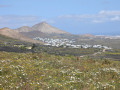
During the volcanic eruptions of 1730 to 1736, a quarter of Lanzarote was buried under lava. Another part was covered in volcanic ash. Such is the case of the Géria region, in the center of the island, where the cultivation of vines has replaced previous practices, but in a very different way. As well as being completely atypical, this walk through the vineyards gives you a view of almost the entire island.
Tour of Islote del Mojon from El Golfo
 4.64 mi
+338 ft
-328 ft
2h 25
Easy
Departure from Yaiza (Province de Las Palmas)
4.64 mi
+338 ft
-328 ft
2h 25
Easy
Departure from Yaiza (Province de Las Palmas)
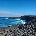
The village of El Golfo, on the island of Lanzarote, was miraculously spared the eruptions of 1730 to 1736. As the lava spread all around the village, right up to the first houses, the highest ground was bypassed by the molten rock. The result is a landscape in which the different phases of the island's volcanism are clearly visible, thanks in particular to the Islotes (Islands) that still stand out against the ocean of lava.
The Gannedel and Massérac Marshes
21.40 mi
+443 ft
-443 ft
2.5 hrs
Easy
Departure from Sainte-Marie (Ille-et-Vilaine) (Ille-et-Vilaine)
Upstream from Redon, the Vilaine valley stretches out between the hillsides that flank it to the north and south. Vast expanses of wild or cultivated marshland follow one another, through the midst of which the river flows.
Cycling along the small roads that wind around these marshes is a refreshing way to explore the area and its villages, away from the main roads.
From Montsoreau to Candes-Saint-Martin
2.18 mi
+184 ft
-171 ft
1h 10
Easy
Departure from Montsoreau (Maine-et-Loire)
Montsoreau and Candes-Saint-Martin are two villages that form a single settlement. They transcend regional boundaries, as the Loire and the hillside unite them.This route allows you to discover the terraced white houses along the river and the confluence with the Vienne.A walk best taken at sunrise to fully enjoy the light on the facades.
Please note: a recent update (June 2026) indicates a disruption to the route due to a landslide, likely above Candes-St-Martin (to be confirmed).
From the sea to the marshes, starting from La Govelle in Batz-sur-Mer
 4.36 mi
+33 ft
-33 ft
2h 00
Easy
Departure from Batz-sur-Mer (Loire-Atlantique)
4.36 mi
+33 ft
-33 ft
2h 00
Easy
Departure from Batz-sur-Mer (Loire-Atlantique)
The commune of Batz-sur-mer is located between the sea and salt marshes, on what was once, long ago, an island. A jagged ocean coastline contrasts with the peaceful landscapes of the salt marshes. Between the two lies countryside that was once used for food production but is now a mix of fallow land and horse pastures. And always in the background is the imposing tower of Saint-Guénolé.