Country:

 City:
City:


The walk starts from the car park at the top of the village of Sénéchas.
(S/E) From the car park, walk down through the village along the main road, the D318.
(1) Turn right onto the street that branches off at the first left-hand bend as you leave the D318. This street is lined with a succession of similar buildings, reminiscent of a ‘workers’ housing estate’, the presence of which seems somewhat unlikely here. Pass this row of houses, then continue straight on along the lovely paved slanting street which then descends through the woods, following the ridge. Further down, it is interrupted by the D318 road leading into the village.
(2) When you reach it, head up this road to the left for about one hundred and fifty metres, then take the path that branches off to the right. The ‘risk of falls’ sign is not without reason, and from this point onwards, caution is essential both in terms of following the route (see practical information below) and ensuring you watch your step.
(3) At the end of a descent through the woods, along which the purple circles of recent signposting appear at very regular intervals, you’ll emerge onto a series of terraces bordered by walls, which slope down to the water’s edge. Whilst it may be worth visiting this spot, which harbours a few masonry lodges built into the terrace walls, you must then return to the very first wall you came across (the highest one) and leave the ubiquitous purple markings behind to follow the yellow ones, which run alongside this wall to go round the entire set of terraces. From this point onwards, you must not lose sight of these markings. After making your way as best you can along this wooded and very rugged route – where you sometimes have to use your hands – you’ll emerge into an open area where numerous terraces are stacked one above the other.
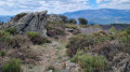
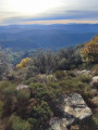
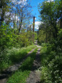
(4) These ‘faysses’ (the local name for these terraces) are in good condition, and the path winds its way between the various staircases carved directly into the low walls, climbing up all these terraces one by one. Here too, it is essential not to lose sight of the yellow markings. Once at the top of this ‘giants’ staircase’, you reach a wooded area dominated by tall pine trees. After taking a moment to admire the silvery ‘serpent’ of the lake lying at the bottom of the valley, you must then begin the descent, skirting to the left around the rocky cliff face on which the terraces you climbed earlier are situated. The route becomes very rugged once more, and the Tour d’Olivon, whose silhouette can be glimpsed through the vegetation, seems as though it will never be reached.
(5) You finally pass at the foot of the tower and then continue along a path that is barely any better defined, which runs alongside the lake’s final circular bend. When you emerge onto a wider path bordered by a long stone wall, you know the slog is over. A narrow path leading down to the water’s edge allows you to take a well-deserved dip in the Cèze.
(6) Then head back up the forest track that descends to the water’s edge, following the three hairpin bends that take you to the ridge beyond which the river continues its course. Follow this forest track for a good kilometre until you return to the D318 road leading to Sénéchas.
(7) Turn right onto it and head back up towards the village.
(1) At the Fork in the road you passed on the way out, continue along the road in the opposite direction to the way out until you reach the car park at the top of the village (S/E).
 Visorando Member
 Difficult
 Easy
Easy