Country:
 City:


Depart from the car park located in the south of the walled town, at the end of Rue de l’Hôpital.
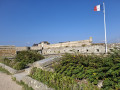
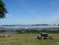
(S/E) Cross the ramparts through the gate next to the car park. The view opens out onto the entrance to the harbour, with the Gâvres Peninsula just across the channel and Groix in the background. Turn left and walk along the ramparts via the Promenade du Lohic, taking the paths that run as close as possible to the foreshore.
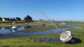
(1) At Pointe du Lohic, follow the coastline to the left to go round the cove just before Pen er Run, then take Rue de Locmalo until you reach this former fishing district. As you emerge onto the cove where the boats used to run aground, you’ll find the jetty on your right where the ferry to the Gâvres Peninsula docks.
(2) As you enter the Locmalo neighbourhood, turn left onto Ruelle de la Rogue or the next street to enter this very densely built-up area. Turn right onto Rue des Marins, then immediately left into a narrow alleyway that winds between the houses to join Rue du Nord. Turn left until you reach Rue de l’Entente Cordiale, then immediately right onto Rue François Rio. Following this street, you’ll cross the main road leading to the walled town. Continue straight on until you reach the sea wall, leaving a large green space on your left.
(3) At the seafront, turn left to follow the promenade that runs alongside the sports ground and cross Boulevard de la Compagnie des Indes to pass under the ramparts promenade.
(4) After this section, turn right and head back up onto the ramparts to continue the walk.
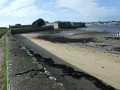
Following the ramparts, you’ll pass above the harbour and the ferry terminal for Lorient, then go round the headland towards the citadel. The route follows the top of the wall that protects the Pâtis, a vast green space separating the town from the citadel. Continue in this way until you reach the memorial to the Resistance fighters who were executed here in 1944.
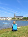
(5) From this monument, carry on along the moat that runs around the barbican, where the entrance to the citadel has been created. Then pass through the gate in the wall to reach the Grande Plage and its row of beach huts. Walk as far as the open-air café at the end of the beach, and leave via the small gate that takes you back over the ramparts. You’ll find yourself on the Pâtis. Follow the paths on the right as they lead back up towards the town, then cut left at the sports ground to join the Grande Rue. Walk up this street to the Place du Marché, turn left to cross it, then right to reach the church, whose bell tower is in your line of sight.
(6) At the Place de l’Église, leave the town hall on your left and the church behind you, then head back to the right towards the Grande Rue. Once you reach it, turn left and follow it up to the Rue de l’Hôpital.
(7) Turn right onto this street, pass the primary and secondary schools, and continue straight on until you reach the ramparts. At the end of this street, you’ll return to the car park where you started (S/E).

 Visorando Member

 Local authority
 Moderate