


 Country:

 City:


Set off from the former presbytery in Saint-Molf, one kilometre from the village centre, heading towards Mesquer.
(S/E) At the start, cross the D52 and head opposite towards Saint-André-des-Eaux. Join the D33.
(1) Turn right. Please note, this is a temporary road. Fortunately, you only need to follow it for a few hundred metres.
(2) When you reach Bringon, cross the departmental road and head left towards Kerbiquet. Follow the small country lane through the hedgerows, which becomes more or less built-up as you approach Kerbiquet.
(3) A few beautiful old buildings form the heart of the hamlet, which has since expanded considerably. Cross the village and then head out along a road leading downhill. At the bottom of the valley, carry on straight ahead to reach Trovray Farm.
(4) Leave the farm on your left and follow the small road to the right as it climbs towards Brézéan. As you pass, you’ll see the Kerdino inter-municipal animal shelter on your left. At the first houses in the village, turn right onto the Chemin des Prés de la Sandre and join the D252. Head uphill to the left for about 150 metres, then turn right onto Rue de la Vallée.
(5) This is the heart of the oldest part of the village; note the oven and the well located here, on the left at the first bend.
Continue along Rue de la Vallée, passing Clos Bertin and then Kersoudé, until you reach an undeveloped area. You’ll come to the next set of houses, which mark the entrance to the village of Coispéan.
(6) Turn left onto Rue du Cosquanguin and join Rue du Fan. Turn left again and follow the road for nearly three kilometres. The route is initially rural, but houses become increasingly common as you approach Trescalan (water tower).
(7) In the villages of La Métairie du Fan and Le Fan, the built-up area is almost continuous; carry on straight ahead. At the junction with the D333, leave the huge water tower on your right and head down to the left towards the Trescalan roundabout and its decorative lighthouse.
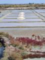
(8) At the roundabout, cross the D99 with care, and head downhill to the right towards Trévaly. The view over the marshes of the Guérande basin is breathtaking, and is well worth stopping for at the top of Trévaly.
(9) Continue down the hill, passing through the hamlet, then cut across the salt marshes to join the D92.
(10) Unless you wish to take a shortcut to the Pointe de Pen Bron, turn left, then right immediately after the Lergat restaurant. The Pen Bron road runs alongside a stretch of salt marshes, then crosses the inlet that feeds them via the Pont de Lancly. Shortly afterwards, you’ll reach the road leading to La Turballe and the forest that covers a large part of the Penbron peninsula.
(11) Continue straight on along the cycle path until you reach the narrowest part of the headland.
(12) On your left, you’ll see the Traict de Pen Bron, a vast expanse subject to the whims of the tides, which feeds a large part of the salt marshes in the Batz-Saillé basin. Carry on to the headland.
(13) The Pen Bron headland is home to a former sanatorium, which now awaits a new future. Just across the inlet that feeds the Traict lies the town of Le Croisic, overlooked by the elegant granite tower of its church.
After taking in the views, head back the way you came to Pont Lancly.
(11) Ignore the bridge and turn left. The road leading to La Turballe winds its way through woodland and marshland before reaching a campsite and various facilities.
(14) At the D92, turn left towards La Turballe and its harbour, following the coastal road.
(15) Opposite the harbour, turn right at the Tourist Office, leave the seafront and drive through La Turballe via the inland route. Turn left onto the main road, then continue along it until you rejoin the coastal road at Ker Élisabeth.
(16). The view opens up after the concrete wall that blocks the view towards the ocean. The road passes above a succession of beaches and coves, particularly near Belmont.
(17) Carry on straight ahead until you reach the tiny harbour at Lérat.
(18) Pass through Lérat, then follow the D99 as it returns towards the coast, which it stays close to until you reach the town of Piriac.
(19) At Pen ar Ran, take a moment to have a look at the rock known as the “Tomb of Almanzor”. Continue along the D99 for about 200 metres, then turn left onto Rue du Véridet. This leads to Pointe du Castelli and its semaphore (nicknamed “the sphinx”), but to visit these you’ll need to leave your vehicles at the previous car park.
(20) From the car park, take Rue du Chatousseau, which leads off to the north and takes you to the village of Piriac. When this street reaches the beach, turn right onto Rue du Mané, then left onto Rue du Budeau. Head towards the market square, then turn left just past it to reach Place du Lenn, which overlooks Saint-Michel Beach.
(21) To leave the beach, take Rue de la Butte to venture into the grid of narrow streets in the village of Piriac. As you make your way through them, you’ll eventually come out onto Place de l’Église; once you’ve walked round it, you’ll reach the harbour.
(22) Walk along the quay to the right, then turn left towards the harbour master’s office. Walk the length of the car park to the small beach nestled at the foot of the harbour jetty.
(23) Get off your bike and walk the few hundred metres along the top of the beach to reach Rue de Port Boucher. Follow this road until you come out onto the coastal road (D452) again.
(24) Turn left and follow the coastal road to the village of Port au Loup.
(25) Pass the hairpin bend in the road as it winds through the village and continue along the D252, passing Porh er Ster beach before reaching the wide bend just before the village of Kerbrien.
(26) At the entrance to Kerbrien, turn left and continue along the D452, running alongside the residential estates. Opposite the entrance to the Domaine de Villeneuve stands a small stone kiosk which once served as a guard post for customs officers, the famous ‘gabelous’.
(27) Carry on up the hill until the road leaves it near the Pointe de la Croix.
(28) The road continues through a wooded area dotted with numerous properties. Carry on to the first roundabout.
(29) At the junction, turn left towards Quimiac, then immediately left onto Allée de la Galerne. This estate road leads to a public park crossed by a footpath. In the middle of the park, turn left onto Allée des Barges, which you should follow to the right. Then take the first left, followed immediately by a right to enter Allée des Alcyons. Finally, turn left to reach the main entrance to Lanséria Beach.
(30) From the beach, head up Boulevard de l’Océan to Pointe de Beaulieu, then take Rue du Fort to reach the entrance to Toul Ru harbour.
(31) Take Rue du Mené to rejoin the coastal road, which you should follow to the left as far as Sorloc Beach. Don’t hesitate to head up to Pointe de Merquel (on the left) for the panoramic view.
(32) From Sorloc Beach, the road leads directly to Kercabellec harbour, through former salt marshes now used for oyster farming.
(33) After the bridge and once in the village of Kercabellec, turn left onto the small road leading up towards Kervarin. This small salt-farmers’ village provides access to a salt-farming area that is still in operation.
(34) Opposite the village houses, take the track on the right which leads into the salt marshes. After crossing a culvert over a channel, it follows the edge of the Rostu salt pan, passing beneath some magnificent properties. At the end of the track, you’ll come to a large salt drying yard where part of the harvest is stored.
(35) Follow the small road to the left, which leads to the tip of the Île de Rostu, running alongside the Traict of the same name.
(36) Retrace your steps back to the salt storage area, then continue along the road which climbs back up towards the village of Rostu.
(37). Pass through the village, then turn left to reach Fontaine Bras.
(38) At Fontaine Bras, turn left to head up towards Kerroué, then Trévin.
(39) After this hamlet, turn left towards the village of Penloc. Pass through the village and head down to the D52.
(40) Turn left onto the cycle path that runs alongside the D52, leading back to the former vicarage at Saint-Molf (S/E).

 Visorando Member

 Easy
 Difficult

